
Tegucigalpa,
the capital of Honduras a beautiful country located in the heart
of Central
America. Sorrounded by beautiful hills and mountains,
this city
with a population of almost 1.2 million people is my place of birth.
As
many other
world capitals it is a place of fun, entertainment, cosmopolitan life,
and the head
of government of my country.
Tegucigalpa
is nestled in a small valley at approximately 950 metres above sea level.
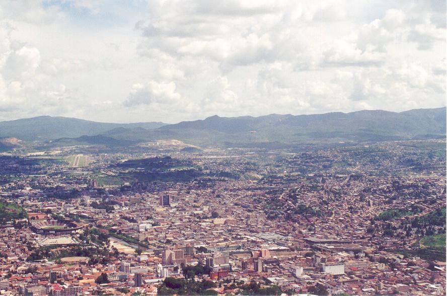
These pictures
are taken from the "El Picacho" (Small Peak) which has a dominant
view of the
city from the north side.
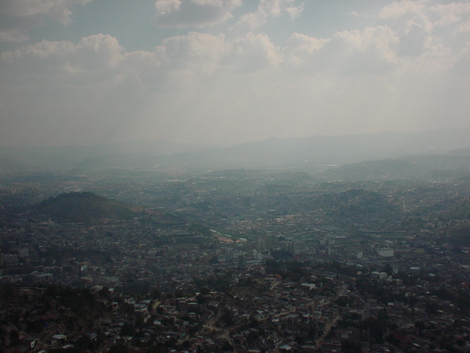
These
pictures attempt to cover different angles of the capital city. In this
picture we
can appreciate
the "Juana Lainez" hill in the middle right part. On the upper right
corner we
can see the southern part of the city (not clearly), a zone that has started
to develop
until recently.
This is one
more view of Tegucigalpa. I miss my city so much!!! Hope you like these
aerial pictures..
I promise to post some more up.
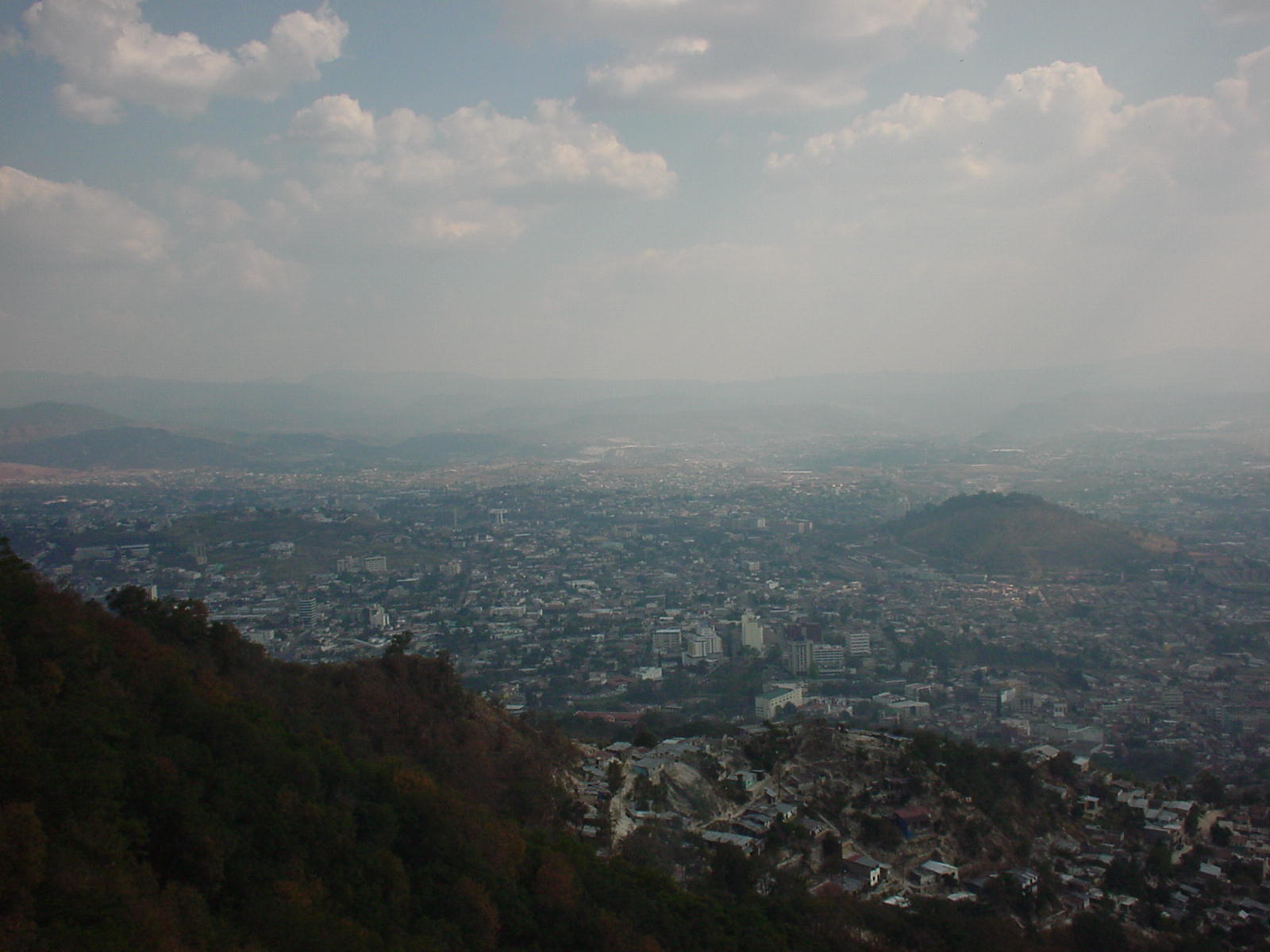
These
are newer views of Tegucigalpa. These are also taken from the El Cristo
de El Picacho place that
spectacularly
overlooks the city. In this picture we can see at the left end the runway
of the "Toncontin" International
Airport which
is claimed to be one of the most difficult landing sites in Latin America.
Below the runway always looking
to the left
we can see the "Tiburcio Carias Andino" national stadium built in
1948.
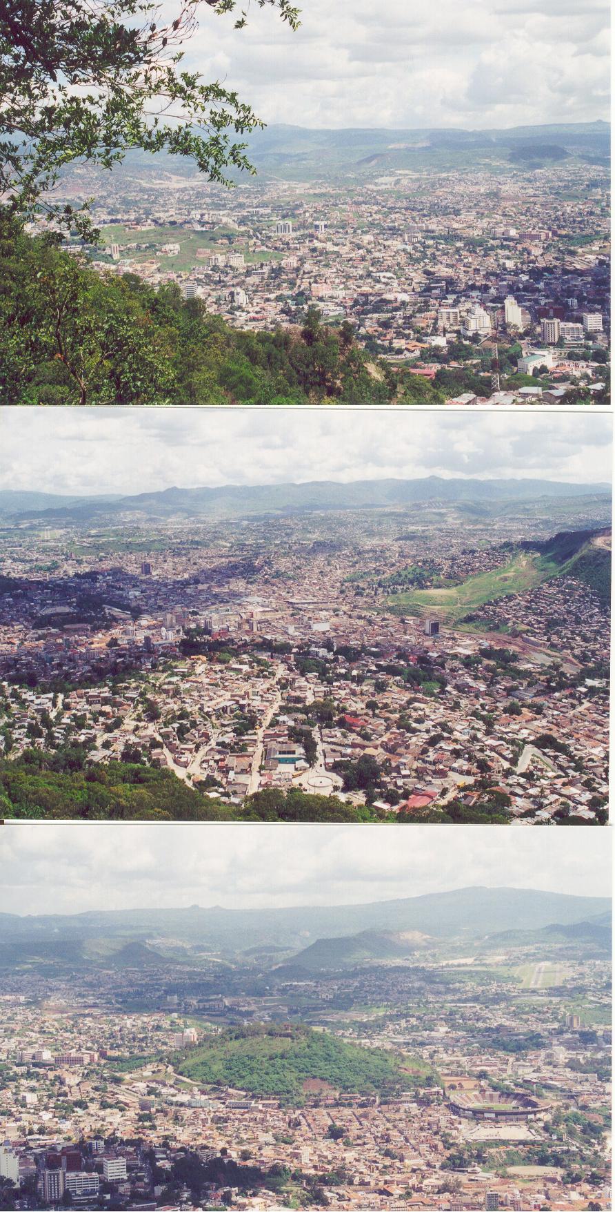
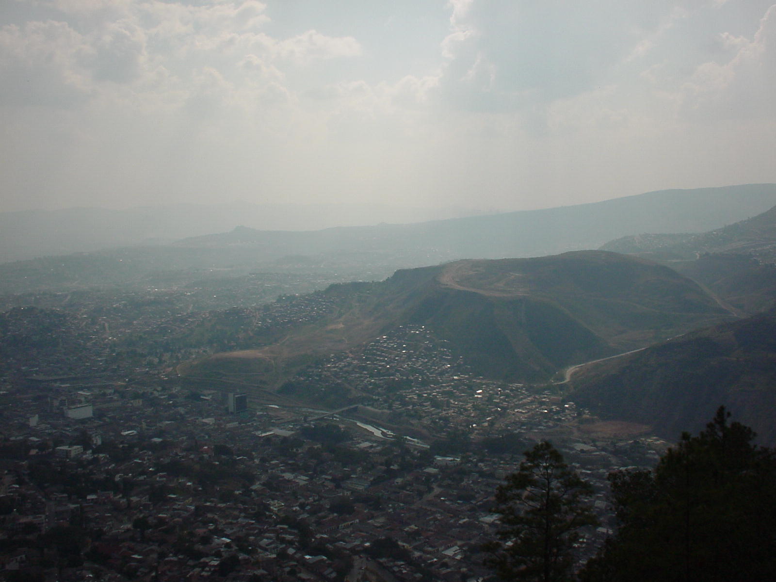
These are some
other views of different angles of Tegucigalpa. The top view in this series
is towards the newer
commercial
sectors of our city called Bulevar Morazan, Avenida Los Proceres, Palmira,
among others. The second picture
looks down
over the old sector of Downtown Tegucigalpa, while the last view concentrates
on the "Juana Lainez" hill with
the national
stadium besides it.
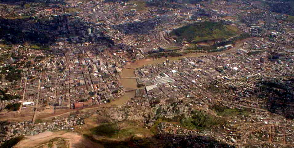
These are some
new aerial images of Tegucigalpa. The first one (below) was taken by a
surveillance helicopter in November 1998
days shortly
after Hurricane Mitch ravaged through Honduras. We can see the swollen
Choluteca River as it passes and divides
the twin cities
Tegucigalpa (right) and Comayaguela (left). With the pass of hurricane
Mitch Tegucigalpa suffered its worst flooding
in probably
more than 100 years. Many people lost their homes and their lives (unfortunately)
and it made Honduras go even more
behind in
economic development... experts say Honduras went back 40 years back in
economic recovery and development after the
passing of
this cyclone..... sad but true.
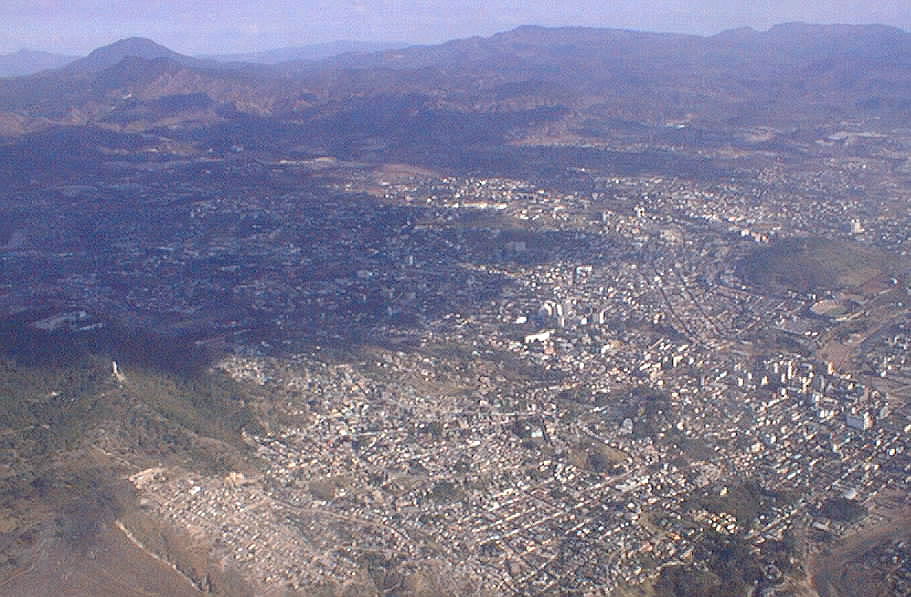
This image
below is taken by another surveillance Helicopter flying over Tegucigalpa
one year later picturing a somewhat
different
story. As you can see Tegucigalpa is somewhat nestled in a "valley" surrounded
by high mountains of more than
2000 metres
in altitude. Tegucigalpa itself lies at 953 metres above sea level in downtown.
The best ways
to get to Tegucigalpa from Canada or United States is definitely flying
by airplane. Few US air carriers
have daily
flights to Tegucigalpa. American Airlines flies daily from Miami and Continental
Airlines flies daily from Houston.
Grupo Taca
has many daily flights flying into Tegucigalpa from many destinations across
the US and Canada. The arrival at
Tegucigalpa
can be a little tedious and scary, since the topography of Tegucigalpa
is a bit irregular, surrounded
by high hills...
the approach to the "Toncontin International Airport" can be quite an experience
by itself. There are many facotrs that
make it one
of the hardest sites to land a plane for any commercial or military airplane
pilot. You can find more details in my
"Toncontin
Airport" page.
