 This is one mountain that I have looked forward to climbing for a couple of years. I had
climbed Mt. Yale earlier
this summer, and from the summit, you could see the approach up the Horn Fork Basin to
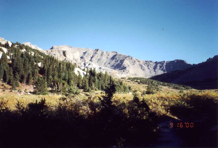
Mt. Harvard. This hike really lived up to its billing. The scenery in the Horn Fork Basin is
stunning.
This is one mountain that I have looked forward to climbing for a couple of years. I had
climbed Mt. Yale earlier
this summer, and from the summit, you could see the approach up the Horn Fork Basin to
Mt. Harvard. This hike really lived up to its billing. The scenery in the Horn Fork Basin is
stunning.
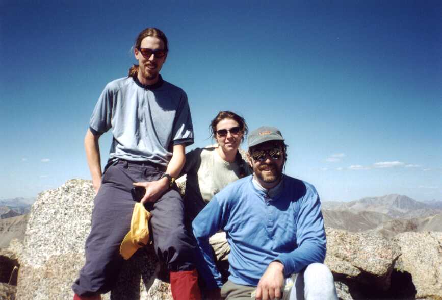
I did this climb with Tim Neville and Misty Blakesley, who also work at Outside. We picked a great weekend for this climb as the weather was perfect. There was hardly a cloud in the sky the entire time we were on the mountain.
 We got a bit of a late start, finally getting on the trail at about 7 a.m. The night before,
we had intended to stay at the Collegiate Peaks Campground on Cottonwood Pass Rd., but as it turns
out it was closed for the season. Instead, we had to look for an alternative area to camp.
We found a spot a couple miles down the road where several other groups were in the same boat
we were, pulled in and pitched our tents. I don't think I fell asleep until after midnight, which
made me a little sluggish when Tim woke me at 5 a.m. After a quick breakfast, we drove to
the trailhead, which was about 10 miles from our camp. Thinking we would have water at
the campground, we did not bring any with us. This caused a delay as we had to filter water
for the trip at the trailhead.
We got a bit of a late start, finally getting on the trail at about 7 a.m. The night before,
we had intended to stay at the Collegiate Peaks Campground on Cottonwood Pass Rd., but as it turns
out it was closed for the season. Instead, we had to look for an alternative area to camp.
We found a spot a couple miles down the road where several other groups were in the same boat
we were, pulled in and pitched our tents. I don't think I fell asleep until after midnight, which
made me a little sluggish when Tim woke me at 5 a.m. After a quick breakfast, we drove to
the trailhead, which was about 10 miles from our camp. Thinking we would have water at
the campground, we did not bring any with us. This caused a delay as we had to filter water
for the trip at the trailhead.
 As it turned out, much of the water pumping on my part was in vain. A couple miles up
the trail, I noticed that the my back was getting wet. Indeed, I had sprung a leak in the
bladder of my hydration pack. I removed it and turned it upside down to try and conserve
water, but at that point I had lost probably 1.5 litres. Luckily, I had also brought a litre of
Gatorade, but I had to seriously conserve water the rest of the day.
As it turned out, much of the water pumping on my part was in vain. A couple miles up
the trail, I noticed that the my back was getting wet. Indeed, I had sprung a leak in the
bladder of my hydration pack. I removed it and turned it upside down to try and conserve
water, but at that point I had lost probably 1.5 litres. Luckily, I had also brought a litre of
Gatorade, but I had to seriously conserve water the rest of the day.
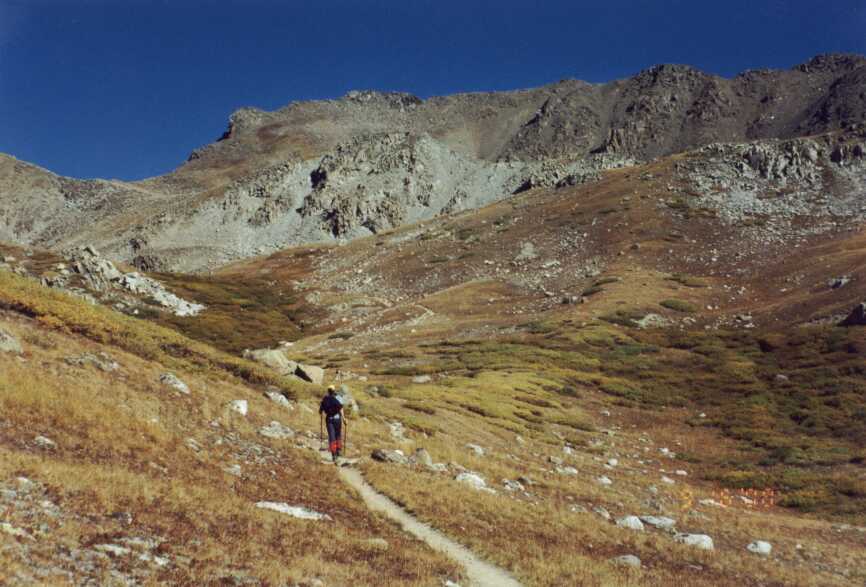
There are several trails up Harvard. We went up the N. Cottonwood creek trail, which is the shortest round trip by a couple miles. The entire route to the summit and back was 12.5 to 13 miles with an elevation gain of 4,550 ft. This was a very well maintained trail with a nice gradual climb all the way to 13,000 ft. From there it gets quite steep as you push for the summit.
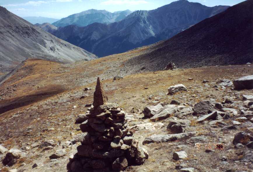 And the cairns! There was a group of people from the Colorado Fourteeners Iniative Program
working on the trail. They were camped in the Horn Fork Basin at about 11,000 ft., and were
building cairns and working on the trail between 12,000 and 13,000 ft. But these were not
just ordinary cairns. I think the thin air was getting to them, because these were works or art.
There were conical cairns, and three side and four sided pyramidal cairns, and they were
about 5 feet tall.
And the cairns! There was a group of people from the Colorado Fourteeners Iniative Program
working on the trail. They were camped in the Horn Fork Basin at about 11,000 ft., and were
building cairns and working on the trail between 12,000 and 13,000 ft. But these were not
just ordinary cairns. I think the thin air was getting to them, because these were works or art.
There were conical cairns, and three side and four sided pyramidal cairns, and they were
about 5 feet tall.
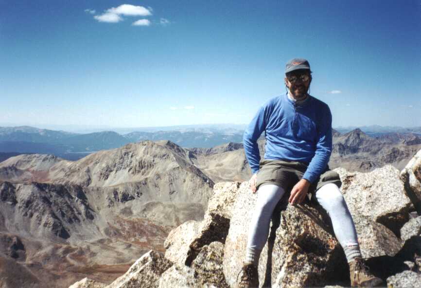
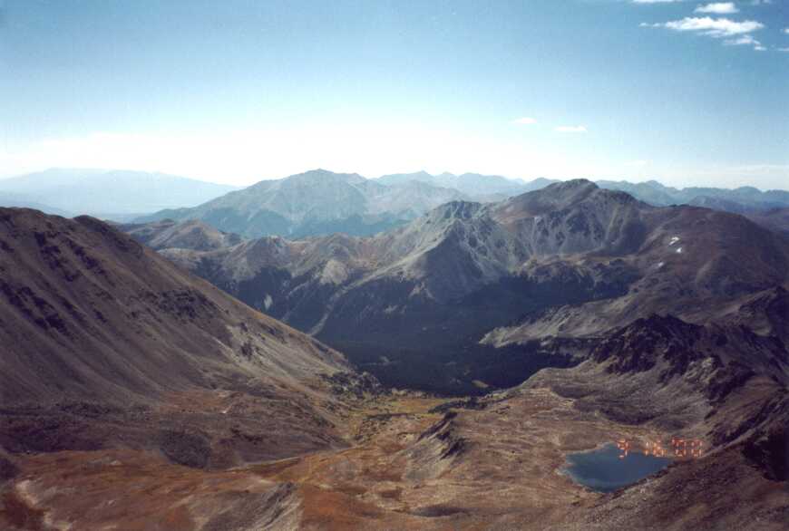
We made the summit around noon. With clear skies, we kicked back and had lunch up top. When we arrived, there were a few other people up there, but it was surprisingly un-crowded for such a beautiful Fall day. The views, of course, as astounding. Belford and Oxford are nearest to the north, with Huron, Missouri, La Plata, Elbert and Massive in the background. To the south, Columbia, Yale, and Birthday Peak define the Horn Fork Basin.
 On the way down, I ran out of water about three miles from the trailhead. Tim offered
up some iodine tablets, and I filled a bottle in a small creek just in case I couldn't make it.
Somehow I managed to get back without testing that water, but the trailhead couldn't come
soon enough. We finally got back to the car at around 4 p.m. A very long day, but very
rewarding.
On the way down, I ran out of water about three miles from the trailhead. Tim offered
up some iodine tablets, and I filled a bottle in a small creek just in case I couldn't make it.
Somehow I managed to get back without testing that water, but the trailhead couldn't come
soon enough. We finally got back to the car at around 4 p.m. A very long day, but very
rewarding.
From there, we headed back to the same spot we camped the night before. After a large meal of pasta with basil, tomatoes, pine nuts and parmesean, we headed over to the Cottonwood Hot Springs to soak.
All said, this was probably the best hike of the fourteeners that I've done. After having done Mt. Yale a couple weeks ago, I actually was not really sore at all after this hike. For the scenery alone, I would highly recommend this hike.