

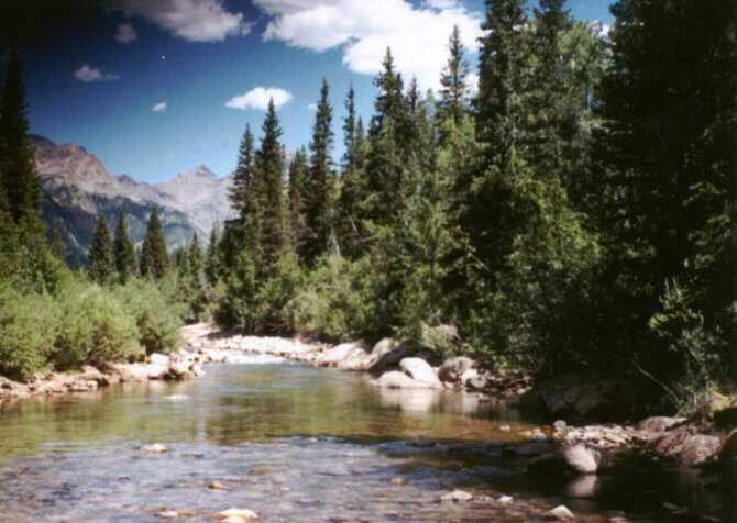
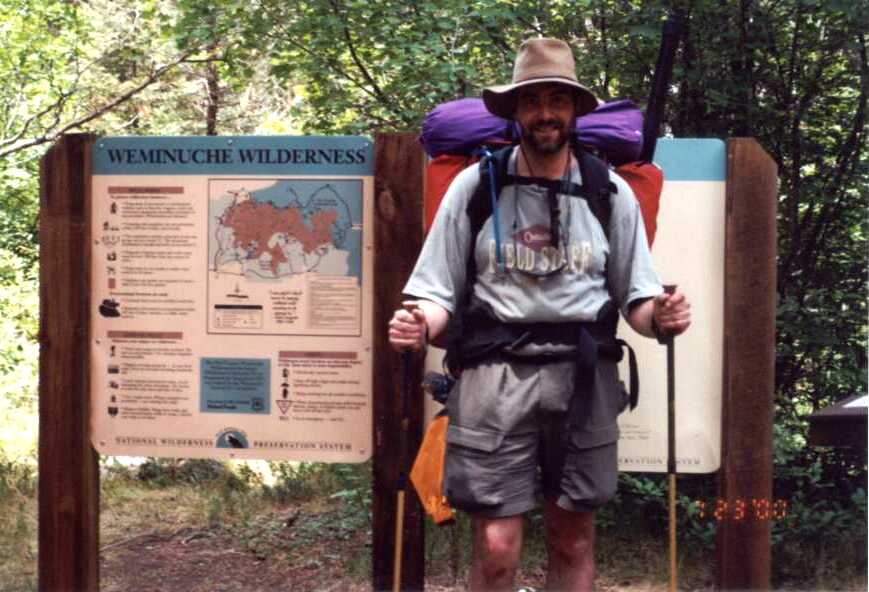
Vallecitos Creek heads high in the Needle Mountains of southwest Colorado near the continental divide. The stream gains strength with the addition of several feeder creeks, and then cuts into a deep valley. The term Vallecitos refers to the narrow nature of the river valley.
For the last couple of miles above the Vallecitos Reservoir, the river meanders through open pasture. Just above this however, the river cuts a deep chasm through basalt canyons for several miles. The trailhead is situated at the base of this steep canyon section. The first mile of hiking consists of climbing to the ridge high above the river. After three miles, the severity of the canyon lessens somewhat by the first bridge, and the river is very fishable above that.
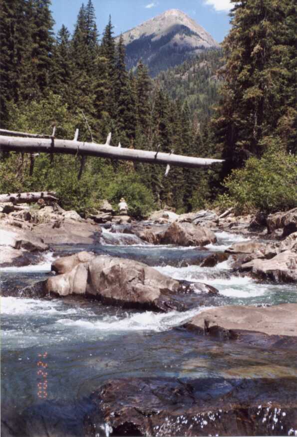
The first day, Tim Pinnow and I hiked up to Dead Horse creek, seven miles from the trailhead. At this point the creek opens into enough of a valley to provide ample campsite possibilities. This valley is lined with 12,000 foot ridges to the east, and 13,000 to 14,000 foot peaks to the west making for some spectacular views.
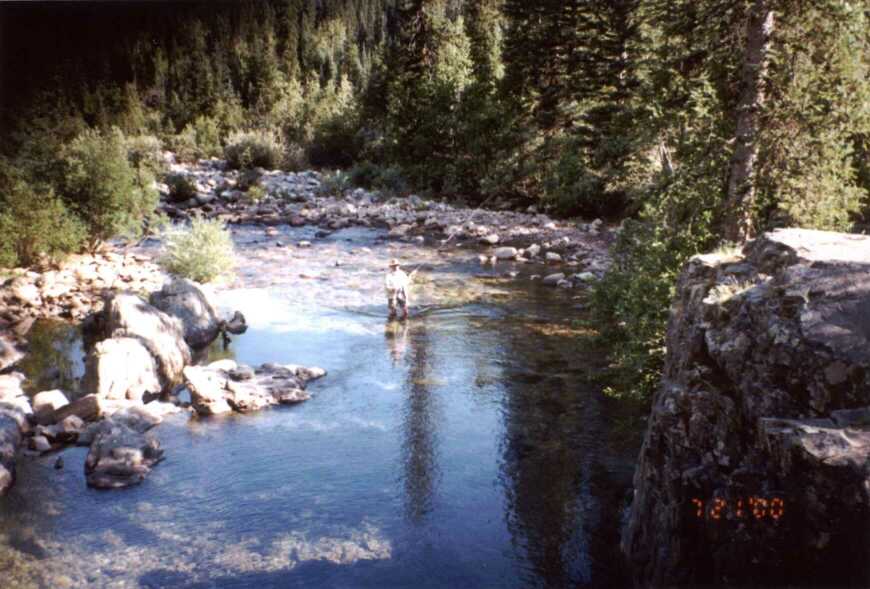
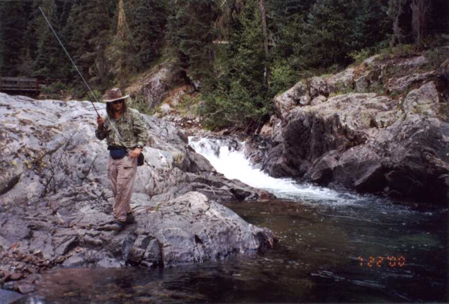
The creek itself is boulder strewn pocket water, which creates great habitat for the numerous small rainbows and brook trout that inhabit it. In this section, we caught a lot of fish in the 6 to 10 inch range, with the occasional rainbow reaching 12 inches.
The fishing was very technical. It required selecting a fly that you could actually tie to your leader. We had to fish tippets all the way down to 4x. I chose #12-#16 stimulators and fished those almost the entire trip.
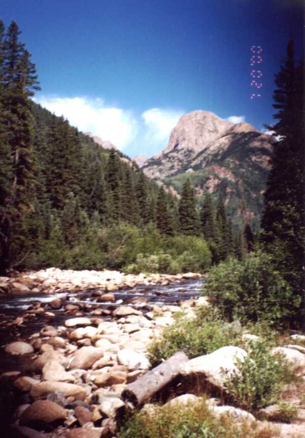
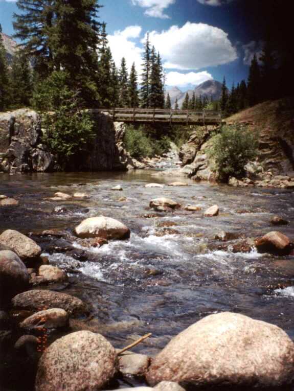
After catching our share of smaller fish in the pocket water near our camp, the next day we went in search of some deeper pools. The scoutmaster of the troop that decided to camp way too close to us said that there was a really deep pool up at the Johnson Creek Trail. We threw a lunch and our fishing gear into my pack, and hiked another mile and a half up to the bridge to check it out. Sure enough, it was very deep, and inhabited by some larger trout hiding 15 feet below the surface. We spent the day trying our luck for these trout, and exploring the area around the bridge. This area does not have as many good fishing areas as the pocket water below, but the views are just astounding. The Needle Mountains tower over you to the northwest, including the 14,000 foot Windom, Sunlight, and Elous peaks.
About 4:30 in the afternoon as I was standing on the bridge surveying the fishes below, a man walked up to me and asked "is this the trail to Emerald Lake?"
He was 50ish, and appeared in decent, though not great shape. I hated to be the one to inform him, but I had to let him know that he had hiked 8.5 miles up the wrong trail. He showed me some pages he ripped out of a Delorme Gazetteer, and I showed him which trail he was on (Vallecitos) and where he was supposed to be (Pine). He asked how to get over to the lake and I told him, explaining that is was a long hike over a 12,000 foot pass and there was no way he would make it that evening. He said that he guessed he would be a day late and continued up the trail. I hope he made it. Just as we were leaving this area, I caught a wiff of smoke. I looked up to see that there was indeed a fire somewhere, as I could see the smoke wafting into the Chicago Basin, high to the northwest. We didn't know it at the time, but later found out that this smoke was coming in from the fire near Mesa Verde, many miles to the west.
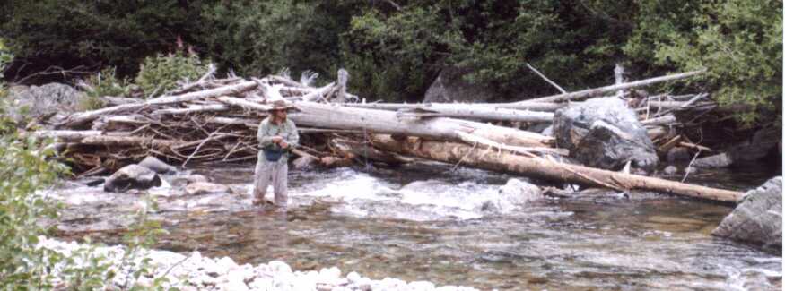
Saturday, we decided to pack up and hike back down stream a ways and test some of the fishing there. We figured this would also make the trip out on Sunday a little shorter. In the morning, we hiked down to the second bridge, about 5.5 miles from the trailhead. After setting up camp, we explored the deeper runs and holes in this section of river, cut into the slick black basalt rock . The fish were just as picky down here, taking anything you could tie to your line. They remained aggressive to large flies until a hatch of tiny midges started about 6 in the evening. At that point, I just about emptied my fly box trying to find something they would take.
Sunday morning we fished for a few more hours, looking for deeper holes that held larger fish. Then it was time to hike out and leave this beautiful creek behind. We saw a lot of people on this trip (more than we're used to), but we were really the only ones fishing. This is the third backpack/flyfish trip Tim and I have done, and they seem to get better each time. At the end of the trip, we found ourselves asking what we were going to do to top this one. I imagine we'll figure something out.
As an aside, this is the first chance I've had to try out my hiking poles. I've suffered knee problems in the past when I am hiking, especially on the downhill portion. They really helped a lot on the downhill. The poles allow you to steady yourself when stepping down, and also helped to bear some of my immense weight. On the uphill hike, I thought they were pretty much useless, and felt that I actually expended more energy using the poles. My knees were sore after this trip, but it was from sliding around on the slippery basalt boulders while fishing, and not the hike itself.
