Site hosted by Angelfire.com: Build your free website today!

NAVIGATING WITH GPS

GPS NAVIGATION, USING COORDINATES OF LONGITUDE & LATITUDE!!!

With this information, simple arithmetic, a USGS map and a little home work, you can navigate freely with your hand held GPS unit. You can work out the coordinates for any location, on any USGS map. You can also find any location on any USGS map, that you have the coordinates for. These coordinates may come from any reliable source, including your GPS unit.

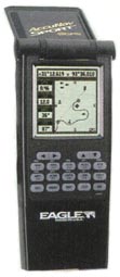
Also, I have written an account of how I tested my method, used to get the coordinates, and my abilities to navigate with the GPS, map and compass, in the Clifty Wilderness and surrounding areas. If you are interested in navigating with the GPS, I hope this makes for some interesting and informative reading. It's a true account of my use of the GPS in those areas.

I am posting this information in an effort to further other's ability to navigate into unknown areas without the dire fear of getting lost. However, one should never take off trail, Wilderness travel lightly. If you find this information entertaining, useful or helpful, drop me an E-mail.

The steps involved in this process are:

1. Getting Your USGS Maps.
2. Preparing Your USGS Maps.
3.Instructions For Figuring Coordinates and Locations.
4. Example Of Figuring A Coordinate

Each following step will be linked at the bottom of each page.

Getting Your USGS Maps

GPS Navigation, Using UTM Grid System

Back To Link Page

jcarl@cinci.rr.com