
Oil Spill in the Allegheny National Forest
DEP Responds to Major Oil Spill in Northwest Pa.
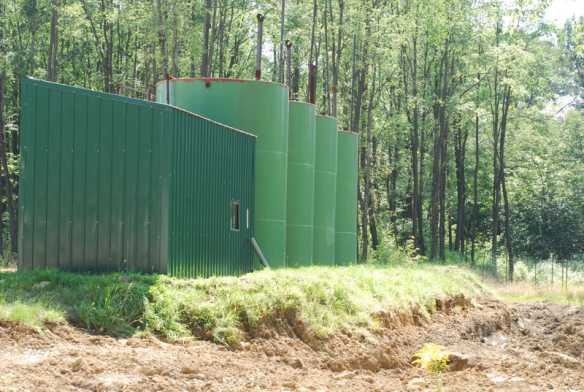
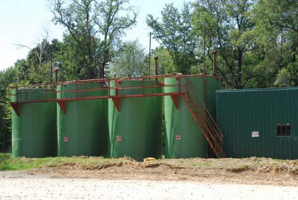
MEADVILLE (Aug. 1 The Department of Environmental Protection, in conjunction with several other state and local agencies, is investigating a major oil spill in McKean County that has impacted an area of the Allegheny National Forest.? Over the weekend, vandals allegedly opened valves on seven crude oil storage tank batteries in Corydon and Hamilton townships, causing?an estimated 36-thousand gallons of crude oil to flow from the storage units.
The leaking oil was discovered early Sunday morning by an employee of Snyder Brothers Inc., the company that owns the vandalized tanks.
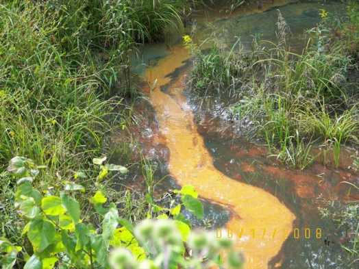
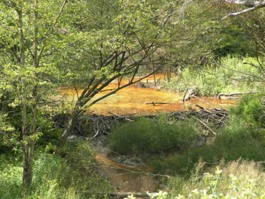
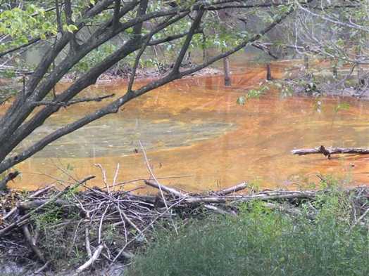
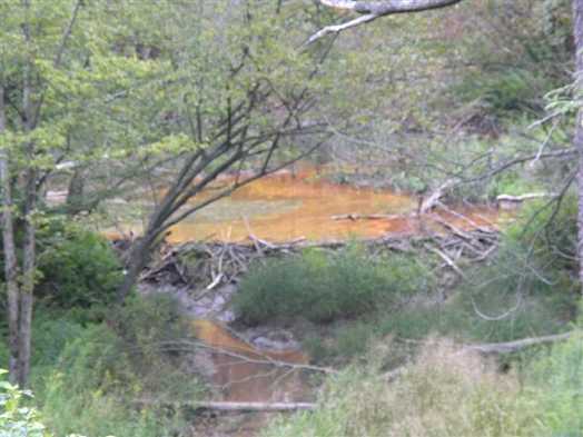
About half of the crude oil made its way to the North Branch of Chappel Fork, which flows to the Allegheny National Forest Kinzua Reservoir.? The rest of the spilled oil was caught in containment diking and other diversions.
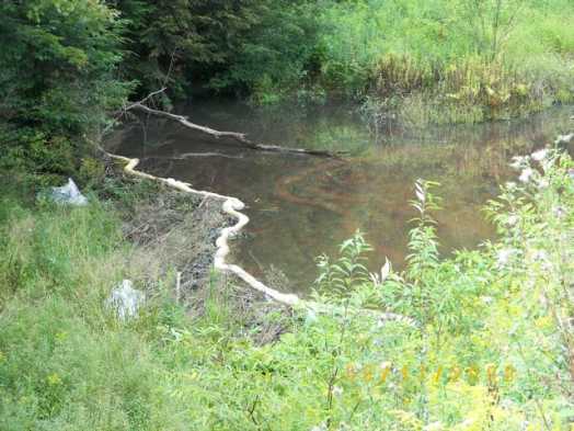
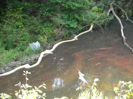
An environmental clean up company hired by the company that owns the storage tank batteries has installed temporary dams on the stream to separate the crude oil from the water. The oil will then be removed by a vacuum truck.
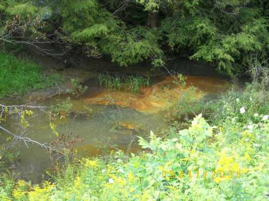
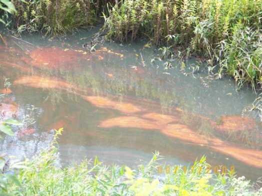
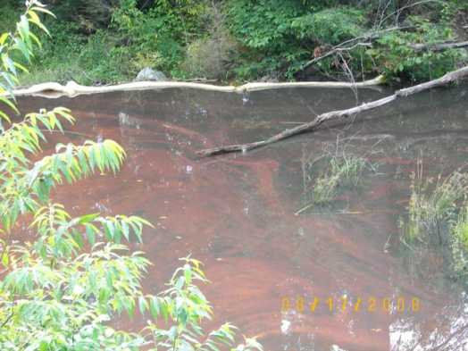
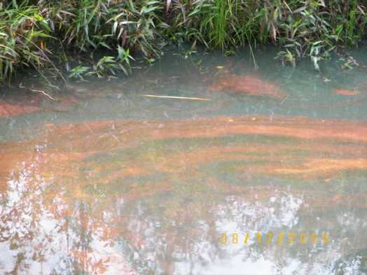
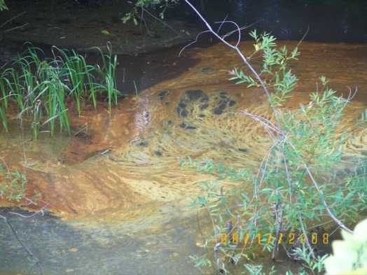
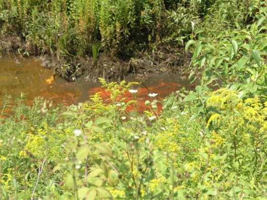
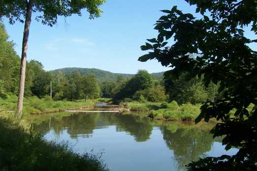
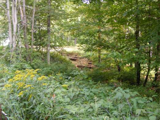
Approximately six miles of stream was impacted by the spill: four miles of Chappel Fork and nearly two miles of Indian Run. The two-mile stretch of Chappel Fork above the containment dam was heavily polluted while the remaining four miles was moderately damaged. Chappel Fork is a unique waterway because wild trout naturally reproduce there. A small amount of oil reached the Kinzua Reservoir and only a very light sheen was observed in the?Chappel?Fork?Bay?area of the reservoir.
Agency staff began seeing dead fish (trout and shiners), reptiles and amphibians as they inspected the streams today. An in-depth biological assessment will begin later this week.
Today State Police arrested a father and son in connection with the incident. Forty-two-year old Andrew Horton and 22-year old Christopher Horton, both of Bradford, are in McKean County Jail in lieu of $50,000 bail after being charged with criminal mischief, criminal conspiracy to commit criminal mischief, causing a catastrophe, risking a catastrophe, and libility for conduct of another.
WESB News: 08/18/08 - Oil Cleanup Continues on ANF
Allegheny National Forest officials are coordinating with several other federal, state, and local agencies to investigate the spill on the forest. Officials say the oil was contained before it reached the Kinzua Reservoir or Chappel Bay. On Sunday, an environmental clean-up company hired by Snyder Brothers of Kittanning installed a containment dam on Chappel Fork to cause the crude oil and water to separate so the oil can be siphoned off to a vacuum truck. About six miles of stream was affected by the spill: four miles of Chappel Fork and nearly two miles of Indian Run. The two-mile stretch of Chappel Fork above the containment dam was heavily polluted while the remaining four miles was moderately damaged. Chappel Fork is a unique waterway because wild trout naturally reproduce there. Officials began seeing dead fish (trout and shiners), reptiles, and amphibians as they inspected the streams today. An in-depth assessment will continue as response efforts proceed.
From Bill Belitskus from the ADP:
Giant oil spill on North Fork (321 south of ranger station)
Wow that is some story, I saw all those come up out of the Pit area. We were picking Black Berries (Wife and I) and were asked by the State Police to move as they had a crew coming up out of the road I was parked on. We saw ALL the mentioned authorities (4 vehicles) come up out of there one of them being forensic! We really wondered what it was all about. I'm sure the State Police that asking me to move got my plate number. Wouldn't be surprised if I don't get a call. They never asked us to leave as we were still picking berries when they all pulled out. And to think the gate was open and I came real close to driving down in there as I'd never been down that road. Sure am glad I decided to park AT THE GATE! :) Good to know what it was all about! All kinds of things run through your mind when you see that in the middle of the woods.
By the way, my wife couldn't believe the destruction of the Gravel Pit. We had been there before. Unrecognizable!
These are from Jim B from Warren:
Here are some from I Champlin:
Giant oil spill on North Fork (321 south of ranger station)
Thursday Aug 21-
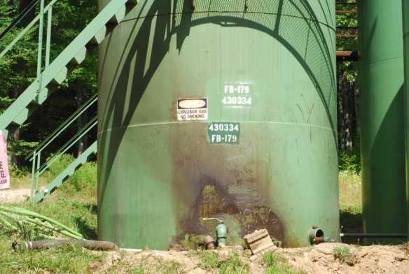
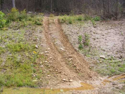
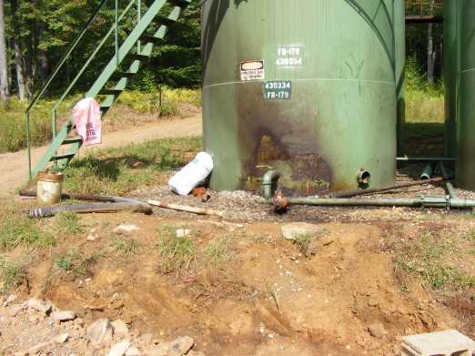
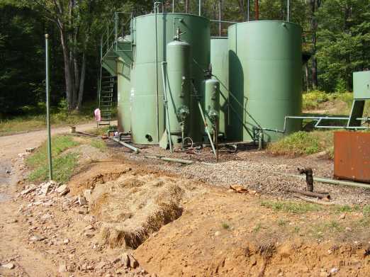
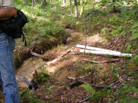
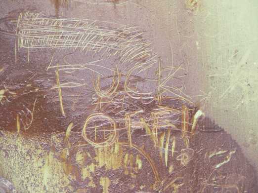
I found two of the tank batteries that were vandalized. They are both accessible to the public (no gates). The first is next to the rock "pond" out 267. The second is within 350 yards of where 267CA starts.
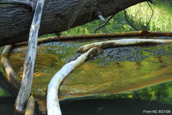
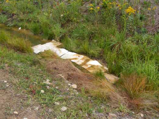
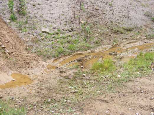
At the first site the majority of the contaminated dirt has been removed with an excavator. The way the land lies most of the oil pooled into a gravel hollow. It seems like only a trifling amount of oil reached the forested part of the woods. Some oil remains around the tanks and has soaked deep into the soil there. The retaining wall was opened with a backhoe or excavator and remains that way. The retaining wall must be rebuilt before it rains or the residue will flow out and into the forest.
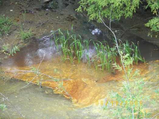
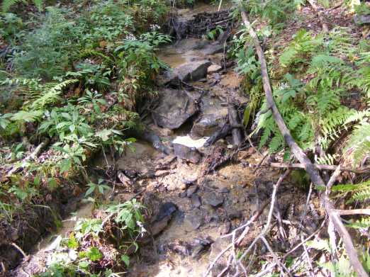
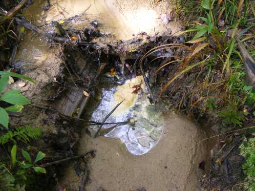
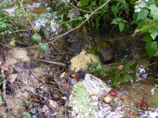
The second tank battery, with "**** off" written on the side of it, spilled across the access road and directly into a small stream that feeds into Indian run. The contaminated soil has been removed with an excavator, right up to the water. The sandy bottom of this little stream is highly contaminated. I took a handful and smelled it. I wish I hadn't. It smelled like a combo of sewage and industrial solvent- much worse than your regular oil smell. It made me dizzy for a few minutes. The water flowing down this stream is clear in appearance but it smells like gasoline and feels slick.
I came across a handsome buck with a big doe in the Indian creek watershed. I use to drink from Indian run. I won't be doing that ever again. Nor am I interested in any venison from the area. Those deer are going to be hard pressed to find clean water.
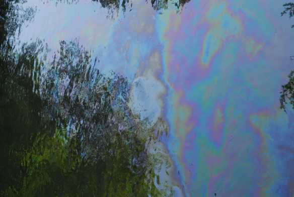
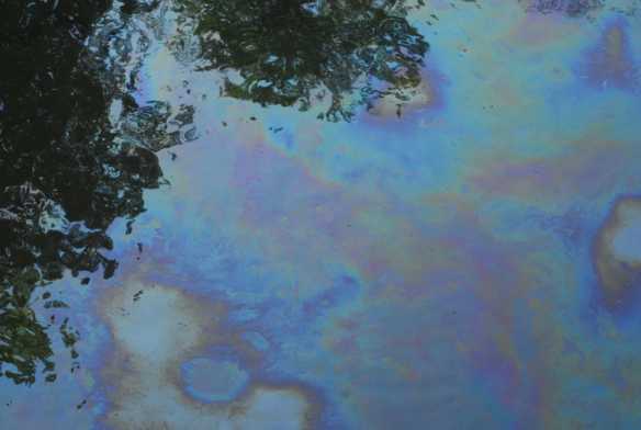
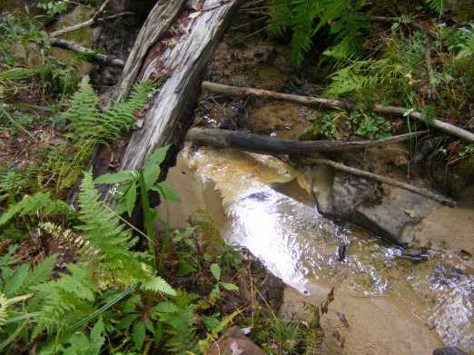
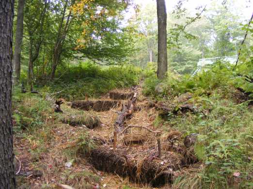
Back down where chapel run is along 321 is the same as yesterday. Tampon dams here and there, and oil everywhere, over every inch of water. If you stand on the bridge you have a good view of the dead bugs floating by, at least 10 per square meter, going by at maybe 6 mph. Someone with a better head for fumes and math should go down there and do a study. Some critter gave a few splashes in the accumulated waste. Thats the only sign of life I've seen in Chapel so far.
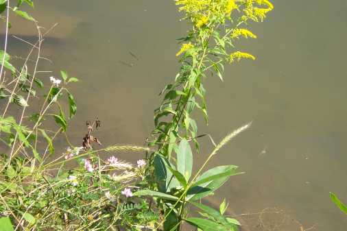
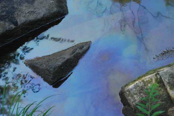
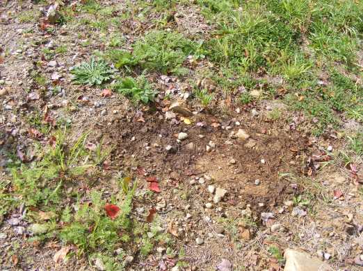
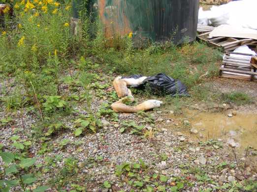
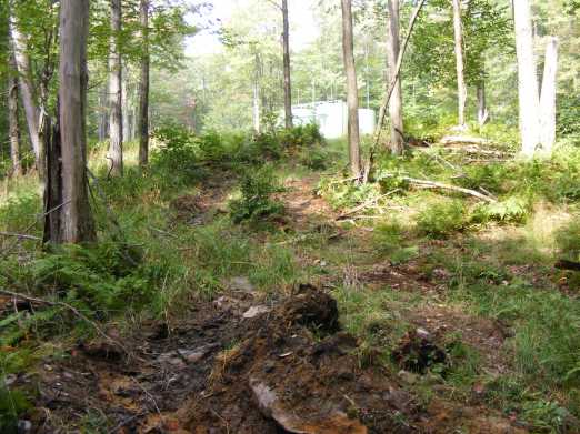
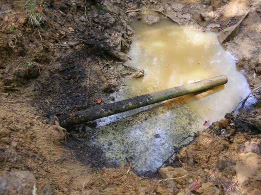
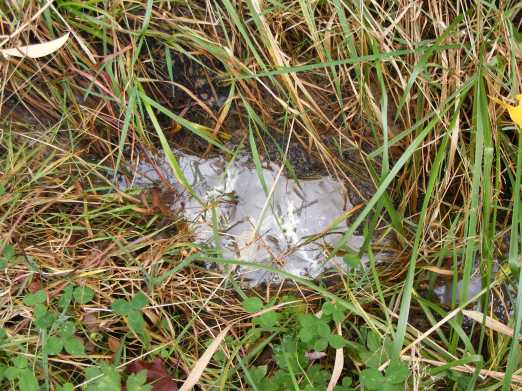
The last picture is of a small unrelated oil spill I came across in the area.
-N
These are from Nick C.:
And these are from Nick C.:
UPDATE FROM AUG 31ST FROM I CHAMPLIN:
UPDATE FROM SEPTEMBER 7TH FROM I CHAMPLIN:
Here are the latest from me and Bill B's trip last Sunday, September 14th. Incredibly, the oil is STILL flowing into Indian Run and then the North Fork of Chappel Bay, a month and a half AFTER it first started spilling. What baffles me most, is why the oil is still flowing into this creek, and there was no sign of any clean-up personnel working on this spill. We found old oil absorbent booms just laying around on the ground, incredibly leaking the oil they collected BACK INTO the ground! And there were pools of oil collected at natural and man made "booms" that are seemingly forgotten about. There are perhaps hundreds or thousands of oil still migrating out of the soil and into the creeks, and there seems to be no continuing effort to collect it or stop it from flowing into Indian Run or the main creek. Did the clean up stop after they got "the most of it"? Will they ignore the rest of the oil making it's way slowly into the creeks? WTF?
Here is an article from a paper south of here,
"The Derrick"
The Derrick Article
Oil spill: Plenty of blame to go around
A
coalition says more public oversight is needed for oil-gas proposals.
The oil spill that polluted two streams in the
Allegheny National Forest underscores the need for more public oversight of oil
and gas development proposals, according to a coalition of environmental and
recreation groups.
The weekend spill from seven storage tank batteries
owned by Snyder Brothers Inc. of Kittanning polluted about two miles of Indian
Run and four miles of Chappel Fork, killing fish, reptiles and amphibians. Both
streams empty into the Kinzua Reservoir.
Police have charged two former
employees of Snyder Brothers with causing the spill. They were committed to the
McKean County Jail.
The coalition of environmental and recreation
groups, including the Allegheny Defense Project, Tionesta Valley Snowmobile
Club, Allegheny Outdoor Adventures and Friends of Rimrock, claim the U.S. Forest
Service and Pennsylvania Department of Environmental Protection also bear
responsibility for the spill.
"These storage tank batteries never should
have been located so close to these streams or their tributaries," said Ryan
Talbott, forest watch coordinator for the Allegheny Defense Project.
"Obviously, the individuals who recklessly opened the valves on these
storage tanks were responsible for the final step of this disaster, but if the
Forest Service and DEP exercised greater concern for our streams before an
environmental disaster, maybe they would have realized that permitting so many
storage tanks full of oil near a wild trout stream was not in the best interest
of protecting this unique habitat," Talbott said in a press release issued
Wednesday.
The Allegheny Defense Project says the Forest Service must
comply with the National Environmental Policy Act and allow the public to review
and comment on proposed oil and gas development projects before the agency
approves any more drilling activities in the Allegheny National Forest.
"We cannot rely on the Forest Service alone to review oil and gas
development plans," said John Stoneman of Allegheny Outdoor Adventures.
"All too often, the Forest Service gives the green light for oil and gas
companies to drill wells and locate storage tanks in sensitive wetlands and
high-quality watersheds," Stoneman said. "If the Forest Service followed the law
like other national forests in allowing public review and comment on private
mineral developments, an alternative location for these tank batteries could
have been suggested that would have prevented this tragedy."
According
to the defense project, the only recourse for the public if it wants to review
oil and gas drilling proposals on the Allegheny is to file a Freedom of
Information Act (FOIA) request with the Forest Service. By the time the Forest
Service responds, however, road construction and drilling has already started.
Bill Belitskus, the defense project's board chair, said the documents
should be made available to the public before any road construction or drilling
takes place.
"The Forest Service only does a cursory, internal review of
the environmental impacts from proposed oil and gas drilling projects,"
Belitskus said. "In some instances, impacts to threatened and endangered species
were not considered until after the Forest Service had already approved the
drilling. It is this kind of after-the-fact analysis that can lead to results we
are now seeing with this oil spill."
The defense project recently filed
a FOIA request for documents pertaining to the Forest Service's internal process
for approving oil and gas drilling projects.
The defense project has
made many of the Forest Service documents available on its website. One oil and
gas case file offers a pointed exchange between Darryl Pierce of Papco, Inc.,
the company that wants to drill at the Rimrock Overlook, and Bradford District
Ranger Anthony Scardina over whether Papco needs approval from the Forest
Service to drill on the Allegheny.
"On the one hand, the Forest Service
tells the public that it can do very little to regulate oil and gas drilling in
the Allegheny because it does not own the mineral rights," said Karen Atwood of
the Tionesta Valley Snowmobile Club
"On the other hand, when it chooses
to, the Forest Service can exert firm control over oil and gas drilling projects
and the documents (the defense project) received prove that. Now it is long
overdue for the public to be included in the process."
Ironic twist or premonition? The North Fork oil spill
Now I'm not
one to believe in physic occurrences or paranormal phenomenon, but this one
caught my eye and attention.
Is this just a case of Irony, or is there
something more going on? You be the judge!
By now, most of us around here
have heard about the huge oil spill on the Allegheny National Forest. Or more
specifically, the North Branch along 321 that flows into Chappel Bay.
The
oil spill was a man made disaster that was caused by an intentional act of
vandalism by a father and son team. Christopher and Andrew Horton. Remember the
name.
They were the two "disgruntled" employees of Snyder Brothers Oil
Inc. who were arrested for causing this environmental disaster that is the worst
disaster to happen in the ANF in recent times.
Just by chance last night
while doing some casual reading, just to pass some time (perched upon my
porcelain throne), I was flipping the pages of a book called "Sawmills Among the
Derricks", by Thomas T. Taber lll. It's about the early days of oil and timber
exploitation around here from the early 1800's to just after the 1920's or so.
This area was exploited for it's oil and timber even that long ago.
While
aimlessly flipping the pages, the words "Chappel Fork" caught my eye, so I
stopped on that page. Then I read the two or three paragraphs on that page about
that area. I was very surprised by what I read (on page 727, for those who have
this book).
It tells of a town that was located where the North Fork of
Chappel Fork turns into a bay of what is now the Allegheny Reservoir (AKA Kinzua
Lake). The town was where 321 comes south down from the Bradford District Ranger
Station and first hits the "bay" or body of the lake. The town at that location
was called "Watsonville". The village of Watsonville was created in the fall of
1885 when W.F.Nichols and Son erected a sawmill there.
A logging railroad
was used that ran up the North Branch of Chappel Fork (now Chappel Bay) to the
Klondike area. The railroad was named after the valley (now rt 321) that was
known as "Oil Valley". The railroad that ran from Watsonville to the Klondike
area was named "the Oil Valley Railroad". Sure, there was early oil development
in the area, but it's just ironic that the creek that is flowing with oil today,
known as the North Fork or North Branch was called "Oil Valley".
Ironic,
but taken alone not too strange. .... But there is more!
The mill at
Watsonville, where the North Fork (comes down Oil Valley) and joins Chappel Bay,
was a mill that cut 60-100,000 board feet of lumber a day. The mill was
supervised by "David Horton"! Horton, being the same last name as the two
culprits that flooded "Oil Valley" with Snyder Brothers oil!
So a valley
(the cut that 321 comes down), was known as "Oil Valley", and my guess is that
we will once again call this area "Oil Valley", but this time for a good reason!
And Ironically the mill at the mouth of Oil Valley, was run by a guy named
Horton, the same name as the guys (Chris and Andy Horton) who flooded the North
Fork with oil.
Was this just a big coincidence or some kind of
supernatural premonition? You tell me! 
Here is a website article that blames the oil spill on environmentalists!

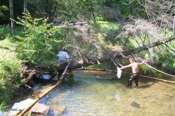
Sucking the crude up with a hose. This is at the North Country Trail
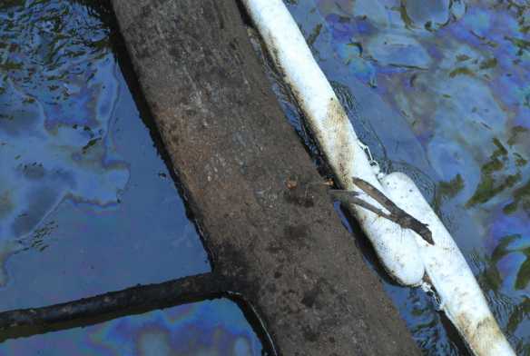
footbridge near Rt 321. Aug.22, 2008.
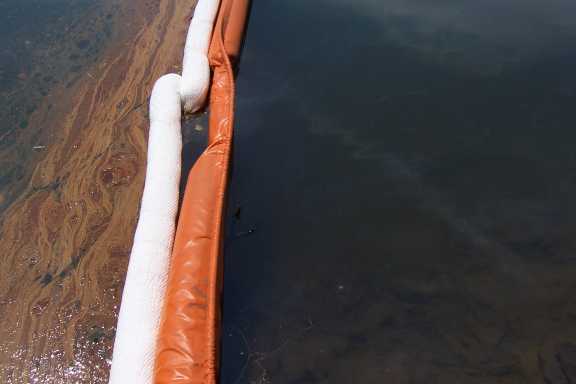
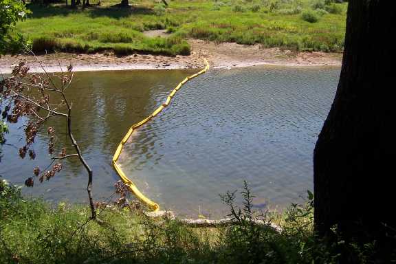
Here is a picture of the last boom on Chappel Run before the bay,
taken today, Friday, Aug. 22, about 2 p.m,. This is the same orange
boom I took yesterday from my kayak and also from shore. Yesterday it
was relatively clean. Today it isn't and is leaking out into Chappel
Bay.
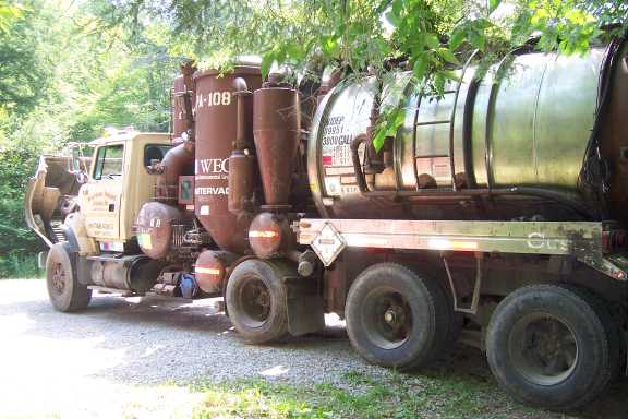
The "Monster Vac" truck up on the trailhead, on Rt. 321. The noise
is horrific. Aug. 22, 2008.
Upstream, in Chappel Run, not far from the North Country trail,
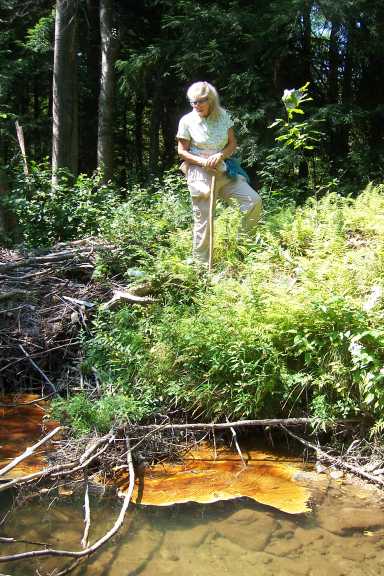
several of these rafts of crude oil. The person is Dr. Dessie Severson,
professor emeritus of biology from the Univ. of Pittsburgh at Bradford.
There are no booms for long stretches of the run, Aug. 22, 2008.
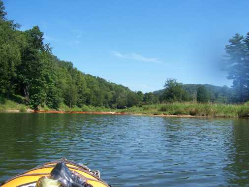
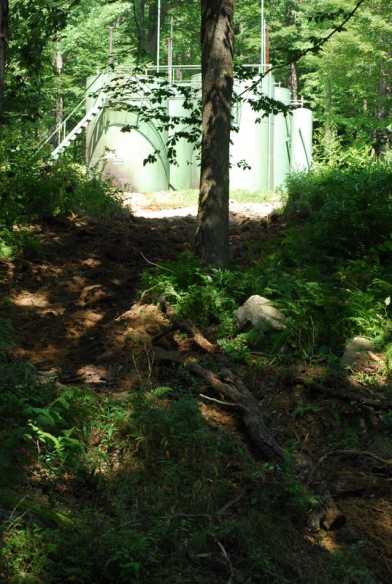
Photos by I. Champlin of Chappel Bay from a kayak, Thursday, Aug. 21.
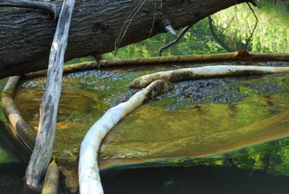
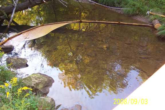
Approaching the upper end of Chappel Bay:
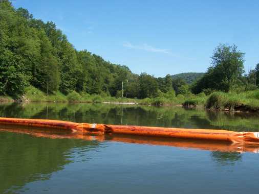
Booms across the upper bay and lower reach of Chappel Run. This orange
boom is working well... there is no oil sheen or brown/orange oil below
this boom (i.e. in the wide part of Chappel Bay itself.)
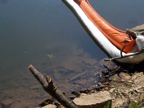
Another view, right behind the orange boom. The white diaper is hardly
soiled. The time is 3:30, Aug. 20. 2008:
Got out of the kayak and walked around on the bank. Looking upstream,
up Chappel Run, lots more booms:
Some oil sheen in the water here, behind the orange boom, but minimal,
minnows swimming around:

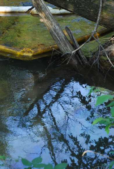

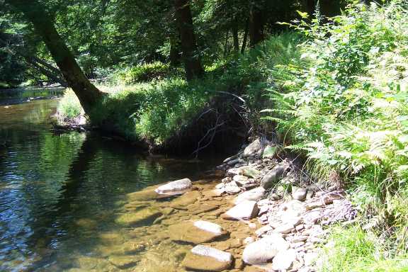
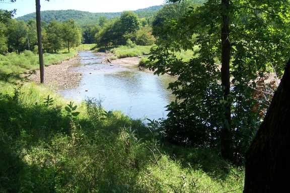
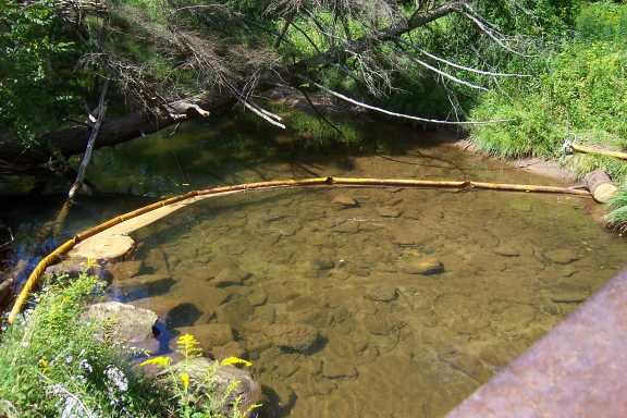
Allegheny National Forest, Chappel Run, Aug. 31, 2008. Bend of the stream near where the picture was taken with Dr. Severson nine days ago, Aug. 22. There is no oil here now.
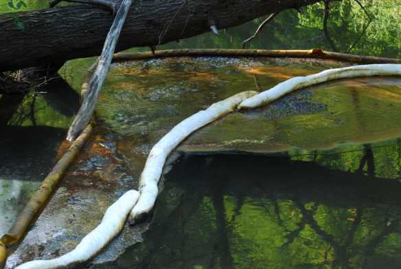
Allegheny National Forest, August 31, 2008, about 1:00. Picture taken from north bank of Chappel Run, last boom before Chappel Bay. Chappel Bay of the reservoir would be to the right of the picture. The wind has blown some leaked oil and leaves up against the boom on the bay side! There is not much oil collected on the upstream side of the boom (to the left, in this photo). This is the site of the original 'orange boom' in photos taken from a kayak and from shore on August 21.
Looking upstream, up Chappel Run. Water level is much lower than two weeks ago when the oil spill occurred on Aug. 16/17. Two more booms are visible.
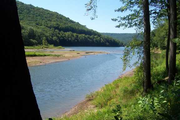
Looking downstream, Chappel Run turns into Chappel Bay of the Kinzua Reservoir. Same foreground tree in all these photos.
Oil on the rocks on the north bank of Chappel Bay, Aug. 31, 2008. Hiking staff for scale. This is BELOW the containment boom, on the bay side, not the upstream side. All photos by I. Champlin.
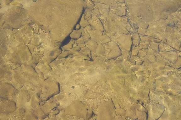
Big trout between the boom and the footbridge, August 31, 2008:
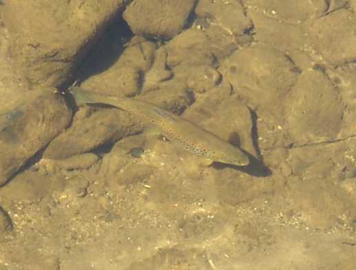
Big trout between the boom and the footbridge, August 31, 2008:
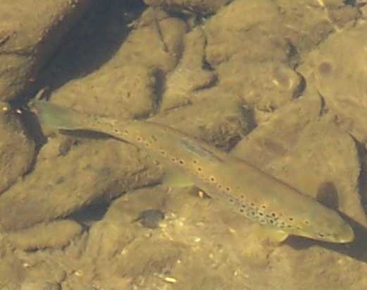
Big trout between the boom and the footbridge, August 31, 2008:
Aug. 31, 2008. Taken from the North Country Trail Footbridge near the trailhead on Rt. 321. No absorbent diaper on the boom.
Detail of the above:
Photos taken by I. Champlin, Weds., Sept. 3 and Sun., Sept. 7, 2008.
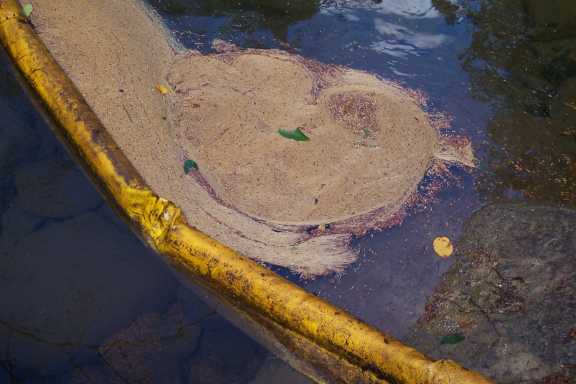
1) From the North Country Trail footbridge over Chappel Run, by the trailhead at Rt. 321. Weds., Sept. 3, 2008:
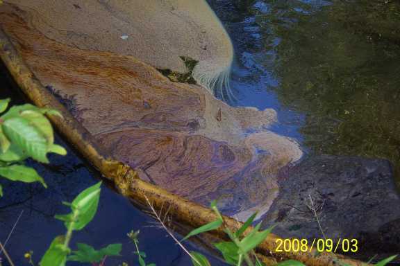
Close up of the above:
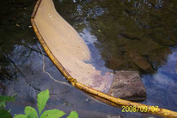
4 days later: From the North Country Trail footbridge over Chappel Run, by the trailhead at Rt. 321. Sun., Sept.7, 2008:
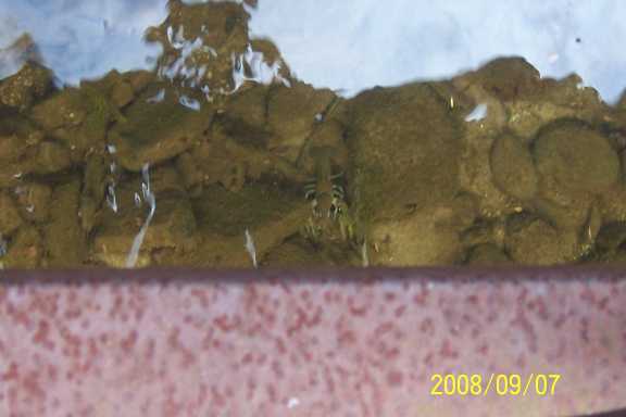
The skirt of this boom is frayed, but trout are swimming back and forth under it. Huge crayfish under the bridge:
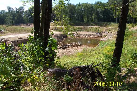
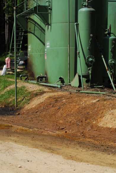
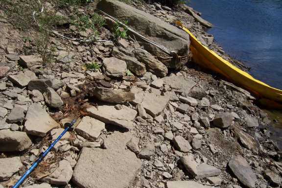
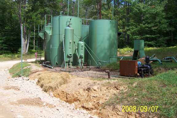
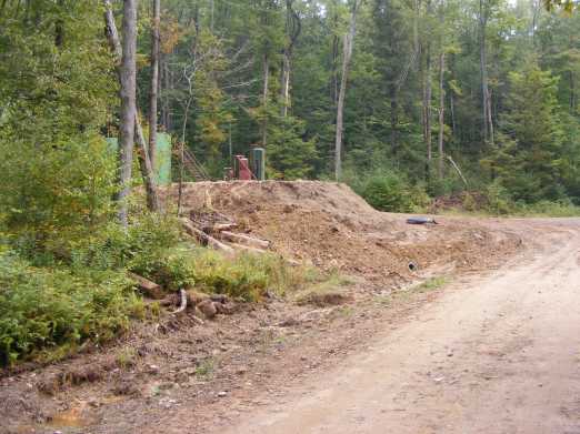
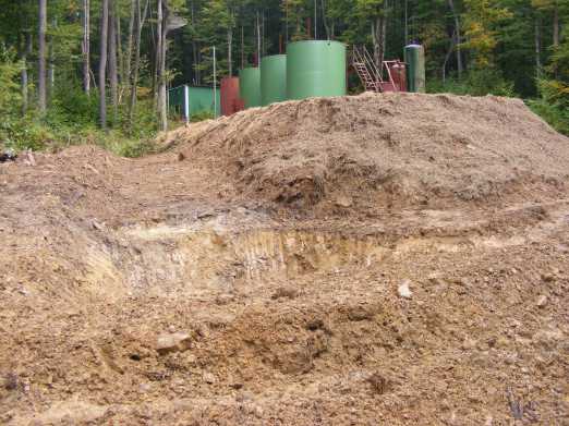
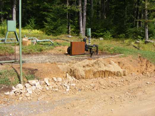
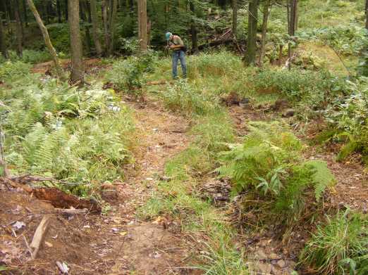
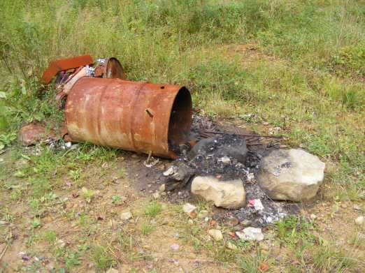
Sept. 7, 2009. Allegheny National Forest, Forest Service Road 267, Quarry and vandalized Snyder storage tanks (Lot 03) that are across the road:
1) Part of the quarry. Storage tanks would be to the right.
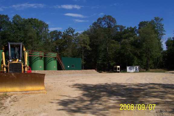
Cleaned-up storage tanks:
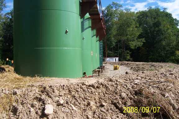
Close-up of new containment berms:
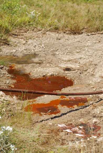
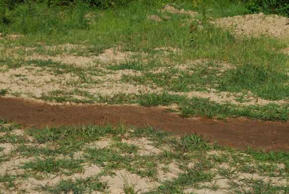
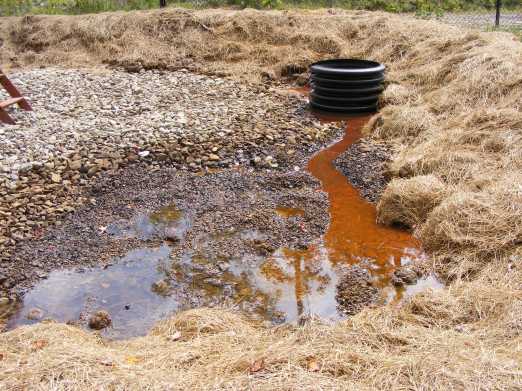
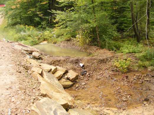
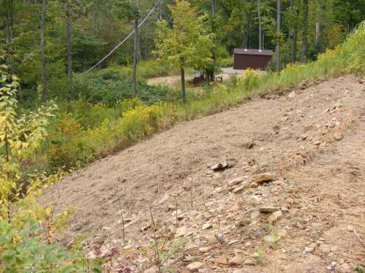
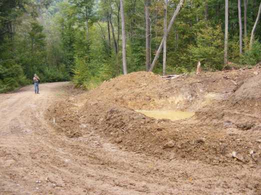
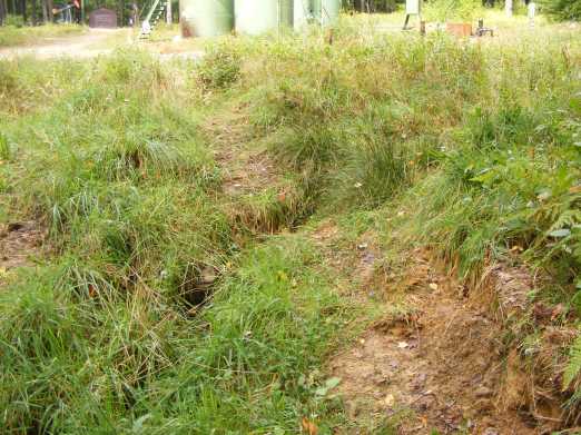
Sept. 7, 2009. Allegheny National Forest, Forest Service Road 267, vandalized Snyder storage tank battery (Lot 02West) that is right near the upper reach of Indian Run. (Indian Run would be downhill to the left):
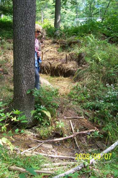
View from Indian Run up a re-seeded and baled slope to the storage tank battery:
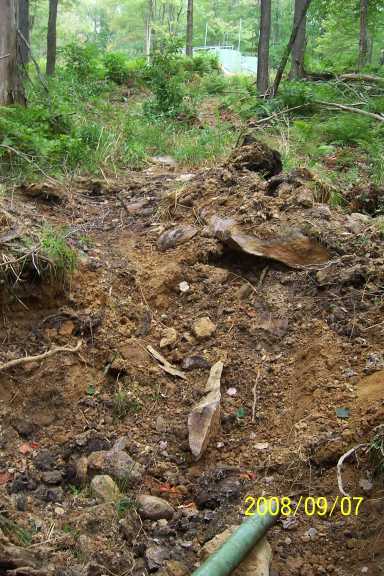
New containment pit:
Another view of this new containment pit. Indian Run is immediately to the right.
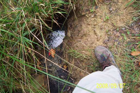
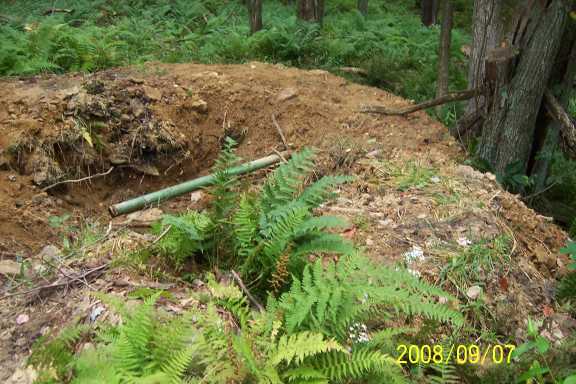
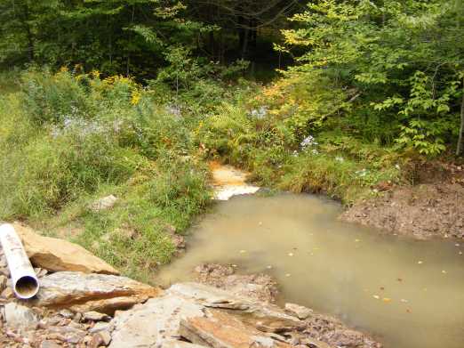
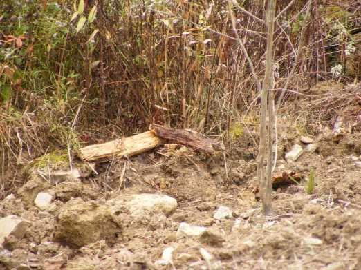
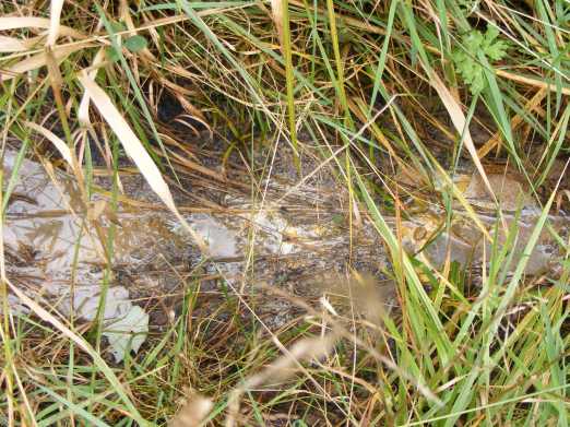
Ditch filling with raw crude. This is roughly above this containment pit, near the road, but this straight ditch does not directly lead into the pit.
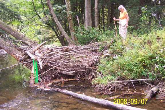
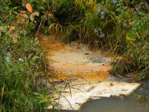
Sunday, Sept. 7, 2008. Bend in the stream bed of Chappel Run (North Fork of Chappel Fork), exact same place of photo taken on August 22. There is oil snagged here now too. Color of flagging is different. Up on the bank, where Dr. Severson is, there is now oil also. See picture #3.
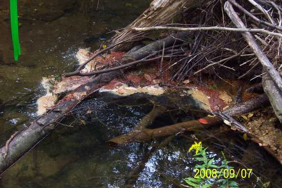
Close up of the snagged oil, above:
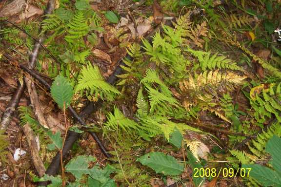
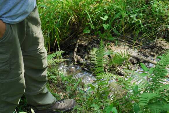
Sticks soaked with oil and ferns damaged by oil hauled onto the top of the bank. Smell of oil is very strong here.
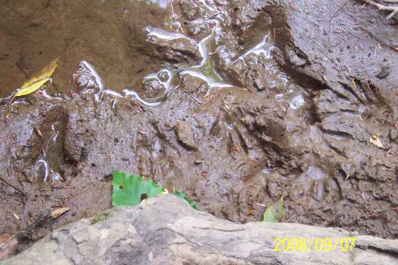
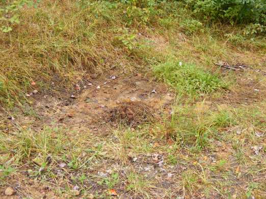
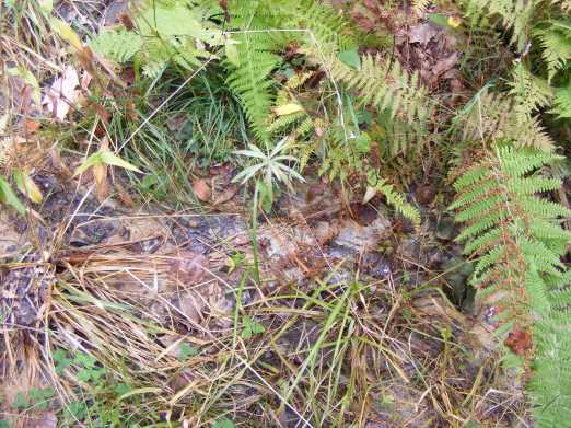
Oil slick and paw prints:


© 1999-2008 JVS