back
Green River Chamber of Commerce
Western Green River
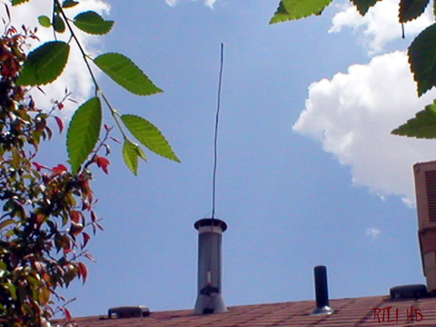
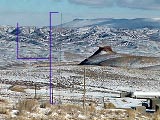
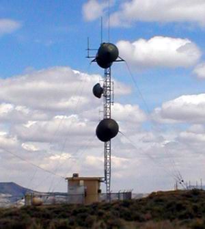
Description....This is a radio station translator for a station with the Callsign K232CU. It is directional. The exact location is N Latitude 41 30 52W Longitude 109 28 42. The other larger antenna is used as a cell phone tower by Uinta Basin Communications Corporation and was just put up 11/28/00.
There are a number of antennas on wooden posts nearby. These are thought to be local antennas.
There are a few antennas behind Green River including a signal bouncer. There are a few more antennas south of there that aren't included here. One is a transmitter for Northwestern Pipeline which is located near McKinnon Jct, 22 miles SW of Green River. (Which is our favorite picture for RTLI and can only be seen and bought in the UBSTUDIOS store).
Description......This is for PacifiCorp. The exact location is Longitude: 109.4843 (109D 29M 3S)
Latitude: 41.4705 (41D 28M 13S). The real location is...South Hill Radio Sta, 200 ft. E. Hwy. 530, 1.9 Mi SW of Green River.
Starting from the south...

A Broken pager/microwave tower in use by several local services. This tower corresponds with others on Aspen Mountain.
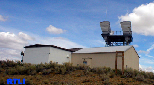
This is the South Hill FAA air traffic facility that also corresponds with the one on White Mountain and Wilkins Peak.
The signs on the door are much the same as the signs on Wilkins Peak's FAA transmitter.
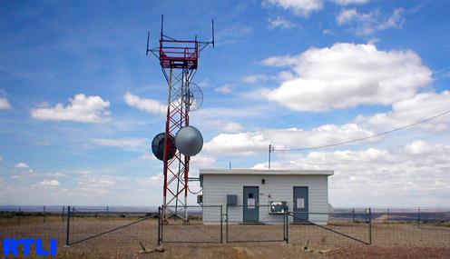
Description......This is a transmitter for the telephone company AT&T. It is a long line transmitting facility. I suspect that the far off one on the "RS east" page is another one of these, as well as the one north of Rawlins WY. This tower has recently been taken care of by American Tower. Freq. unknown. The black two dotted one you see next to it is a UP antenna which is below. Right down the road from there is the PacifiCorp antenna. 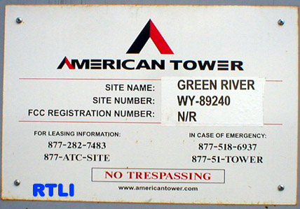
The sign on the ATTLL door.
The Union Pacific RR transmitter on South Hill.
In the Valley of GR
There are several towers in the valley of Green River. I guess I may put BEAT 740 AM on as well.

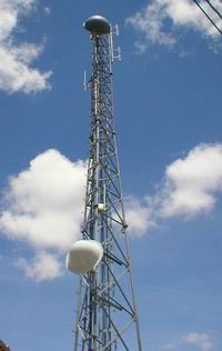
Description.....Kugr's only antenna... Brodcasting a radio station on 1490 AM in a suprisingly sound location. It isn't directional of course. (new pictures of this one are soon to arrive on a seperate page).
It's exact location is....N 41 30 56 W 109 26 11. The height of the antenna is 216 ft above the ground. To see the actual studio and microwave antenna click here!
 Description.....This is a road condition/ weather antenna right by I-80. It is used by WYDOT. On the freq 162.550 it is known as "Cemetary Separation" You can't miss it either way you go. Very small also. Exact Loc. unknown...but right smack next to I-80 near the tunnel. On the east side of it in fact. As you can see.
This is a UBET Wireless tramsitter that is also used by the UP railroad for several things. As you may know it can be seen from the northern part of Uinta Dr. Exact Loc. unknown.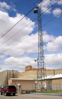
Another view with the RTLI Mobile at the bottom.
THE SIGNS FOR UBET