The Wheeler-Kenyon method
From Wikipedia, the free encyclopedia
The Wheeler-Kenyon method is a method of archaeological excavation. The technique draws its origins from Mortimer Wheeler's work at Verulamium (1930-35), and was later refined by Kathleen Kenyon during her excavations at Jericho (1952-58).
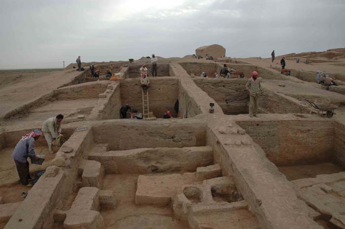
The Wheeler-Kenyon system involves digging within a series of 5x5 meter squares set within a larger grid. This leaves a (1 meter wide) freestanding wall of earth--known as a "baulk"--on each side of a unit. These vertical slices of earth allow archaeologists to compare the exact provenance of a found object or feature to adjacent layers of earth ("strata"). During Kenyon's excavations at Jericho, this technique helped discern the long and complicated occupational history of the site. It was believed that this approach allowed more precise stratigraphic observations than earlier "horizontal exposure" techniques which relied on architectural and ceramic analysis.
Sources: Joseph A. Callaway, "Dame Kathleen Kenyon 1906-1978," The Biblical Archaeologist, Vol. 42, No. 2. (Spring, 1979), pp. 122-125.
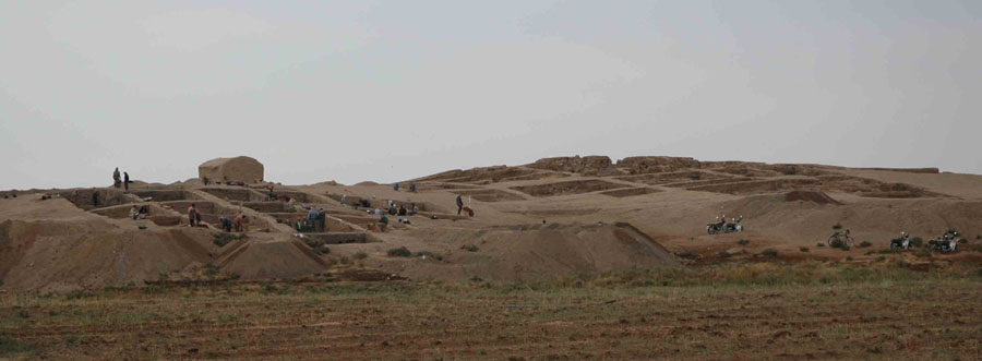
The excavation below is on the five-hectare site of Tell Sabi Abyad. It has been carried out under the leadership of Professor Peter Akkermans since 1986. It is organised by the Leiden University and the Netherlands National Museum of Antiquities.
The mound is situated in Syria about 30 kilometres from the Turkish border.
Work in 2004 took place in Operation II, dated at about 6100 BC, and in Operation III, dated at about 6800-6200 BC.


The excavation in the northwestern part of Tell Sabi Abyad (Operation III), with settlement remains dating between 6800 and 6200 BC.
