Lake Champlain Trivia
|
|
Fishing Implement From The Past 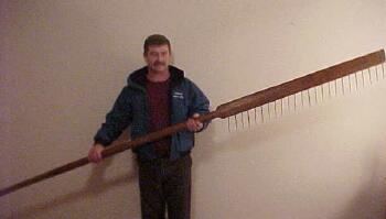 |
| - In Years past this very "pike paddle" was used on the south end of Lake Champlain to navigate in the shallows and harvest spawning pike as they lay stacked up in their spawning beds. The narrow paddle is equipt with 6 inch spikes! Thanks for the history lesson Leon! |
|
Legendary History 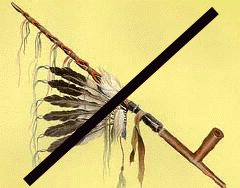 |
| - In the centuries prior to it's discovery by white men, Lake Champlain was claimed by bitter rivals, the Algonquin and Iroquis indian nations. - According to Abenaki legend the small island known as Rock Dunder near Shelburne Point represents a being known as Ojihozo who created Lake Champlain by pushing and pulling himself from the earth between the Adirondaks and the Green Mountains. When Ojihozo proudly saw all that he had made, he sat on a small island and turned himslf to stone so that he could guard and protect his creation forever. |
 Indian legends tell of great horned creature   |
|
- The lake was officially "discovered" by Samuel de Champlain on July 4, 1609. One of the many documented sightings of a serpent in the lake was by Champlain himself. He also noted "la mouette" (the gulls) near the mouth of a river. When his map was drawn up, the mapmaker forgot to cross the "Ts". From then on, the river was refered to as Lamoille, a name which has no significance. |
 |
In 1666 Seigneure de la Motte built Fort Saint Anne on Isle la Motte to protect against Indian raids. General Montgomery used the spot as his headquarters in 1775, prior to his expedition into Canada. Today the site is marked by Roman Catholic shrine honoring Saint Anne. |
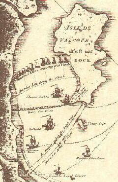 |
- A significant battle occured at Valcour Island in the fall of 1776 when Benedict Arnold delayed an invaision by the British navy allowing the Americans precious time to rebuild their forces over the winter. |
 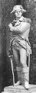 |
| - The Hero Islands were named in 1779 by Ethan Allen in honor of himself and his brother Ira.
|

|
| - On Vermont's Grand Isle sits what is likely to be the oldest log home to survive in the US. The 25' X 30' "Hyde Cabin" was built of cedar logs in 1794 by a Bunker Hill veteran named Jedidiah Hyde. The building was moved from its original location to a spot near Grand Isle Village. All parts of the structure are original with the exception of the roof and fireplace. |
 |
| - In 1808, Thomas Jefferson ordered a trade embargo against Canada, The locals, many of whom relied on the exchange of goods up and down the waterway, were induced to smuggle their goods in small boats through narrow passages connected by carrying points. Savage Point on North Hero Island was one of many examples. The remote islands and shoreline offered numerous hiding places along their route where they could avoid being caught. Later, during the 12 years of prohibition, these same passages to and from Canada were used by rum runners with boats. |
 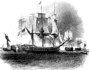 |
| - On September 11, 1814 a superior British fleet invaded and attacked a small American navy on Plattsburgh Bay while British ground forces simultainiously attacked Plattsburgh. On the lake, the British mothership Confiance was disabled and its British commander, Captain Downie, was killed. American Lt. Thomas MacDonough and his small navy prevailed and forced the surrender of the British navy on Lake Champlain. |
 |
|
Spectacular Geography and Complex Ecology |
| - The Lake Champlain basin is supplied by water draining from New York's Adirondack Mountains on the west and Vermont's Green Mountains to the east. The waters flow in a northerly direction into Quebec's Richelieu River and continues on into the St. Lawrence River, and from there, into the Atlantic Ocean. |
 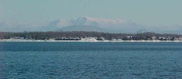 |
| - Lake Champlain stretches 120 miles in length, from Whitehall, New York to Lacolle and Missisquoi, Quebec. It is 12 miles across at its widest point. Its surface area encompasses 435 square miles, 270 in Vermont and 150 in New York. There are 587 miles of diverse shoreline. Lake Champlain's deepest spot is slightly over 400 feet while the average depth is 68 feet. |
 |
- There are 71 unique islands scattered about Lake Champlain. |
 |
- During a wind event a continuous "bathtub effect" or "seiche" causes the lake level to rise on one end as it drops on the other. |
 |
| - The Lake is divided into five distinct areas, each with different physical and chemical characteristics and water quality. These lake segments include: the South Lake, the Main Lake or (Broad Lake), Malletts Bay, the Inland Sea (or Northeast Arm), and Missisquoi Bay. |
 |
| - Lake Champlain stratifies in the spring and summer. The warmer, less dense, upper layer of the Lake known as the epilimnion usually extends down about 33 feet in the Main Lake during the summer. Below this layer, there is a sharp transition in temperature called the "thermocline," dividing the warm upper layer from the cooler water below. The cooler more dense layer is know as the hypolimnion. In the spring and fall, when the layer temperatures converge , the waters mix and a turnover occurs. |
 Unique Island Habitats 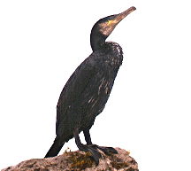 |
| - Young Island, just off Grand Isle, has been overrun by Double Crested Cormorants. The runaway population of this migratory water fowl has totally defoliated Young Island and is invading new territory. They are building nests on islands previously disregarded by cormorants, subsequently threatening several other bird species sanctuaries. Cormorants eat perch and smallmouth bass in large numbers! In 1998 the state of Vermont began a multi year program to reduce the numbers of these birds by oiling their eggs. In 1999 Young Island was home to over 3000 nests, Soon after that number was reduced to about 1700 nests. |
 |
| - Isle La Motte is the site of a 480 million year old coral reef, the world's oldest. This sponge-like coral reef existed near where Zimbabwe is now, when our region of the North American plate was located in a tropical sea, south of the equator. |
  |
| - Rock ledges on Valcour Island reveal marine fossils nearly 450 million years old. On Valcour's southern interior there is a great blue heron rookery. This island also supports a healthy population of white-tailed deer. It is the largest of the lake's uninhabited islands with a surface area of 1000 acres. |
 
|
| - On the Four Brothers Islands there are eight species of nesting water birds and five species of ducks, geese and mergansers. Last year, a pair of glossy ibis were the first of its species to nest on the islands. As a result, Lake Champlain's Four Brothers Islands are now noted as the nothernmost nesting site for ibis in the world. |
  Great Blue Heron |
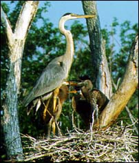
| - Shad Island, located ner the mouth of the Missisquoi River on the north end of the lake, is the site of one of New England's largest great blue heron rookeries. In 1999 biologists counted a record 581 nests on the island. This island is an example of habitat being encroached upon by cormorants since the biologists also counted 34 pairs of the invasive birds among the heron nests. |
|
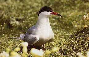
| - Lake Champlain is also home to the common tern. Fewer than 200 pair nest on about six islands in the lake, the most noted being Popasquash Island. Lake Champlain has the only known inland nesting population of these birds in New England. |
 New England's Most Diverse Freshwater Fishery |
- Lake Champlain is home to over 80 species of fish. 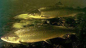
|
| - Native Atlantic salmon were once plentiful in Lake Champlain. On a 1776 map of Lake Champlain by C. J. Sauthier, a salmon fishery was noted at the mouth of the Great Chazy River. Atlantic salmon are now stocked by both New York and Vermont agencies. The Vermont record for the Atlantic salmon was caught by a fisherman casting from shore for perch. |
|
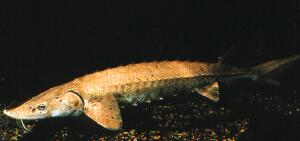
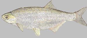
| - The Lake Sturgeon and the Mooneye are among Lake Champlain's endangered species. |
 |
|
Home
| ||
