|
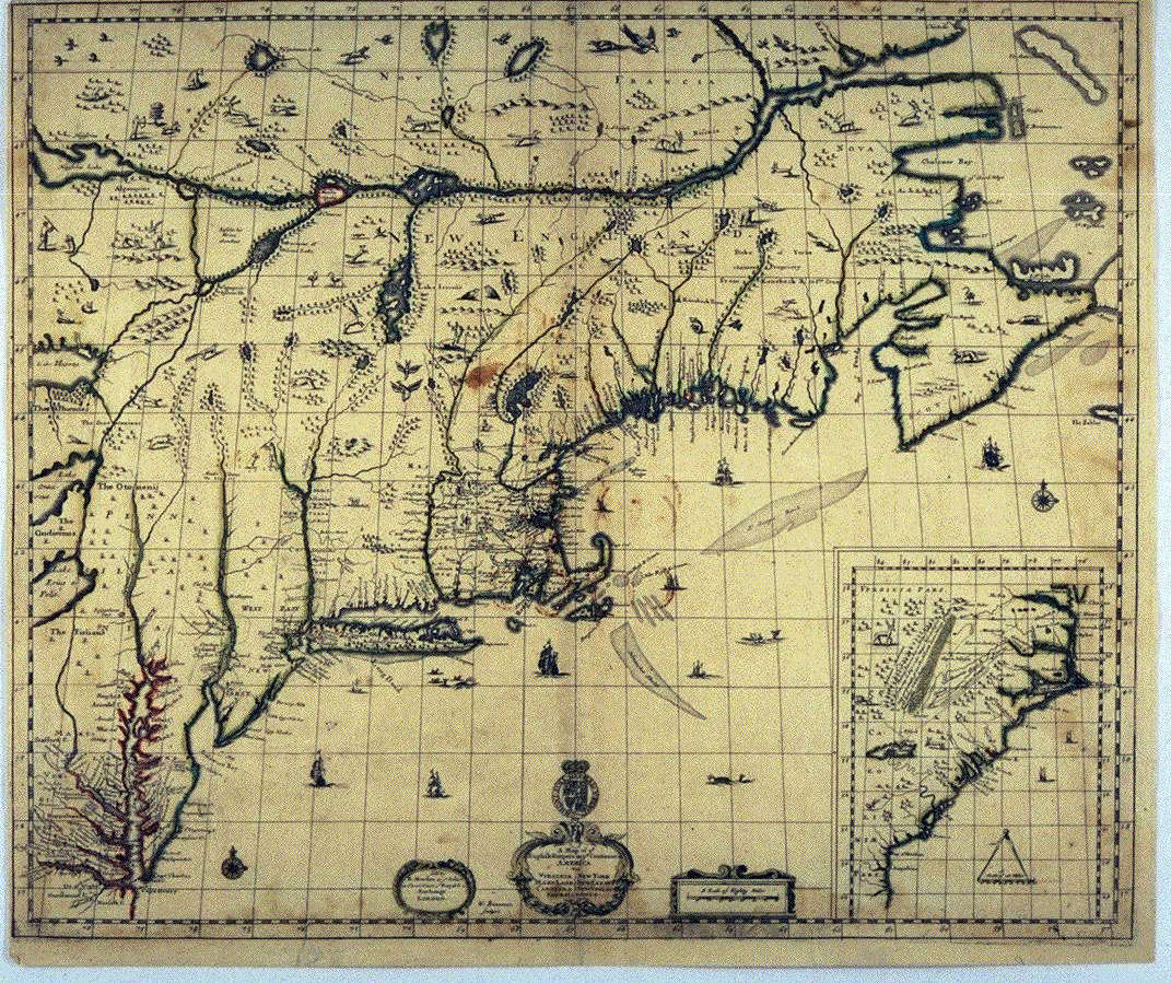
Robert Morden’s map of British North America is a late version of a map originally published in 1675. Like many early map makers, Morden relied on compiling information from previous maps, rather than utilizing new surveys or other original sources. His map is a mixture of elements derived from various Dutch and English maps, including, including Seller’s 1674 map of New England. The Morden map belongs to a "family" of almost identical maps published between 1675-1700 by several well-known British cartographers, including John Thornton, Richard Daniel, and Philip Lea. Most of the features on this map are copied from Dutch maps or the map by John Seller shown previously. The Morden map does have a number of improvements over its predecessors, particularly in its depiction of Long Island and New England, which reflect the gradual improvement in geographical knowledge of these areas. The map also includes a scene of whaling from small boats off Long Island. The whalers are probably English colonists, but they are using a technique adapted from the local Indians. This is one of the earliest depictions of whaling in the New World. Paul E. Cohen, Manhattan in Maps , 48-49.Henry Stevens and Roland Tree. "Comparative Cartography," in R.V. Tooley, The Mapping of America, 63, 72 Courtesy of the John Carter Brown Library. |