
undefined
The urban life of the Sudan is mostly concentrated in Khartoum, the capital city which is one of three sister towns built at the convergence of the Blue and White Niles: Omdurman, the largest and most indigenous lies to the north-west across the White Nile, Khartoum North, the smallest of the three lies to the north across the Blue Nile and Khartoum itself on the southern bank of the Blue Nile.
Many historians took different hypotheses regarding the origin and meaning of the word “ Khartoum”. Linguistically Khartoum or Al-Khurtoom الخرطوم is an Arabic word meaning the elephant’s trunk. The shape of the narrow tongue of land between the Blue and white Nile in which the town was built looks like an elephant’s trunk. But there is another historical story which tells that at the time of the Roman conquest of Egypt, the Romans sent expeditions up the Nile, where they discover at the site of the present Khartoum, the safflower seed which is called "Ghrotum". The safflower seed oil was used as medicine to cure wounded soldiers.
Captain J. A. Grant, who reached Khartoum in 1863 with Captain Speke’s expedition, belived also that the derivation was most probably from the woord Ghortum the safflower (Carthamus Tinctorius L.)
At Khartoum the two Niles meet forming a most extraordinary and remarkable natural phenomenon as the dividing line between the white or (light brownish) waters of the White Nile and the blue (dark greyish) waters of the Blue Nile can clearly be traced and witnessed nearby or from a high distance.
The history of modern Khartoum starts with the appearance of an elderly pious man called Sheik Arbab al-Agayed who lived in Khartoum in the 17th century. Large number of disciples and adherents started to gather round him in Khartoum. Two prominent disciples are Sheik Hamad Wad Um-Maryom and Sheik Khojali (early founders of Bahri or Khartoum North)
Ismail Pasha who was sent by his father Mohamed Ali Pasha the Khedive of Egypt, chose Khartoum - the thin strip of land at the convergence of the rivers - as a military outpost during his military expedition to the Sudan in 1821. Soon the town was chosen by the Turco rule as a capital for the Sudan until they were ousted by the Mahdi.
In 1885 the Mahdi followers, ending the reign of the Turco-Egyptian's khedive, killed Maj. Gen. Charles George Gordon, known by the name “the Chinese”. The Mahdi established the first Sudanese national state in Omdurman. The capital of country was then shifted to neighbouring Omdurman across the White Nile.
After the fall of the Mahdist state, Khartoum was reinstalled as a capital of the condominium Administration in 1898. Lord Kitchener was sent out by the British to re-occupy the Sudan and he inaugurated the era of the Anglo-Egyptian Condominium in the Sudan after defeating the Sudanese forces at the battle of Omdurman Karrari as known by the Sudanese) in 1889. Kitchener rebuilt Khartoum in the shape of the Union Jack which he hoped would make it easier to defend( something which had been done also in Faisalabad city, in the Indian Pennisula).
"Residential areas along the banks of the Blue Nile were surveyed for British colonial officials. The Gordon Memorial College, later becoming the University of Khartoum, was opened in 1903 and military barracks and ' Native Lodging Areas' at Burri, east of Khartoum were works in progress in these early years. In 1909, the first railway bridge crossed the Blue Nile, thus giving the capital a fairly rapid link to the coast at Port Sudan, The city grew quickly and it expanded to the south, east, and west. Under the Leadership of Sarsfield-Hall (1929-36) an industrial area was provided for west of Shari al Qasr (Victoria Avenue) and exigencies of traffic control began to make some of Kitchener's diagonal streets obsolete. A master plan was designed to account for European and Native residential areas, for workshops and factories, a market center, for ' noxious' trades, and for owners of animals and their vehicles. The Khartoum airport lies constant expansion, it may fall victim to the pressures of urban growth and plans are advanced for a newer, more remote and modern airport. While Khartoum is vastly bigger than in the days of the British , the essential inner from remains the same expect for the residential ' New Extensions' to the south and east,( The KENANA Hand Book)"
Khartoum grew rapidly and prospered during the period between 1825 and 1880. In 1834 it became the capital of the Sudan, and many European explorers used it as a base for their African expeditions.
Khartoum of Today is a quiet metropolitan place. It has peaceful, tree-lined boulevards, and in some areas still bears the marks and scent of the ancient British Empire
In 1909 the Blue Nile Bridge was built to link Khartoum with Khartoum North and northern Sudan. In 1928 the White Nile Bridge was constructed to connect Khartoum with Omdurman.
Khartoum lies on latitude 15 N, longitude 30 E. Its altitude is 1214 feet above the sea level.
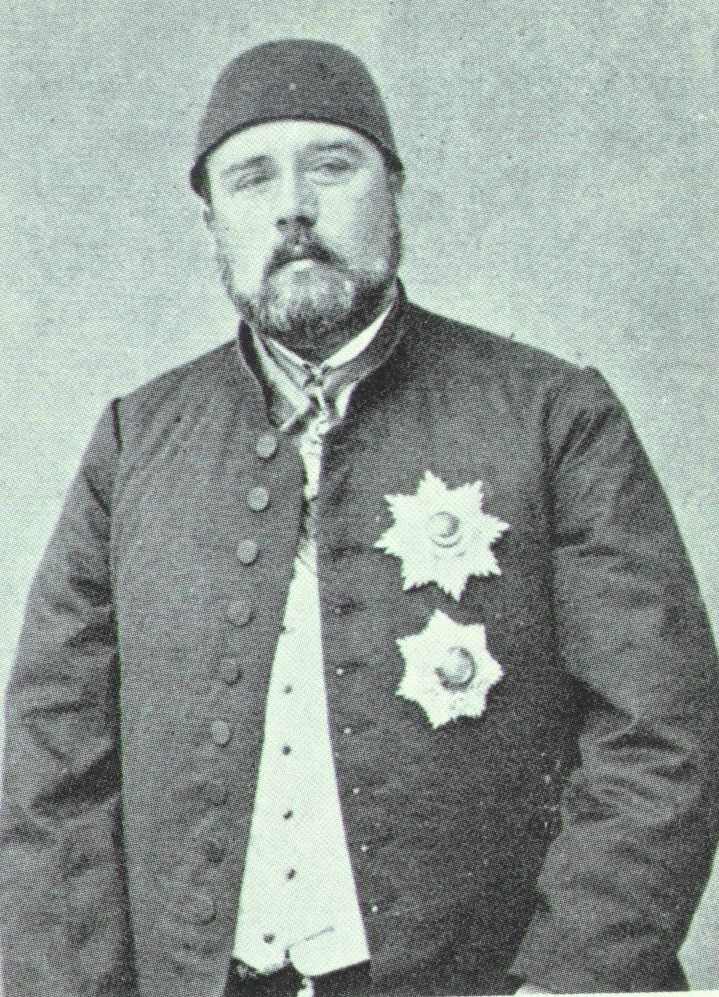
Ismail Pasha, the founder of Khartoum

Modern Khartoum
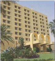
Khartoum Hilton
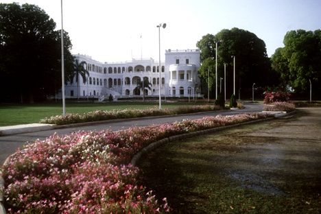
The Presidential Palace, one of the promunent features was built in 1821.

Byzentine stylish old church, Khartoum

A Mamlouk's style Mosque in Khartoum

Khatoum fruits kiosks:colors and scents
Khartoum slides show
