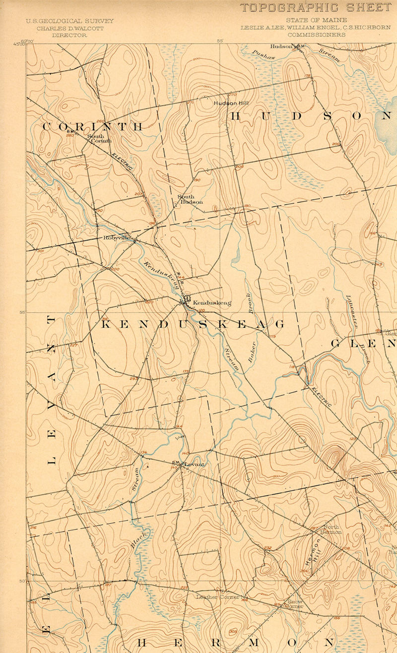
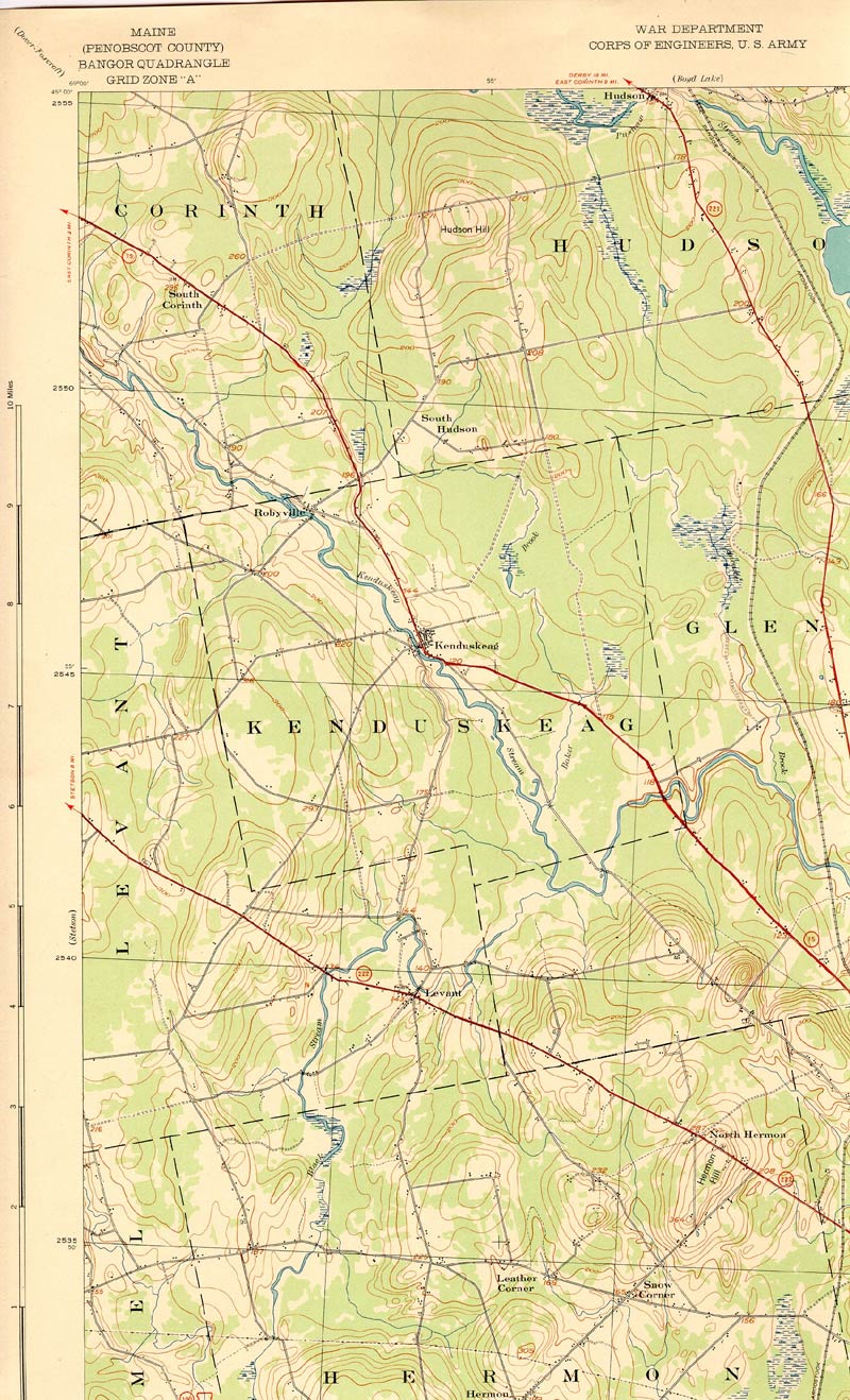
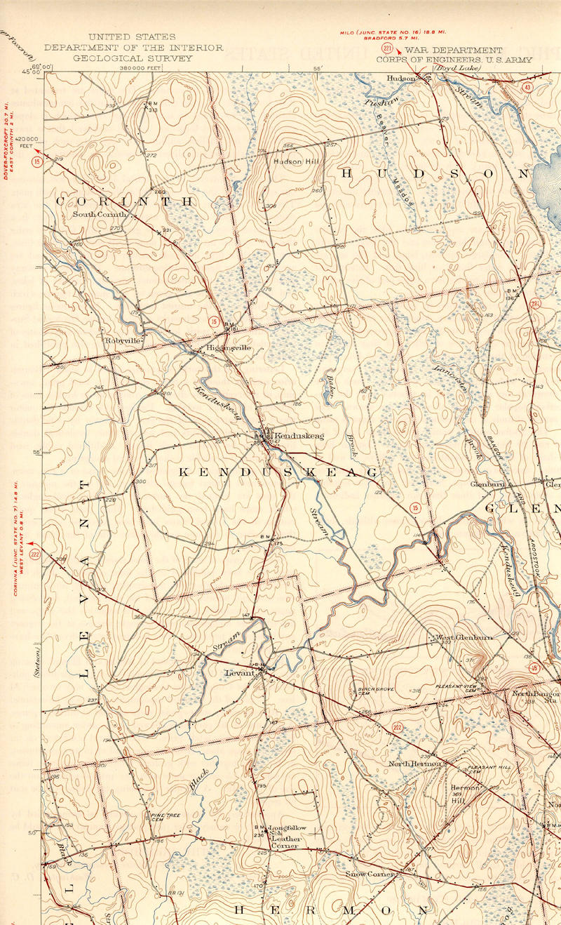
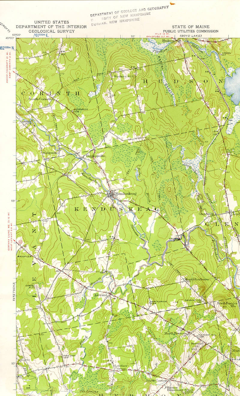
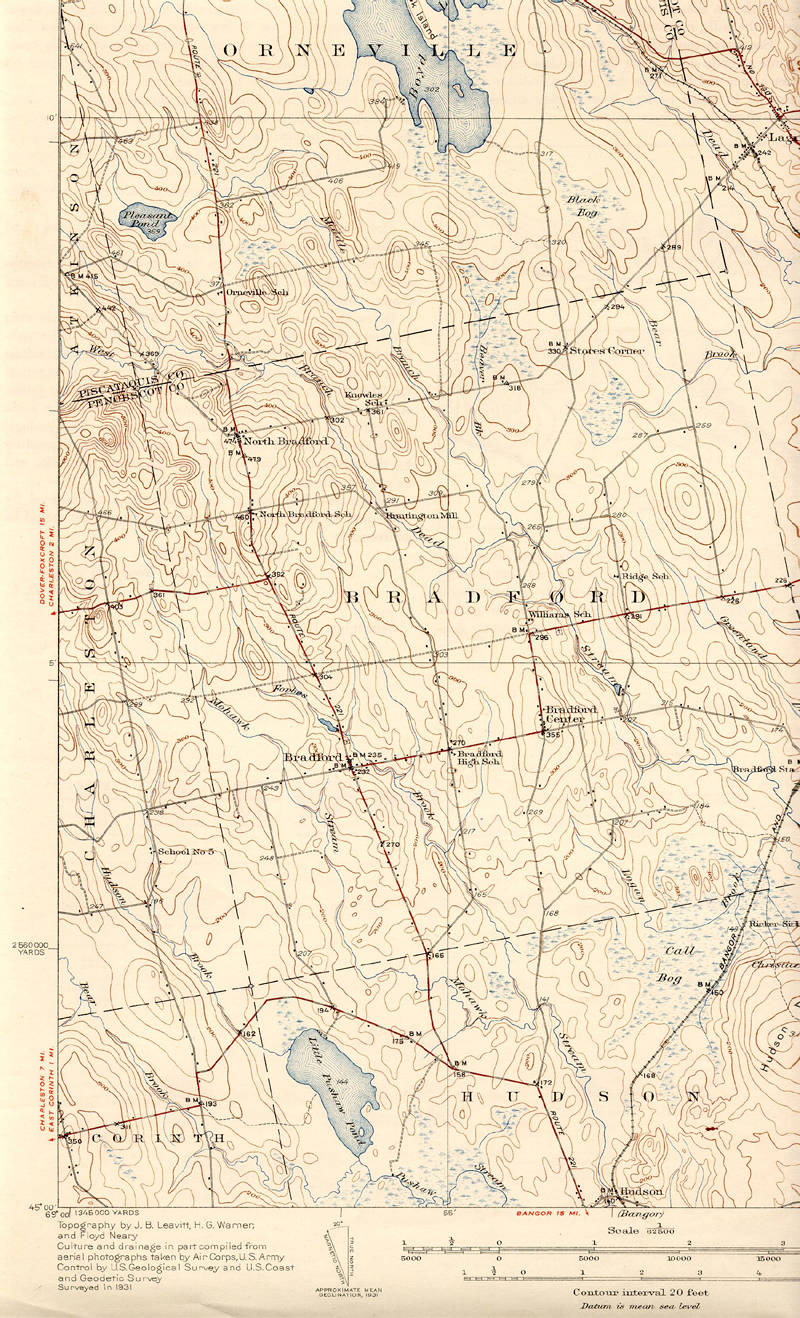
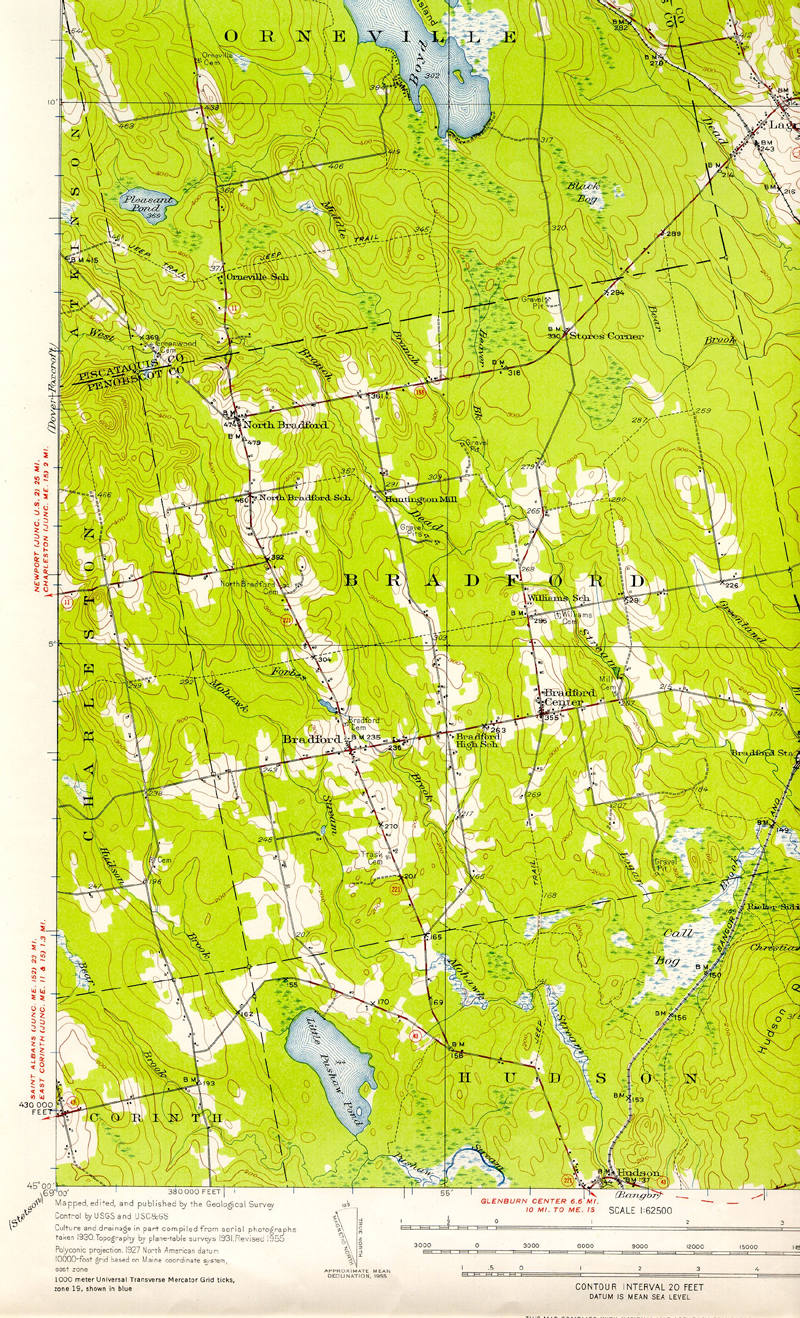
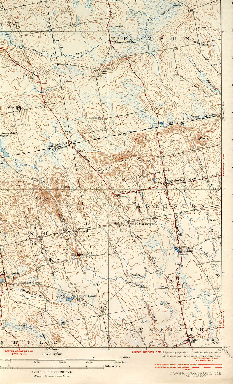
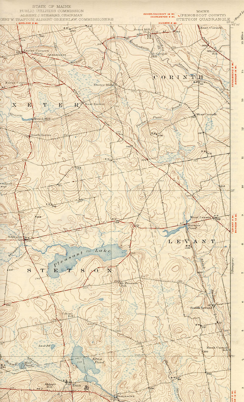
Historic Maps can be
of great interest to people researching their family’s history. In some cases, the Delorme maps are nice but
the US Geological Survey even points out where houses were located. In the following maps, found thanks to a key
in a recent article of DownEast Magazine, you can see how the Town of Corinth
has evolved over the years. Because the
USGS designs its maps in quadrants, the Town of Corinth is divided up in four
sections. The coordinates for the
center of town, 45°69°, are the corner
of each of the maps indicated here.
Further links are provided to the University of New Hampshire’s website,
where other Maine maps can be explored.
The files on the New Hampshire website are very large (1.5- 2 MB), due to the way
that they were scanned at the University of New Hampshire and will take a few
minutes to load on a phone connected modem. The files provided here have been reduced in size for readability and ease of loading and are therefore not as high of a quality.
Please be patient.
University of New
Hampshire DIMOND LIBRARY
Documents Department & Data Center
Historic United States
Geological Survey Maps of New England
Alphabetic
Map Listing

