undefined
undefined
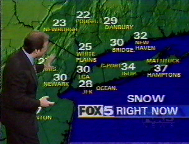
SNOWSTORM 2000
Friday Dec 22nd: Many of the computer models were forecasting a major winter storm for the East Coast. An upper level low in New Mexico would move across Texas during the first part of the week. A surface low would form along the Gulf coast and move slowly eastward and reach the Atlantic by early Friday and swing up the coast. At the same time, a small, but vigorous storm would drop out of western Canada and move Southeastward during the week. They would merge over Cape Hatteras early Saturday and move NNE, giving Long Island a major snowstorm.
Wednesday Dec 27th: It looked like the southern storm was moving faster than expected and would be heading out to sea. However, the storm from Canada, now located in South Dakota, would move to the lower Ohio River Valley, by late Friday. Then it would transfer it's energy to the North Carolina coast and form another vigorous storm that would pull in some of the moisture and energy from the southern storm. In addition, the upper level low pressure left over Ohio would pull on the new coastal storm keeping it close to the coast. Instead of the storm tracking on a NE or NNE course, it would track north and then NNE and at a slower rate. The storm was expected to really intensify just southeast of Long Island Saturday afternoon.
Thursday Dec 28th: Forecasters were calling for up to a foot of snow with winds of 40+ mph. Snow was to start around dawn on Saturday and get heavy during the afternoon and into the night. It was to snow into Sunday.
Friday, Dec 28th: Winter Warnings and Coastal Flood Watches were issued.
The Coastal Flood Watch read:
A COASTAL FLOOD WATCH IS IN EFFECT FOR SAT FOR LONG ISLAND SOUND & THE OCEAN FACING SHORES...
LOW PRESSURE WILL DEVELOP ALONG THE NORTH CAROLINA COAST TONIGHT. THIS LOW WILL INTENSIFY RAPIDLY AS IT MOVES UP THE COAST SATURDAY... PASSING NEAR OVER EASTERN LONG ISLAND OR JUST EAST OF THE TWIN FORKS SATURDAY NIGHT. NE WINDS AHEAD OF THE LOW WILL INCREASE TO 30 T0 40 MILES PER HOUR WITH HIGHER GUSTS ON SATURDAY. THESE WINDS WILL CAUSE TIDE LEVELS TO RISE TO 3 TO 4 FEET ABOVE PREDICTED LEVELS. THIS WILL LEAD TO WIDESPREAD MINOR FLOODING & POSSIBLY MODERATE COASTAL FLOODING WITH SATURDAY'S HIGH TIDES CYCLES.
I sent out an email at 4 PM giving the official forecast and my forecast.
"This is the latest official forecast. My forecast follows below.
A WINTER STORM WARNING FROM 800 AM EST SATURDAY UNTIL MIDNIGHT COASTAL FLOOD WATCH FOR SATURDAY
TONIGHT...becoming cloudy in the mid 20's. SATURDAY...snow developing, heavy at times in the afternoon. Snow accumulations by evening 3 to 6 inches, and becoming windy in the low 30's. SATURDAY NIGHT...snow, heavy at times until midnight. Total accumulation of 6 to 12 inches. Wind in the upper 20's. SUNDAY...snow showers likely, with only light accumulation expected, windy around 30. SUNDAY NIGHT...partly cloudy & breezy in the upper teens.
I'm in agreement with the Winter Warning, Coastal Flood Watch, & accumulation by evening. I differ on the total snowfall accumulation. The twin forks, especially the south one, will see some sleet and rain mix in late in the day for awhile, and I would not be surprised to see it all rain there for a short period of time. The snow should start between 5-7 AM. While I believe that the amount of snowfall for the storm will be somewhat less than what they are currently calling for, later Saturday afternoon and into the night will be very nasty. Winds & heavy snow will make travel very difficult if not impossible. We will still have some lingering snow showers on Sunday AM that will only add about an inch of new snow. Here's my call on amounts. Twin Forks, especially the south, 6-8". The rest of Suffolk County 7-9". Nassau County 9-12". New York City 10-12". The higher number is for the western part of the areas and the lower for the eastern. Winds will be 30-40 mph with some higher gust, so drifting snow and coastal flooding will be a problem. So an ugly Saturday followed by continued cold weather. Maybe some more snow later next week."
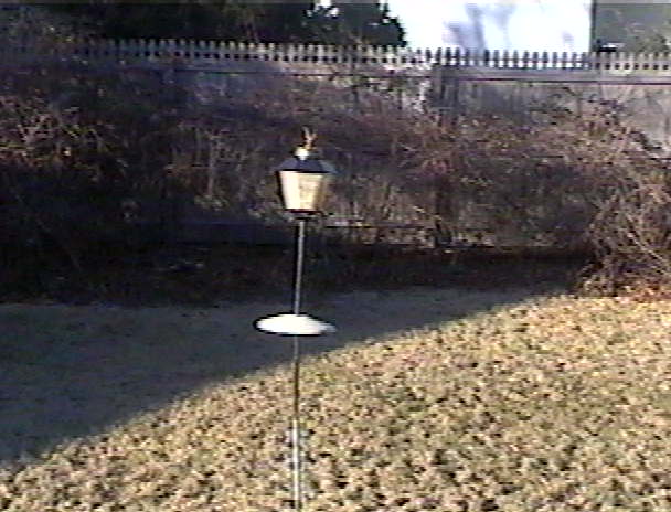
A few clouds showed up in the afternoon, but the birds didn't flock to my feeder the way they usually do before a storm. Did they know something that I didn't?
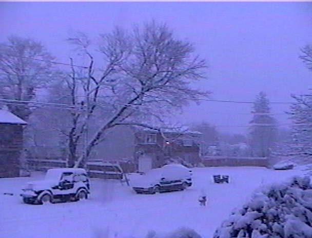
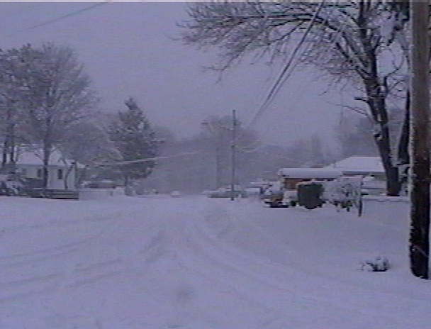
Click picture to enlargeSaturday, Dec 30th:Snow started falling earlier than expected, around 4 AM. It fell at a moderate to heavy rate with not much wind until 9:30 AM. At this point, almost 6 inches had fallen.
8 AMAlmost 5"
| Snowing Hard
| Real Pretty
| |
Later in the morning, this is what the NWS was saying
"NATIONAL WEATHER SERVICE NEW YORK NY
1045 AM EST SAT DEC 30 2000
..THE NATIONAL WEATHER SERVICE CONTINUES THE WINTER STORM WARNING FOR THIS AFTERNOON FOR THE ENTIRE TRI-STATE REGION... A LARGE COASTAL STORM WAS GATHERING STRENGTH OFF THE NEW JERSEY COAST. THIS LOW WILL MOVE OVER LONG ISLAND THIS EVENING AND TO THE GULF OF MAINE BY SUNDAY AFTERNOON.
HEAVY SNOW WILL CONTINUE INTO THE EARLY AFTERNOON OVER MOST OF THE REGION...AND THEN BECOME LIGHTER. TOTAL ACCUMULATIONS WILL RANGE FROM 10 TO 15 INCHES OVER WESTERN SECTIONS OF THE AREA TO 5 TO 10 INCHES OVER EXTREME EASTERN PORTIONS OF LONG ISLAND WHERE SOME RAIN MAY MIX IN FROM TIME TO TIME.
BY LATE AFTERNOON MOST OF THE ACCUMULATION SNOW SHOULD BE OVER WITH SOME SNOW SHOWERS STILL LIKELY TONIGHT AS THE STORM MOVES SLOWLY AWAY FROM THE REGION."
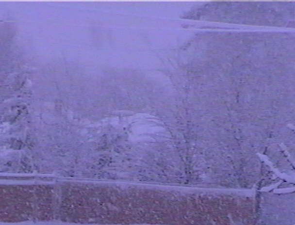
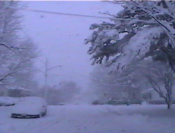
The snow was getting deeper.
| 9:15 AM | | 9:45 AM | |
| 10:15 AM | | 10:30 AM | |
As the wind picked up some, the snow started to lighten up at 10:45 AM. Just before noon, rain & sleet started to mix in, and then it went to all rain. By noontime the NWS cancelled the Coastal Flood Watch.
| 2:30 PM | | 2:45 PM | | The best way
to travel | |
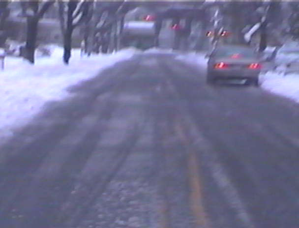
Light rain fell until 2:30 PM. At this point, the storm started moving across the eastend of Long Island. The winds went West, the tempature, which had risen to 34.8, started to drop, and the rain changed to sleet and then snow. At Center Moriches, some blue sky and hazy sun was observed as the storm's center passed over. It seemed as if the storm had developed a hurricanelike eye. By 4 PM, the snow ended. The bulk of the precip was done. 7.5 inches of snow had fallen.
History of the storm via TV.
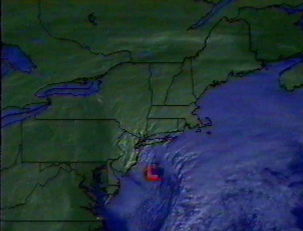
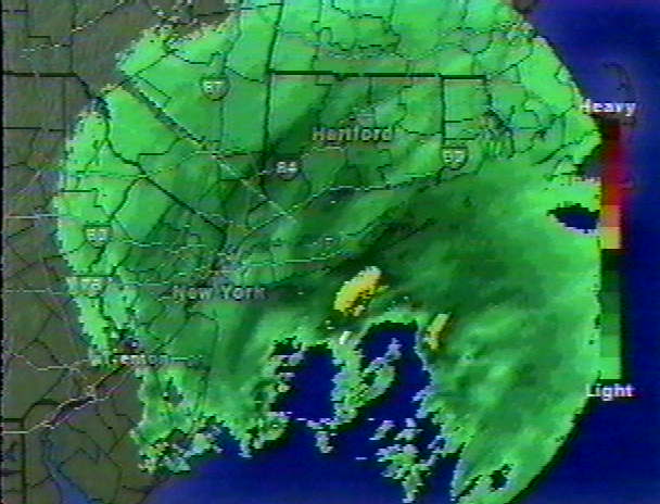
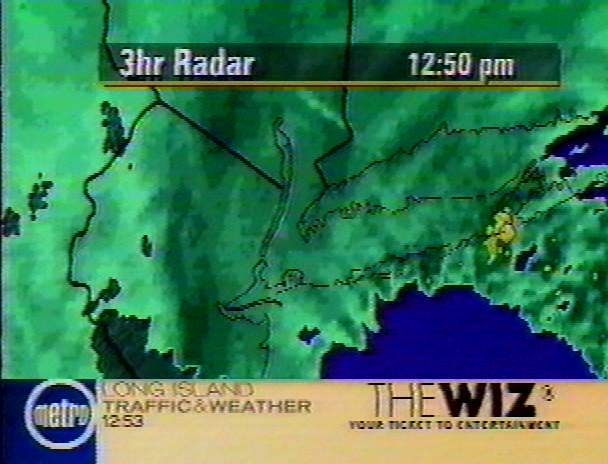
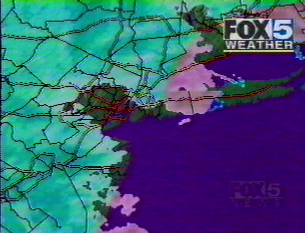
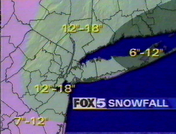
| 9 AM Sat Pic | | 9:15 AM Radar | | 1 PM Radar | |
| 1:30 PM Rain/Snow line | | 1:30 PM Expected Snowfall | | 1:30 PM Area Temps | |
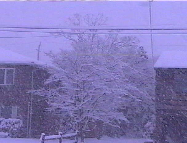
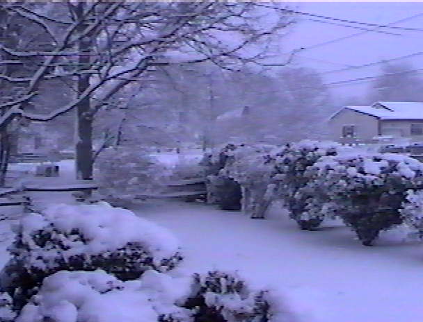
Christmas lights on new fallen snow always makes for a pretty scene.
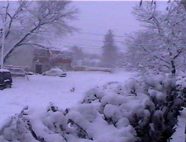
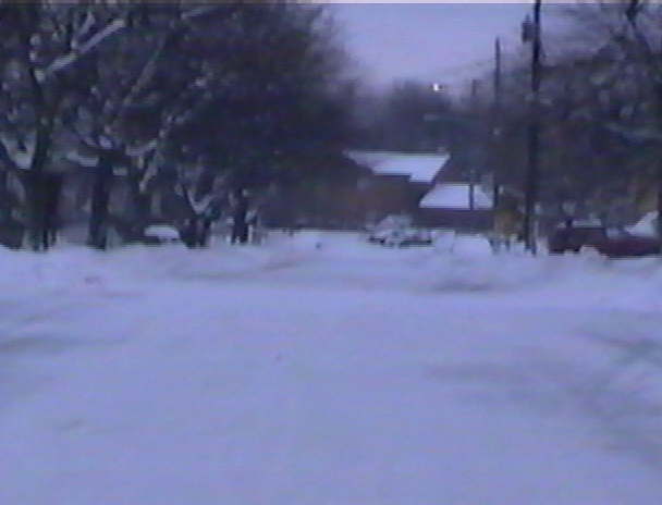
Sunday Dec 31st: It's always so pretty the day after a snowstorm.
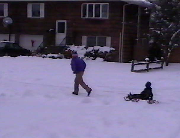
There's always things to do after a snowstorm.
Tuesday Jan 2nd: The sideroads were still snow covered.
SNOWFALL TOTALS FOR THE AREA| NYC Area | Long Island | New Jersey | Connecticut |
-
CENTRAL PARK 12.0
-
JFK AIRPORT 10.0
-
LAGUARDIA AIRPORT 13.0
-
BRONX 11.0
-
WHITE PLAINS 16.0
-
YONKERS 13.5
-
OSSINING 11.5
-
MAMARONECK 16.5
-
MOUNT KISCO 13.0
-
SUFFERN 18.0
-
HARRIMAN 12.5
-
MIDDLETOWN 18.0
-
NEWBURGH 14.5
-
CARMEL 13.0
-
BREWSTER 13.0
|
MINEOLA 10.1
NEW HYDE PARK 10.0
OCEANSIDE 15.6
PLAINVIEW 12.0
EAST MEADOW 13.2
GLEN COVE 14.0
BALDWIN 11.0
LEVITTOWN 11.0
VALLEY STREAM 14.5
BRIDGEHAMPTON 2.7
CENTERPORT 11.8
ISLIP MCARTHUR AIRPORT 9.0
LAKE RONKONKOMA 9.0
BRENTWOOD 11.2
WEST BABYLON 10.0
PATCHOUGUE 6.0
HUNTINGTON STATION 12.0
BAYSHORE 9.5
EAST ISLIP 6.5
MANORVILLE 7.0
ROCKY POINT 6.5
EAST QUOGUE 3.5 | -
JERSEY CITY 16.0
-
SECAUCUS 15.0
-
ELIZABETH 12.0
-
UNION CITY 16.0
-
HOBOKEN 12.9
-
NEWARK AIRPORT 13.9
-
WEST ORANGE 17.0
-
WEST MILFORD 20.0
-
HAWTHORNE 16.0
-
CLIFTON 19.0
-
LITTLE FALLS 19.0
-
GREENWOOD LAKE 20.0
-
HEWETT 25.0
-
RUTHERFORD 17.0
-
TETERBORO AIRPORT 13.0
-
FAIRLAWN 16.0
-
ELIZABETH 14.0
-
UNION TOWNSHIP 15.0
| -
BRIDGEPORT 10.0
-
GREENWICH 15.5
-
NORWALK 15.0
-
DANBURY 13.0
-
DARIEN 12.5
-
NEW CANAAN 13.0
-
WATERBURY 10.5
-
MILFORD 9.0
-
NEW HAVEN 8.8
-
SHELTON 8.0
-
EAST HADDAM 5.0
-
HADDAM 6.0
-
CLINTON 3.5
-
GROTON 2.5
-
NORWICH 4.5
|
While the snowstorm didn't live up to it's advanced billing, it still was a fairly good one.
HOME
`