
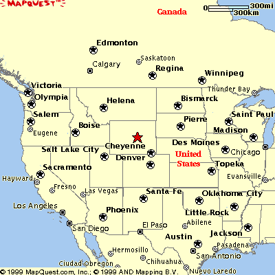
The red star shows where Wymoing is in the United States. Yellowstone Park is in Wyoming.
A map of Yellowstone and it's relation to other points in Wyoming. Yellowstone is cleary in the northwestern corner of the state.
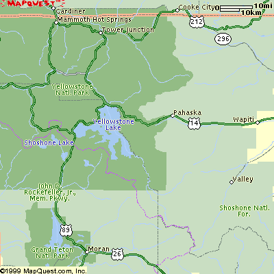
A general map of the park as it as today, including the main loop around the park, and each seperate country (section) of the park, along with it's attractions.
The grand loop road is 143 miles long, forming a figure "8" with connecting spurs to the 5 park entrances. The grand loop will take you to the 5 different countries of Yellowstone.
Mammoth Country: (Thermal area) Mammoth Hot Springs is a huge hot spring that has formed limestone terraces, colorful steaming terraces made of travertine (encrusting deposits) calcium carbonate- which the hot springs bring to the surface from beds of limestone.
Geyser Country: This is where you will find "Old Faithful", the park's (and possibly the world's) most famous geyser. It erupts on an average of every 65 minutes. It shoots up a column of 11,000 gallons of water close to 200 feet in the air. Beehive Geyser is more spectacular than Old Faithful, but only goes off every 20 hours. Grand Prismatic Spring is also here, the largest and most beautiful hot spring in the park, at 371 ft. wide. Colors are caused by algae and bacteria. Geothermal features also include fumeroles, mud pot, and hot springs. (Any hot spring could become a mud pot with the right balance of acidity, moisture and clay. Constant flow of water keeps most springs clear.) This country also includes Excelsior Geyser, who's last known eruption was in 1890, when it blew to 300 feet. It is now a huge boiling vat producing 4,00 gallons of water a minute.
Lake Country: Yellowstone Lake,the largest, high altitude lake in North America is here. It flows into the Yellowstone River.
West Thumb, which is almost a seperate lake next to Yellowstone is a water filled Caldera created by an eruption about 150,000 years ago, domain for native cutthroat trout, bald eagles, bison, bear, and moose which wander the shores of the lake.
Canyon Country: Contains the Grand Canyon of Yellowstone. Yellowstone River carved the Grand Canyon of Yellowstone over the last 200,000 years. Yellowstone River plunges into the Grand Canyon of Yellowstone. The Lower falls of Yellowstone are twice as high as Niagara Falls. The bright yellow, orange, and red of the canyon walls are caused by heat and chemical reaction on gray and brown rhyolite rock. Hayden Valley is also here, which is home to buffalo, grizzly bears, coyote, and elk, just to name a few.
Roosevelt Country: Petrified Forest on Specimen Ridge. 50 million years ago, during volcanic eruptions, dust and ash fell down on the forest. Rain and water minerals slowly replaced wood fiber, turning them to stone. Growth rings are visible. Also home to deer, bison, and lamar wolves. Recaptures Old West. Stagecoach rides are available in this section of the park.
