Belonging
The Whitsunday Region
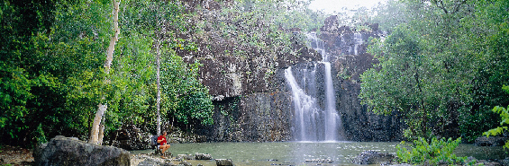
Image supplied by Whitsunday Shire Council
The Proserpine Shire was created on 10 January 1910 as a result of being excised from the Wangaratta Shire (Bowen). In 1989 the Shire changed its name to become the Whitsunday Shire Council.
The Council provides a range of local government services similar to most local authorities in Queensland as well as being responsible for the provision of potable water supply and sewage collection and treatment. The Shire employs 189 full time equivalent persons to provide these services (i.e. this includes trainees and apprentices). The Council also undertakes a number of business activities that support the provision of services in the shire. They are Shute Harbour Transit Facility; Whitsunday Coast Airport®; Foxdale Quarry and the Proserpine Caravan Park.
The Whitsunday Shire covers an area of 2,679 km2 and has experienced significant population growth from 15,522 in 2001 to 18,120 in 2006. This represents an average annual increase of 3.1% compared to the Queensland state average of 2.2% for the same period. Based on the Planning Information and Forecasting Unit (PIFU) predictions on the high series of population forecasts, the area will grow at the rate of 2.7% p.a. over the next 20 years to 2026, resulting in a projected population of 30,715.
The Shire is experiencing tremendous growth in development with some $2 to $3 billion worth of development approvals in existence. These developments range from the Dent Island resort golf course and associated condominiums; the Port of Airlie 300 berth marina and associated hotels, retail and residential precinct; the Links resort golf course and 2,600 mixed density dwelling complex and associated resort type facilities; the Clough residential estate 1,500 mixed density dwelling complex as well as other significant developments of smaller scale. All these are in the Airlie Beach and Cannonvale areas. In addition there are two significant residential developments in Proserpine, which will provide an additional 500 to 1,000 residential allotments with a further 600 dwelling residential development in Jubilee Pocket.
The Council has a population base in excess of 18,000 permanent residents plus on any day some 4,000 to 7,000 tourists creating a centre of regional proportion. The area receives in excess of 750,000 tourists annually and rates in the top ten destinations in Australia for international visitors.
Belonging to me means being safe and having a sense of security. It means I am accepted. My thoughts, actions and belief’s are mine and we belong. Belonging doesn’t mean that you are owned and it’s not that you loose any part of you. You’re sharing you, all of you and you are teaching and learning from the different people who belong and whom you belong to.
Jody Lee
Whitsunday Shire Council
© Copyright 2007. All images contained within this website are protected under Australian Copyright Law,
and as such may not, under any circumstances be copied, used, or reproduced without permission. For
further information regarding the copyright restrictions of these images contact Auz Vizions Photographics.
|
|

