|
Lukachukai Mountain goes by many different names, depending on the part of the mountain discussed. This page only gives names to the northern part of Lukachukai Mountain.
The mountain is still largely used as a summer camp for sheepherders. For that reason, it is called Shíík'eh (A Summer Place) in Navajo. Since many Navajo families don't have cattle, it is hardly used by this name anymore.
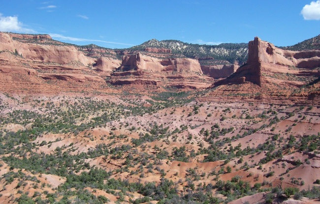
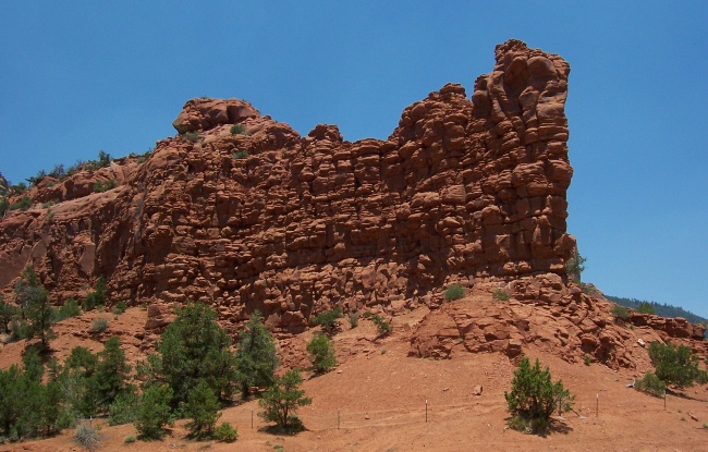
The most northern part of the mountain, shown below, is called " eezhch'iih Deezgai" (White Ash Pile). eezhch'iih Deezgai lies east-west. To the east of this part of the mountain there's a mountain lake called "Wide Lake," which is a direct translation of the original Navajo name, Be'ek'id Hóteel. eezhch'iih Deezgai" (White Ash Pile). eezhch'iih Deezgai lies east-west. To the east of this part of the mountain there's a mountain lake called "Wide Lake," which is a direct translation of the original Navajo name, Be'ek'id Hóteel.
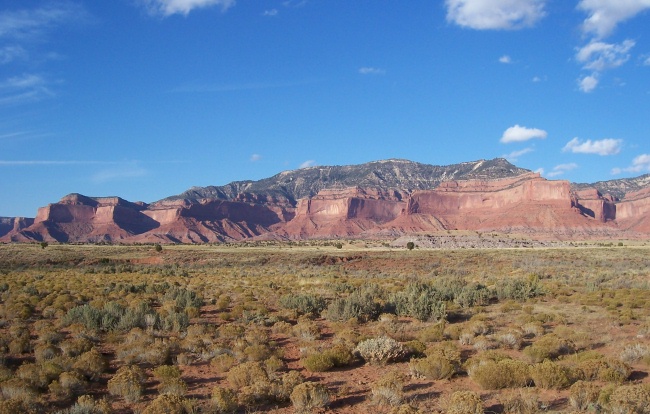
Lukachukai Mountain lies in an "L-shape." Right at the L-bend, Navajo Route 13 crosses over, connecting Lukachukai, AZ with Red Valley, Az. This road divides the true Lukachukai Mountain from it's other half which spreads north-south. Since this north-south portion is covered with white spruce trees it is called Ch'óshgai (White Spruce Tree). This is where the English-name for Chuska Mountains is derived.
At the top of the mountain where Navajo Route 13 crosses over, there is a rest area called Ayání Deeshgiizh (Buffalo Pass). Further down the road towards Red Valley, a steep upward incline gathers the most snow, making travel over the mountain almost impassible. For this reason, this portion of the mountain road is called Nchííl Dah Nídíjihí (Snow Packs Up). The current paved road follows one of the original paths over the mountain. The area around Nchííl Dah Nídíjihí always had this name.
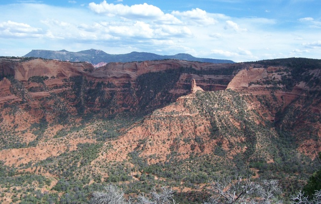
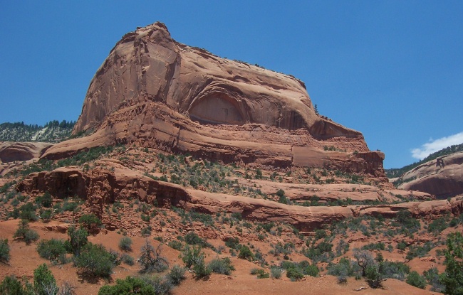
The highest point of the mountain, called Dzi Dah Neeztíinii (Mountain Lying Down Up High), occurs right at the "L-bend" next to a second nearby peak called Bidáá' Dilkoohí (The One With A Smooth Edge). It's picture is shown to the left. Dah Neeztíinii (Mountain Lying Down Up High), occurs right at the "L-bend" next to a second nearby peak called Bidáá' Dilkoohí (The One With A Smooth Edge). It's picture is shown to the left.
My maternal grandmother told me that after the Twins, Naayéé' Neizghání (Monster Slayer) and Tó Bajishchíní (Born For Water), killed all the monsters that were plaguing the Navajos in the Navajo Mythology, they gave the livers of
all the monsters killed to their mother, Changing Woman (Asdzáá Nádleehí). When she traveled from Dibé Ntsaa (Big Sheep Mountain, at present-day Mount Hesperus), naming the various regions in Navajoland going from east
to west she traveled through Nchííl Dah Nídíjihí to Bigháá' (It's Top). From Bigháá', she walked down the western slope of the mountain, where she danced with the livers tossing them to various parts of the base of Lukachukai
Mountain.
The area where she danced, called Ha'dishzhiizhí, is a sheep trail that connects Bigháá' to the Lukachukai valley. Where the livers were thrown, natural springs & washes were created, such as Tó Deezlíní (literally "Water Flow," at present-day Wagon Wheel), Tó Sik'aaz Háálíní
(Cold Water Flows Out), Tó Ts'ósí (Narrow Creek), Góhníinii Ch'ínílí (Hualapai Creek Flowing Out), Dówozhii
Ch'ínílí (Greasewood Creek Flowing Out), & Tó Tsoh (Big Creek).
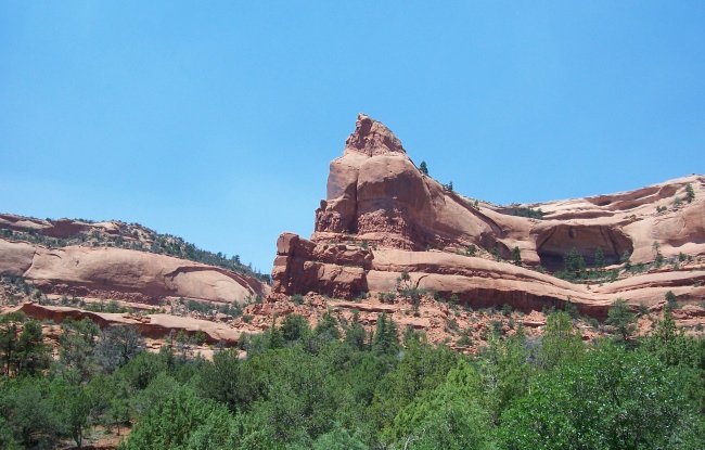
Changing Woman named other rock formations at this time, shown in pictures below. These formations include ichíí'ídi (At The Red One, in K'aabizhii Valley). Tséghah Hoodzání (Hole Thru The Rock, also known as "Cove Arch" or "Royal Arch"), Tsé Bit'aa'í (Butt Rock), Tsé Anáá'í (Eye Rock), Tsé Yist'iní (Stacked Rocks, also known as "The Book Shelf") & Tsé Binááyoí (Wind Blows Around The Rock).
Other areas a part of Lukachukai Mountain that Changing Woman named not shown here are Dzik'i Hózhóonii (Beautiful Mountain) & Tsédáá' Dik'á (Rock Edge Grounded Down).
In Navajo mythology, this mountain range, along with the Carrizo Mountains, makes a male figure lying down called Yódí Dziil (Wealth Mountain). Ch'óshgai (Chuska Mountains) forms the head; Leezhch'iih Deezgai (Lukachukai Mountains West) forms the chest, abdominal areas, and limbs; and Dzi Náhoodziii (Carrizo Mountains) forms the feet.
My grandmother also says that Tsé Anáá'í (Eye Rock) is actually the head of Tééhotsódii (Water Monster) mentioned in the Navajo creation myth.
Matthew's Peak is located around the northern end of the Chuska Mountains. It is known as Tsé Binááyoí in Navajo, which means "Wind Blows Around The Rock." This portion of the mountain range is also known as the Tunicha Mountains on some maps, which is derived from another Navajo name of this mountain range, Tó Ntsaa. This means "Big Water," which describes the large amounts of water that flow from this area from snow melt or rainfall.
Another road crosses over the Chuska Mountains, thru a pass called Narbona Pass or Washington Pass. This road connects Crystal, Arizona, to Sheep Springs, New Mexico. In Navajo, this pass is called Béésh ichíi'ii Bigiizh, which means "Red Metal Gap." The phrase "béésh  ichíi'ii" is also used for "electrical wires" in Navajo. For this reason, some people say that Béésh ichíi'ii Bigiizh refers to the electrical poles that cross over thru this pass. Others say that it is an older name because Navajos used to collect copper metal for arrowheads in this mountain pass long ago. ichíi'ii" is also used for "electrical wires" in Navajo. For this reason, some people say that Béésh ichíi'ii Bigiizh refers to the electrical poles that cross over thru this pass. Others say that it is an older name because Navajos used to collect copper metal for arrowheads in this mountain pass long ago.
Click on the pictures below to see enlarged versions of the thumbnails.
|