| FIND A VILLA | Villa Amalia | Villa Amalia movies | Megala Chorafia | Chania | The surrroundings | Excursions |
Google Chrome thinks enlarging my pictures, some links and sometimes scrolling through the pages is a popup. If you want to navigate my website than please allow "popups". |
| DAY TRIPS AND EXCURSIONS THAT YOU CAN MAKE FROM VILLA AMALIA |
|
Below I have described a couple of day trips you can make from Villa Amalia. If you want to know more about a certain village, beach or church, then click on the link to read more about it and see all the pictures. These are just some examples of tours and walks you can do in this area, because there are a lot more. For some trips (eg to Kissamos, Frangokastelo, Chora Sfakion) it is useful to leave early and keep track of how much time you need to drive back.
|
| Trip 1: Armeni, Stylos, Megala Chorafia, Aptera, Fort Izedine and Kalami Beach |
|
|
|
|
 |
|
|
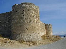
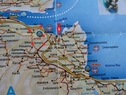
From Armeni you drive to the village of Stylos. There is a nice square with large plane trees where you can have a drink or something to eat. The area is fertile and Stylos is famous for its spring water that floats down from the White Mountain. In Stylos the spring water "Samaria" is bottled, which you can buy all over Crete. There are many flowers in the village and it is very green. In Stylos is also the beginning of the Diktamos gorge, which is 7 kilometer long and takes about 3 hours to walk. Interesting is the ruined stone Byzantine church of Agios Ioannis Theologos, which has remains of frescoes. The church was closed when we got there but there are some holes in the walls and windows through which you can take a peek. It dates from the 12th century and is being renovated (2010). From Styos you drive to the cosy village of Megala Chorafia. Time for a cup of coffee or, if you departed a bit later maybe a lunch. Allthough Megala Chorafia is only very small it has three nice taverns, a kafenion and a minimarket From the village square of Megala Chorafia you take the exit to Aptera (Monday closed). This antique town was destoyed by the Arabs in the 9th century. Archeologists found graves, temples and the remains of houses and fortifications from Hellenic, Roman and Byzantine times. From the town there is a spectacular view over the Bay of Souda end the Turkish fortress of Izzedine. The wide city walls of Aptera are quite impressive. Aptera is the largest Roman site on the island of Crete and the city was extremely important for both the Minoans and the Romans due to its geographical location above the largest natural harbour in the Mediterranean Sea. At Kalives and at Marathi, at the entrance of the bay, the city had its harbours. Aptera dominated a large, mostly flat and fertile area. From Aptera you drive on to Izzedine. The fortress of Izzedine dates from the Turkish period - 1816. It is situated on a hill that overlooks the Bay of Souda, the White Mountains and all of the Apokoronas. The fortress can be reached through the village of Aptera. Down the hill on the coast and on an island in the bay there are more fortresses from a later date. The Bay of Souda is considered the best harbour area / protected bay of Crete, and this explains all these fortifications. From the fortress there are magnificent views over the Bay of Souda and the green valley where Kalives is situated, and you can distinguish a part of the ancient city wall of the old town of Aptera. You can also see a small piece of the village of Kalami (which is situated below the fortress that you see downhill) and in the distance you can see many other villages like for instance the coastal village of Almirida. The fortress of Izzedine has been restored but it is not open to the public (at least not that I know, we always found the gate closed when we got there). Drive back to Megala Chorafia and take the main road back to Kalives. Just after you have taken the exit to the left (to Kalives) you immediately run into the exit (on the left) down to the beach of Kalami, which is unknown to most of the people. Tourists don't seem to exist here. Kalami is a nice place to have a look at and for making a walk. On the pier in the village there are men with fishing rods. There are not many houses here and you'll pass a few small beaches. On the first one there are some beach umbrellas. Along the way are many blackberry bushes and a bit further left a banana tree. |
| Trip 2: Almyrida, Gavolochori, Vamos, Melidoni and Fres |
|
|
|
|
|
|
|
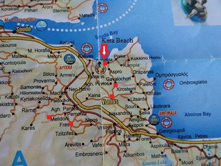
In Almyrida you take the exit to Gavalochori. In the village there are remains from the Byzantine, Venetian and Turkish periods, and artefacts found in Gavalochori proof that the village was inhabited in earlier times (Minoan, Neolithic and Roman times). On the village square of Gavalochori there is a World war II memorial. The Venetian wells of Gavalochori can be reached about a 1 kilometer walk from the sign in the village that is pointing to all the sights. The narrow road leads uphill until you reach a T-junction. Here you turn left. On the left side (yellow arrow) there is some round structure (unknown but could be Venetian or older) and as you walk on you will see the Venetian wells on your right hand side. Walk even further any below you can see what looks to be a Venetian (or maybe even Roman?) bridge. From Gavalochori you drive to Vamos. Vamos is the capital of the district and one of the larger villages in the Apokoronas area. There are mini markets, tavernas and all kinds of local shops. There is a large church in the village and plenty of pretty and old trees. The next destination is the village of Melidoni. Melidoni is a vey charming traditional village with narrow streets and old houses. The large prominent church of the village with its dome and two towers is really beautiful. It looks like it has been made of some kind of sandstone. From the square that runs around the church you've got a wonderful view over the Apokoronas and Souda Bay. The tavern of the town seems to be a true work of art: with small pebbles someone made something very strange with all sorts of bows and decorations. Some pebbles he colored so that a kind of painting was made. Maybe an option to have some lunch? Take the same way back and turn right towards the village of Fres. The village has a large village square with tavernas, kafenions and shops. In the middle is the imposing church of the village and a memorial with statues. Fres is famous for its Byzantine church of Madonna of the Two Rocks, which is set on two large rocks and surrounded by terraced gardens. It can be reached by following the signs from the main square leading to the upper village. From the church there is a path leading to the St. Antonius Cave, where you have panoramic views to Souda Bay and the Akrotiri peninsula. In the village of Fres there is another, larger Byzantine church, the Church of Agii Pandes. |
| Trip 3: Kokkino Chorio, Drapanos, Ombros Gialos, Kefalas and Vrisses |
|
|
|
 |
 |
|
|
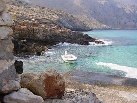
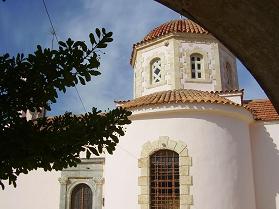
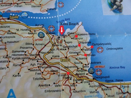
The next stop is the village of Drapanos. The small village with its white houses is set in the woods and in the back are the mountains. In the village of Drapanos is the Agia Pandeleimonas church. Nearby the village is a church which is built in a cave, called the Agios Ioannis church. Just outside the village Drapanos is a large number of Venetian "sternes" or wells. If you come from the direction of Kokkino Chorio and drive through Drapanos you first pass the church (on the right hand side) and then come past a house that is painted orange and purple (on the left), and after that you pass the Drapanos exit sign and drive out of the village. If you keep following the road then after 1.1 kilometers there is a path on the left. You will pass a number of such paths before you get there, so you may have to look around a bit before you find the right path. I have made a picture of the path so you know what it looks like (see the Drapanos page). If you follow the path for about 100 meter you will come to the Venetian sources. In these wells there is still water and there are goldfish swimming in them. In this environment the Venetians grew grapes for wine making and if you look around you will see that the landscape is divided into terraces. Time for a lunch in Ombros Gialos. Ombros Gialos is actually nothing more than a taverna at a place where the sea has a beautiful turquoise color. Ombros Gialos is situated in a beautiful bay and the taverna is very good. It is possible to go into the sea here but there is no real beach. Drive back from Ombros Gialos and turn towards the direction of Kefalas. In my opinion Kefalas is the most picturesque village in the area. It is over 800 years old and thought to have been founded around 1175 A.D. during the Greek Byzantine times under Emperor Michalis Komnenos. Inside it's boundaries there are a large amount of historic buildings from Venetian and other times, some beautifully restored, others in ruins. From 1669 until 1898 Kefalas was under Ottoman Turkish occupation. It's a large village, but it is quiet. There are squares, beautiful old trees, an old stone windmill, a couple of taverna's (one with Illy coffee!) and two supermarkets. Supposedly there are some 30 churches in the village, most of which are from the time of the Turkish occupation, when land would not be confiscated by the Turkish rulers if there was a church on its grounds. I didn't count the ones that I have seen, and I haven't seen all of them, but it is defenitely the village in Crete with the largest amount of churches that I have encountered. The last destination of this trip is the village of Vrises. The village of Vrises is renowned for it's goat cheese and yoghurt. Vrysses (or Vrisses, Vrises) is a new village dating back to 1925. It is located on the road which links the north coast with Sfakia. There is not much to do in Vrysses but the rivers that flow through its centre make it a nice place to escape the summer heat, in the shade of the giant plane trees. |
| Trip 4: Alikambos, Chora Sfakion, Ilingas Beach and Aradena |
|
|
 |
|
|
|
|
At the end of the road you turn right to the cosy village of Chora Sfakion. The village has about 400 to 500 inhabitants but it used to be much larger (about 3000 inhabitants that traded with Africa). It was a place of resistance in Venetian and Turkish times, and also during the German occupation. There is a village beach and there is another sandy beach where you can rent umbrellas and sunbeds not too far away. On the west side of the village you can also reach more quiet beaches after a 30 to 60 minutes walk. Chora Sfakion is a very nice little village to go and explore. There are many small shops and there is a large choice in taverns, so a good opportunity for a lunch. Just outside Chora Sfakion on the way to Aradena you will find the beautiful Ilingas Beach. This lovely pebble beach is situated at the end of the Ilingas gorge, at a distance of approximately 2 kilometer from Chora Sfakion. On the beach there is a taverna where you can get something to drink. Ilingas is a quiet beach and on the east side of the beach there is a cave where you can find some shade. There is space here on the beach for naturists as well. Further in the direction of the west the road leads to Anopolis and the Aradena Gorge. From Anopolis the road leads to the Aradena Gorge with its iron bridge hanging over it. Close to the bridge there are several paths leading you downstairs, giving you the opportunity to make a walk in the gorge, which leads from the village of Aradena and the White mountains all the way to the sea (about 7 kilometer) where it ends at the sea of Marmara, a small beach near Loutro. Immediately after the bridge on the right side there is the small and allmost abanboned settlement of Aradena with a small Byzantine chapel. This chapel dates from the 14th century and is dedicated to the Archangel Michael. It contains wallpaintings and icons, but as you might have expected: we found it closed, so if you are coming here becuase you want to admire these beautiful wallpaintings and icons than there is a big chance that you are going to be disappointed. The steel bridge dates back to 1986 and was a gift to the nearby village of Agios Ioannis of four brothers from a rich (oil) family who come from the region. Sometimes you can bungee jump from the bridge. |
| Trip 5: Komitades, Frangokastelo and Rodakino |
|
|
|
|
|
 |
|
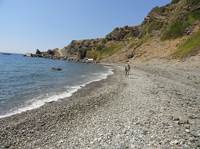
After this continue to Frangokastelo. The village of Frangokastelo is dominated by a 14th century Venetian castle (built in 1371), of which only the outside walls remain, with on each corner a tower. On May 28, 1828 a big battle took place at the castle when there was an uprising against the Turks. The Greeks, lead by a man from Epirus on the mainland (Hatzimichalis Dalianis) took over the castle. The Turks sent reinforcements and 385 of 700 Greek "rebels" in the castle were massacred. Next to the castle the statue of the Greek rebel Hatzimichalis Dalianis can be seen, next to a statue of a local hero from the uprising (Nik Deligianakis from the Sfaka area). The beach of Frangokastelo is quite large and in the area are plenty of other quiet beaches to choose from (Lakki Beach, Koutelos Beach, Fata Morgana beach or Orthi Ammos Beach, just to name a few). For those that fancy some lunch I recommend the Orthi Ammos Tavern which is situated at the sea close to the castle. If you continue on the road from Frangokastelo eastwards you will see a small chapel on your left hand side after about 300 meters. This chapel stands on the grounds of the former Christian Basilica of Agios Nikitas, which dates from the second half of the 6th century A.D. This basilica was 26 meters long and the remains can still be seen. There are large mosaic floors that are in pretty good condition, depicting geometrical patterns and images of animals. The basilica was abandoned when the Arabs raided the island and in later times its stones were used by the Venetians to build the Frangokastelo castle. The small church that now stands on the place of the old basilica is the Venetian Agios Nikitas church which dates from the 13th century. It is built with materials and the mosaic floorings from the old basilica and decorated with wall paintings. Go on and drive further eastwards to Rodakino. From Kato Rodakino there is a road, about 2 kilometer long, to the beaches of Rodakino that lie in the Bay of Korakas. There are several beaches with names like Sunrise Beach, Polirizio Beach and Korakas Beach. The beaches of Rodakino / Korakas / Koraka are one of the last hidden - undiscovered - treasures in the south of Crete. A further walk of about ten minutes over the headland will bring you to the next beach which are pristine and practically undiscovered. Behind that there are two more beautiful beaches that are usually empty. These beaches are situated behind a low hill at the west side of the accommodations and there are no facilities here. For this reason and because it is more difficult to get to it these are good beaches for nudists. Behind the largest of the beaches continue to drive upwards until you see the sign "akropolis 1,4 km" on your right hand side. Leave your car at the parking nearby and walk up the hill, than take the first path on the right leading down or walk on to the next path leading down for the second beach etc. I really wanted to keep these beaches a secret, but okay, now I told you... Don't forget to bring water and a good sunscreen if you want to go and visit. |
| Tocht 6: Souda, Agia Triada & Gouvernetou monastery, Minoan cave and the Katholikou monastery |
|
|
 |
|
|
 |
|
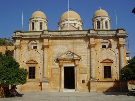
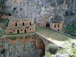
The Agia Triada monastery is situated in the north west part of the Akrotiri Peninsula, which is situated on the east side of Chania town. The town of Chania is at a 16 kilometers distance. The Agia Triada Monastery was build in the seventeenth century (1612). The monastery of Agia Triada has three domes. The bell-tower was added later in 1864. In the 19th century the monastery housed and important theological school. Inside the Agia Triada Monastery there is a library and a small museum with icons. It is a beautiful monastery and it's worth to have a look at it. The Gouvernetou monastery was built in the 16th century (1537) and on the outside it looks like a Venetian fortress because of the high, thick walls and towers around the monastery that were built to defend it against attackers. Of the original four towers only two survived. At the back of the monastery at the monument is a path to a cave in the hills (the Cave of the Bear) and the monastery of Agios Ioannis (the one of St. John the Hermit), better known as the Monastery Katholikou. The cave is dedicated to the Virgin Mary, and here artifacts were found that indicated that the cave was once dedicated to the goddess Artemis (the goddess of hunting). The Cave of the Bear owes its name to a stalagmite (the big white) in which with much imagination you could recognize a bear. In this shape of the bear the goddess Artemis would appear. In front of the cave are the remains of another old monastery and down below in the valley you can see another old building. The Minoan cave is reached after about 15 minutes walking, the Katholikou monastery is another 30 minutes walk away. This monastery dates from the sixth or seventh century and is probably the oldest monastery in Crete. It is partly built into the rocks / cave. There is a bridge in front of the monastery which is 50 meters long and 15 meters wide. It runs over a 30 meter deep gorge (the Avlaki Gorge). The monastery is partly a ruin but it is beautiful. |
| Trip 7: Nopigia, Kissamos & Kissamos museum, Falassarna Beach and Ancient Falassarna |
|
|
|
|
|
|
|
This trip goes to the west of the island of Crete. Nopigia is one of the oldest villages in the area and used to be a center for wine distribution. Now it is surrounded by farmland. There is a good beach and there is a camping site in this Nopigia. The village used to be the location of an ancient city. In the village are Byzantine churches like the Byzantine church of Agios Pandeleimonas. You can easily reach this church from the highway to Kastelli if you turn south towards Koleni. You will see it at your right hand side. The church has the shape of a cruciform with a dome. Kissamos itself has remains of a Venetian fortress and there are beaches, a cosy boulevard with taverns and a nice village square. In Kissamos you will also find remains from Roman times (a villa, mosaics, baths) and there is an early christian cemetary. If you vist the town of Kissamos it is very interesting to take a look at the objects dispayed at the Archaeological Museum. This museum is housed in a Venetian-Turkish monument and houses artefacts that were found in the Kissamos district. The finds go from prehistoric times through to late antiquity (Early Christian Period) and is really interesting. The building has two floors and the material is displayed according to chronology and geography. Besides the vases, beautiful statues, glass, jewelry and coins there are also two beautiful large colorful (and almost intact) mosaic floors on display. This is something not to be missed and puts a new light on any of the visits you will later make to the archaeological sites in the area. Falassarna is a quiet village, with some small hotels, apartments and taverna's. It's the place of a spectaculair big sand beach, with beautiful rocks in the sea, making it look like something out of a fairy tale. It looks like a landscape of dunes, with fine sand. Falassarna is also the site of an ancient Hellenistic port, which was surrounded by walls and connected to the sea by a canal. 10 Minutes north by foot some of the walls and the defensive towers can still be seen. The port used to be at the sea, but since the earth is slowly elevating on the west side of the island of Crete (and sinking in the east) the former port has moved inland. The beach is a fine sandy beach and the water is of a beautiful color and crystal clear. Some parts of Falassarna have umbrellas and sunbeds for rent but the beach is not really super-commercial. It is long and wide, and there is always a nice quiet place where you can lie down. There is an exit "Big Beach" to the large beach and when you drive further you will come to the next beach, which is also large. At the end of the beach it is a bit rocky. This is also the place where you can lie down if you are a naturist. Further away there are some small coves where you can also lie down. The beach of Falassarna is one of the prettiest beaches of the island of Crete, and its fine and sometimes red or pink sand give the beach a tropical look. On the north side of the beach Falassarna about 2 kilometer away are the remains of "Ancient Falassarna. Falassarna was the major port of the city Polyrrinia. They are now busy with excavations (2009) and not everything is exposed yet. The old Falassarna was found not so long ago. Because the west of the island of Crete is slowly moving up, the port is now around 6 to 9 meter above sea level. It is also suspected that during a massive earthquake and tsunami in 365 AD the city was suddenly elevated conciderably in one single stroke. Besides the remains of walls (including walls of an Acropolis) and towers, a rock carved stone throne can be seen and there are tombs, cisterns, storerooms and the ruins of houses. |
| Trip 8: Georgioupoli, Lake Kournas and Kastellos |
 |
 |
|
|
 |
|
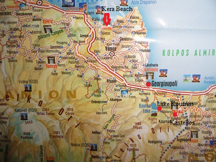
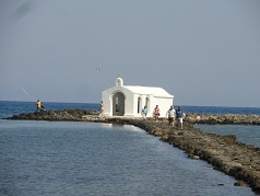
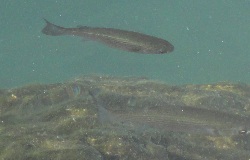
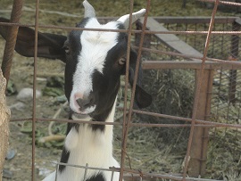
Drive via Vamos or via Gavalochori and Kefalas to the cosy coastal village of Georgioupoli. Here is the start of a 10 kilometer long sandy beach and there are many nice shops and taverns. A white church, the Agios Nikolaos, is placed at the end of a pier in the middle of the sea. When the waves are not so high you can walk to this little church and burn a candle. A river runs through the village where fish and apparently also turtles have their home. From Georgioupoli follow the signs to Lake Kournas, the only sweet water lake on the island of Crete. The special colours of the lake, from green to turqoise and blue, and the beautiful and special mountains around it, the abundance of wildlife, the cosy taverna's and souvenir shops around the edge of the lake: Kournas has a lot going for it. Kournas Lake is about one and a half kilometer in diameter and at the southern end it is up to 45 meters in depth. There are special birds floating in the water, big orange fish swimming around, and it seems trees are growing from the bottom of the lake (when the water is really high). On my visit we even saw a turtle swimming around. For the people that love it enough to wanna go and explore some more on the lake it's possible to rent a water bike (cost: 7 euro in may 2003 and prices are steady - visited again in 2009). There's some sort of a beach and a lot of olive trees and other vegetation. It is a special place for wildlife including for birds. You can even swim in this lake if you like. Drive further towards the village of Kournas and take the exit to "Kastelos". The authentic small village of Kastellos is located on a hill in the eastern part of the Apokoronas and because it is on an altitude of 252 meters high, there are beautiful views of the sea and the tourist resort of Georgioupolis. The name of the village comes from the fact that it is built like a castle. Originally the people lived in the lower valley but in 1800 they were forced to move to higher grounds because of the violence of the Ottoman rulers. Much of this old part of Kastellos is now deserted and dilapidated. Yet Kastellos is a nice village to pay a visit to. Time has stood still here. There are small gardens with tomatoes and other vegetables, flowers, free-range chickens, goats and the occasional cat. It is very quiet. The single local you run in to is surprised to see you and gives you a friendly hello. |
| Trip 9: Lake Agia, Agia Kyriaki monastery, Theriso and Meskla |
|
|
|
 |
 |
|
|
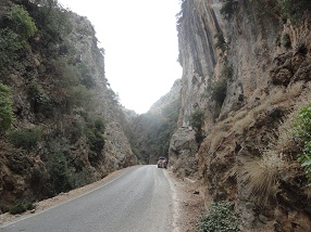
Lake Agia in het westen van Chania is een van de twee meren met zoet water in Kreta (de andere is de beter bekende toeristische attractie Lake Kournas). Lake Agia of Lake Agias is door mensen gemaakt, dus een kunstmatig meer, en het wordt beschouwd als een waterreservoir. Lake Agia kan worden bereikt door de afslag te nemen naar Omalos op de Chania - Kissamos weg. Het meer is een rustige plek met bijzondere bloemen en vogels en een kleine kerk op haar oevers. The Agia Kyriaki monastery is located at a distance of 12 kilometers southwest of the city of Chania. The road to the monastery of Agia Kyriaki is located between the villages Mylonia and Varipetro. It is a mile driving away from Varipetro over a narrow paved road. The monastery of Agia Kyriaki was built in the 17th century and was a haven for refugees from the Turkish invaders in the 19th century. After the monastery had fallen into ruins it was renovated between 1993 and 1996 and now it has been brought back to its former glory. Within the walls of the monastery you find the chapel. In the monastery now live 12 nuns and the complex is since 1637 owned the nearby monastery Chrysopigi. Around the monastery there is a beautiful garden with various fruit trees. A path leads from the monastery up to several cave churches and the Kastelos fortress which is located high on the mountain. These cave churches are fairly new, but it is still interesting to take a look at them. Along the way you have beautiful views of the landscape, and the caves themselves are interesting as well. Up on the mountain around the fortress Kastelos are a lot more caves. From this impressive fortress you have a view over the whole of northwest Crete. The small village of Theriso is located 14 kilometers south of Chania at an altitude of 580 meters, at the top of the Theriso gorge. The drive to the gorge is considered spectacular and is popular with Chania residents for the cooler temperatures and grill restaurants of the village. The beautiful Theriso gorge can be seen from the road as it runs along the bed of the gorge for 6 kms, which can perhaps be scary to some people that are afraid of heights. The Theriso Gorge is the only gorge in Crete through which you can drive the whole length. Theriso is a historic village, which used to be difficult to reach, because it was enclosed by the mountains and quite inaccesible. Because of its strategic position the village is interwoven with the the struggle for freedom and independence of the Cretan people from the Turkish invaders. Nowadays it is an interesting village to visit and it is a little bit on the tourist track, with two churches, two museums and several supposedly good taverns. In Theriso you also find the Byzantine church of Agios Georgios and Agios Charalambos, which dates from 1555 and has painted stars on its ceiling. On the two sides of the altar-cross are wooden carved painted sharks and mermaids, and there are pretty icons in the church. Meskla is the site of an ancient city, and various artefacts and remains of cyclopean walls have been found here. The ruins of the houses and the remains of a city wall can be seen around the village of Meskla. It is unsure which city was situated here and what its name was. The village of Meskla was destroyed during the Venetian period (when the leader of the revolt, Kantanoleon, had his headquarter in Meskla) and also during the Turkish period. Two of the Byzantine churches with 14th century frescoes in the village have survived the destructions though. One of these churches is the Church of Christ Saviour or "Sotiras Christos Church" with paintings by the hand of Theodoros Daniel and his nephew Michaeli Veneris dating from 1303 A.D. The church was founded by the monk Leontios Khossakis. A bit further on the road if you walk through the village over the bridge on the north side of the village you find the 14th century Virgin Mary Church. This church contains parts of earlier buildings including a temple of Aphrodite that was once built in this exact place and the mosaic on the floor of the present church floor was once the mosaic floor of a fifth century basilica. Behind this church a very large and imposing new church has been built. |
| Trip 10: Alikianos, Koufos, Maleme and Vlacheronitissa |
|
|
|
|
|
|
|
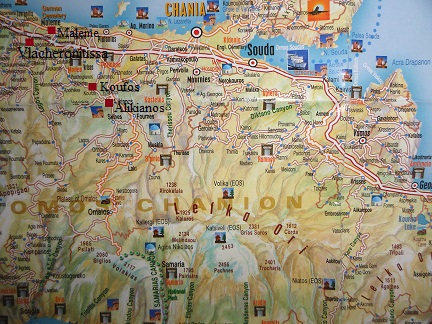
Alikianos is a nice village situated about 13 km from the town of Chania on the way to the Omalos mountain. You drive from Chania first to Oasis (a kind of modern suburb of Chania), then along Lake Agia and shortly afterwards you take the exit on your right to the village Alikianos. The first thing you notice when you enter the village is the beautiful big church that stands here with its dome and two towers. At the church is an impressive war memorial of marble with a bronze bird on top to commemorate the people of the Greek resistance that were killed by the Germans in the village. If you walk from the church into the village you will pass houses of which many have orange or lemon trees in the garden. In the village there is even a real factory where orange juice is made. Crates of oranges are piled up in the street and you can see how they are washed and then disappear into the machines. In Alikianos are the ruins of the Venetian castle that once belonged to the aristocratic Molini family and in a street a little further lies the 14th century church of Agios Ioannis. The church looks nice on the outside and inside the church (which was open) are some fragments of wall paintings to be seen. The Byzantine Zoodohos Pigi church just outsied Koufos dates from the 14th century. It is situated among the orange trees on the right hand side of the road as you go drive south from Alkianos. The Zoohodos Pigi church is also known as the Ai Yannis Kyr-Yannis Church. It is indicated by a brown sign along the side of the road. You can already see it from the road. The first time we drove past it because we thought it was a new church. Instead the church was partially restored. It is set about 25 meters from the road. Inside the church are frescoes of saints and of the Virgin Maria, but unfortunately the church was closed at the time of our visit and some pieces were closed with wooden planks. Maleme is a village in the west of Crete in between Chania and Kissamos, at 16 kilometer distance from Chania and not far from Kolimbari. Many battles took place in this area during World War II because the airport of Crete was situated in Maleme. This is the place where the German paratroopers started their attack on Crete in May 1941 and where many German soldiers were killed. In nearby Vlacheronitissa over 4000 over these German soldiers - almost all of them very young men - lay buried at an impressive war cemetary which overlooks the Gulf of Chania and the village of Maleme. Next to the was cemetary is a taverna with a collection of old weapons and all sorts of memmorabilia of World war II. There is also a late Minoan tomb to see (1400 - 1100 B.C.) in Vlacheronitissa. This tomb is located at the end of a path. The tomb can be found by following the brown signs that point to most of the interesting antiquities in Crete. The tomb stones are quite large and the tomb is almost completely intact, which of course is very unusual after such a long time. |
| Tocht 11: Karydi monastery, Koimeisis church, Agios Asomatoi and Agios Nikolaos church |
 |
|
|
|
|
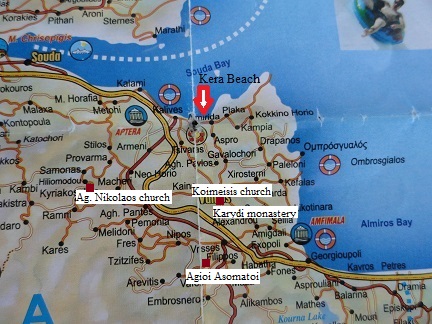
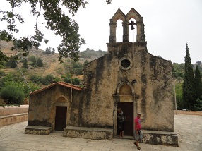
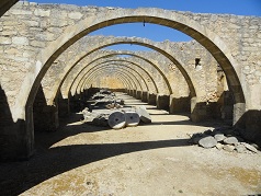
Go to Almyrida and take the exit to Vamos. The monastery Agios Georgios in Karydi opening hours 7:30 to 14:00 and 16:30 to 20:00) is located about two kilometers east of the large village of Vamos. It can be reached if you drive into Vamos from the north and follow the long road through the village of Vamos and exit the village again. You keep right at the first fork and go down the mountain until you see the sign, after just over a kilometer, that points to the monastery (at the next fork). Here you turn left. The monastery of Agios Georgios in Karydi was founded around 1600 when there was a settlement here in this place. In 1829 they began olive cultivation, which made the monastery grow and it provided work for many people. An olive oil factory arose with twelve large arches, which was completed in 1860. The production was 25,000 barrels of oil per year. In 1923 the monastery and many of the surrounding olive groves were destroyed. Only since 1996 they try again to restore the monastery and keep it in good order. The church on the site contains fresoes of the 1880s and in one of the buildings on the left side of the church a small part of a bone of Saint George is kept. Drive back to the fork towards Vamos and keep driving in a straight line (so the other direction than the sign that points to the Karydi monastery).. The church of the Koimesis Theotokou is located in the vicinity of the monastery of Agios Giorgos Karydi, not far from Vamos in Apokoronas, just below the village of Vrisses. There is a brown sign on the side of the road that points you to the church. You walk on a path through the olive fields and herds of sheep and as you walk you will see more signs. The small stone church contains frescoes but it was as so often in ancient churches on Crete, closed. The church is surrounded by ancient walls of an even earlier date (some pieces date from the 13th century and apparently the Koimesis Church belongs to the nearby Monastery of Karydi). Drive back to Vamos and take the exit to Chora Sfakion and Vrisses. In Vrisses take the exit to Vafes and follow the road for a couple of kilometers. On your right hand side you will than see the brown sign pointing to the church of Agioi Asomatoi. You walk down the stairs to reach this Venetian church. The church of Agioi Asomatoi (council of the archangels) is dated to the 15th century. It is a small single-aisled church. Its type is very common on Crete during the Venetian period (1211 - 1669). A particular feature of the church is the decoration of its interior. Instead of the usual scenes of the life of Christ and representations of saints, the entire interior of the church is covered with geometrical patterns. The church of Agioi Asomatoi was built on the ruins of an older one, a single-aisled church with a narhex, which is dated to the 6th - 7th century A.D. Parts of the walls and the floor of the first church were revealed during the excavation, as well as the base of the altar. The remains of a second aisle were unearthed north of the older church. This aisle is also dated to the 6th - 7th century A.D. Cist graves were excavated east and west of the church, some of them containing small jugs. These objects were common offerings to the dead in that period. Northeast of the church were found the remains of a building with three rooms, which is also dated to the 6th - 7th century A.D. So far the excavation in the area has produced a significant number of finds such as a group of vessels (jugs, a cup and a lamp), a small bronze buckle in the shape of a cross and a small double-column with an inscription referring to Bisshop Epiphaneios. Drive back to Vrisses and take the old national road to Armeni. You follow the route Provarma - Samonas - Chiliomoudou to Kares. After passing the village of Chiliomoudou you are not far from the Agios Nikolaos church anymore. It is easy since you only have to follow the brown signs that point into the direction you should take to get there. On your way up the curvy roads and through the villages you will get wonderful views of the valley below, the bay, Kalives and Almyrida, and the White Mountains. The Agios Nikolaos Church is a Byzantine church dating from the 11th century. The walls of this church are decorated with frescoes that date from 1230-1236. Because the church is in a remote position these frescoes have never been changed and they are all original. A sign at the church says that the church is opened all days from 9.00 to 15.30 except for Fridays when it is closed, but supposedly it is also more often closed that opened on the opening hours. It's not allowed to take pictures inside the church. Above the church of Agios Nikolaos there is a small chapel built into a cave. This chapel is called the Agia Mama. If you leave the Agios Nikolaos church and drive further you will see a sign after about 600 meter pointing to the Agia Mama chapel. You can park your car here and walk up the steep track to the chapel. |
| TRIP 12: KALIVES, EPISKOPI AND ARGIROUPOLI |
|
|
|
|
|
|
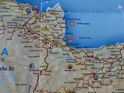
Kalives is sort of a big village with plenty of shops, a butcher, a bakery, a supermarket, a post office, a petrol station, kafenions and restaurants, and a very nice church. Kalives has good sand beaches. The eastern beach is the most popular because it is in the village itself. The western beach is more quiet and about one km away. Kalives remains relatively quiet compared to some of the other seaside resorts on the north coast of the island of Crete. The village has all facilities you can ask for in a holiday resort, like good supermarkets and plenty of tavernas to choose from. There is a large village square next to the church where you can have a drink or something to eat in the shade of some very large and old trees. Here you find also the remains of some buildings from the Venetian times. From Kalives there are two exits to the New National Road. Pick one of them and head towards Rethimnon. From the highway take the exit to Lake Kournas and then at the fork head for Dramia. You are now on the Old National Road. You come through the village of Episkopi. This traditional village contains many old stone houses and a big church that can already be seen from afar. There is a bit of traffic in Episkopi, mainly cars going to places in the neighborhood (including a monastery, Lake Kournas the village of Argiroupoli), but this is only on one road and the rest of the village is very quiet. Many of the houses make an abandoned and dilapidated impression. Here and there you see a bird in a cage outside a house. There are more small churches, and there is a memorial in the village. From Episkopi follow the signs to Argiroupoli. The village is located in the hills and there are many remnants from Roman times to find, such as a port, floor mosaics and many tombs. In the neighborhood are also plenty of waterfalls and a monastery from the 10th century with wall paintings from the 12th century. In ancient times Argiroupoli was allready a city of significance. In Dorian times it was called Lappa. In the year 67 BC the city was destroyed by the Romans. Lappa supported Octavianus in his battle with Mark Antony and when Octavianus later became Emperor Augustus, he rewarded the city and helped to rebuild it. Lappa was then a flourishing city until the 9th century AD when it was destroyed by the Saracens. The city was rebuilt and the name changed to "Poli" (city). During the Turkish domination it was known as Gaidorpoli (Donkey City). In 1822 the village got its final name Argiroupoli. Despite all the violence in and around the village, there are still a few things well preserved, like a Roman mosaic with 7000 stones and a Venetian gate. In the courtyard of the Agia Paraskevi chapel there are remnants from the Minoan times (one step). Northwest of the village are waterfalls and water sources and a church that is carved out in a rock (the Agia Dynamic church). Nearby are also the remains of a Roman aqueduct, Roman baths and watermills. Northeast of the village (follow the old path next to the local school) is an old Roman road leading along a large quantity of Roman tombs, a church that is carved out in a rock (the Church of the five virgins) and a thousand years old sycamore. |
| TOCHT 13: KOLIMBARI, GONIA MONASTERY, AFRATA BEACH, RODOPOS, RAVDOUCHA AND RAVDOUCHA BEACH |
|
|
|
|
|
|
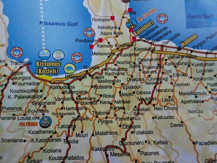
Go to the New National Road via Kalives and head for Chania. Drive past Chania and get of the road at Kolimbari. Kolimbari is an attractive village at the beginning of the Rodopos peninsula in the north west of Crete, with a long pebble beach on the east side (called Tavroniti), some dilapidated houses, and lots of fish restaurants. On a hill just outside the village you can see the 17th century Monastery of Gonia, that is still inhabited by five monks. Here you find a small museum with religious artefacts like bibles with silver covers, silver crosses, priests vestments and old icons dating back as far as the 13th century. Some of these icons are considered to belong to the most imporant icons of the island of Crete. The monastery of Gonia was built between 1618 and 1634 and is one of the most important monasteries on Crete. The monastery of Gonies is opened on all days except Saturday (when it is closed) from 9.30 to 13.30 and from 16.30 to 20.00, there is a dress code (no shorts, no short sleeves etcetera). From the monastery the road goes further to Afrata and then to Afrata beach. The beach is at one and a half kilometers distance from the village and there is a taverna. There are also sun beds and umbrellas for rent. Turn around and turn right towards the village of Rodopos. It is a quiet village with several churches, some shops and a large square with a few taverns and a well. On the village square is also an ancient Roman column with inscriptions, dating from the time of Emperor Hadrian (119-138 AD). It gave the distance to the Diktynna Sanctuary which is situated in the north of the peninsula. In Latin is written that the road to the sanctuary was funded by the emperor Hadrian and the rich Diktynna sanctuary itself. The column was excavated in the 19th century and until the beginning of 2002 it stood next to the Agios Georgios church. In 2002 it was moved to the main square (where it is more noticeable). The Agios Georgios church is an old church. I myself think that it dates from the Byzantine period, but I can't find any further information about it. You can find it a bit further down into the village on the right hand side of the road. After Rodopos go back to where you came from. the road stops in the village. At the fork in the road turn righ to Ravdoucha. Ravdoucha is located on the west side of the Rodopos peninsula. It is a village of mostly older stone houses, but also with some newly constructed ones. There is a nice little church on the square that was built in 1897. Except for a few kafenions there is not much of facilities available. At Ravdoucha you take the road down which leads to Ravdoucha Beach, which is two kilometers away. And although it is sometimes written that the road is not good, this information is now outdated. The whole stretch to the beach is paved, even if it is not very wide on some places, and here and there it is a bit steep: it's doable. On the way to Ravdoucha Beach you'll pass by another, larger church (left) and a beautiful old white church with a cemetery (right). Here you can make a stop to enjoy the magnificent view over the Gulf of Kissamos. At this white church there is a fork in the road and here you go further down where after a few hundred meters on the right side of the road you will see the Byzantine church of Agia Marina. It is indicated with a (brown) sign. You walk up the stone stairs to get to the the small church. In the Byzantine church of Agia Marina are fairly well preserved frescoes of Jesus, the Virgin Mary and saints. Of the image of the face of Jesus only half has survived, but Mary and some saints have stood the test of time better. The church is very small, but definitely worth a look. After the Agia Marina church the road goes further down and not far from the church down there is another fork in the road. The two signs - if you go right or left - refer to the different beaches of Ravdoucha. If you take the road to the left you will drive along a nice church after a few hundred meters. This church is built partially into the rock. Inside is a whole collection of icons and you can burn a candle here. At the end of the road lies the beautiful pebble beach of Ravdoucha. |
| TRIP 14: RETHIMNON, MINOAN CEMETARY OF ARMENI AND PETRES BEACH |
|
|
|
|
 |
|
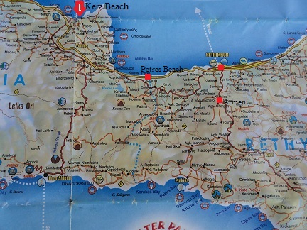
Go to the New National Road via Kalives or via Vamos and Georgioupolis and than towards Rethimnon. The town of Rethimnon with its 20.000 inhabitants is one of the bigger cities on Crete, and unlike Chania and Heraklion it depends heavily on tourist for its excistance. It has a historical centre with remains from all periods in history, including Turkish remains, and a Venetian harbour, lighthouse and castle. The harbour is one big stretch of restaurants that overlook the beach and the ferry harbour (with boats which go regularly to Piraeus). Directly behind the harbour is the old part of the town with narrow alleyways, tourist shops, Turkish minarets, churches, a city park, musea, Venetian style houses with covered wooden balconies, old mosques and an old Turkish bathouse with junk piled up in it. 1 - The Venetian fortress. In this large fortress all the residents could have a safe retreat in case of attacks from outside. The construction of the fortress was started in 1573.
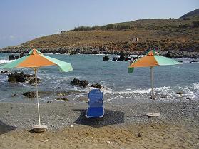
It measures 1300 meters around. There are many more interesting things in Rethimnon to go and have a look at, for example the Venetian Rimondi fountain, a Turkish bath and a Turkish school and the 13th-century monastery of Agios Franziskos. Near the entrance to the Venetian fortress is also the Archaeological Museum of Rethimnon with finds from the Stone Age to the Roman period of the island. The Minoan cemetary of Armeni is situated 8 kilometers south of Rethymnon and can be reached by taking the exit to Spili and Agia Galini. The necropolis is situated just outside (on the north side) of the village of Armeni (there are several villages with the name Armeni on Crete). Armeni itself is just a small village and not very spectacular. It was founded in 961 AD by Armenian soldiers from the army of the Byzantine general Phokas, who conquered Crete from the Arabs in that year. The tombs are placed in a field under the shade of the trees. There are around 200 of them and they date from 1300 - 1050 B.C. These tombs are carved out of the rocks and steps take you down where you can have a look at them. Some of them have the stones that used to close them off still next to the entrance. They are all chamber tombs exept for one which is a larger "Tholos tomb" - meaning it is beehive shaped in rings, and these rings get smaller the higher to the ceiling of the tomb. This one extra large tomb is protected with a wooden roof and has light inside (this will automatically go on as you step inside). A nice stop on the way back to have a drink or a dip into the sea is Petres beach. It's located just off the road between Rethimnon and Georgioupolis, close to Gerani, at the Petres bridge. There are two authentic Greek tavernas at one of the small beaches, and it's very quiet. On the other side of the bridge is the start of a very long sandy beach which stretches all the way to the village of Georgioupolis (10 km long, it is called - Episkopi Beach). The beginning of this beach is also used by naturists (we make a regular stop here). Petres is a nice place for a break, and the scenery is very beautiful. You find lots of rocks in the sea and a lot of wild flowers (I guess that depends on which time of the year you are there). |
| Trip 15: Deliana and Rotonda |
|
|
|
 |
 |
|
|
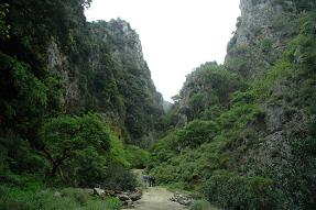
Deliana is a small village in the northwest of Crete, not far from Kissamos and at 36 kilometer distance from Chania. The village lies at the beginning of the Deliana Gorge, which is the beginning of a hike surrounded by high cliffs and unspoilt Cretan nature (the walk takes about 1.5 hours). At the bottom of the gorge there is a small church where you can have a rest. The Byzantine church in the village, the Agios Ioannis church, is in good shape. It is a pretty church from the outside and on the inside there are beautiful frescoes on its walls. This church is open for the public and in my opinion this is one of the nicest Byzantine churches in this area (and maybe even in the whole of Crete). Rotonda is the place of the Byzantine church of Rotonda or the Church of the Archangel Michael. It is situated close to the village of Episkopi in the west of Crete. The church has the only 5 concentric ring stepped dome on Crete. The design is so rare in Byzantine terms that only the church of Agios Nikolaos in Thessaloniki is similar. It is believed that the church was originally built during Crete's first Byzantine period in the 6th Century and then either rebuilt or additions added in the 10th Century when it was the seat of the Bishop of Kissamos. Sections of the mosaic floor date back to the 5th Century A.D. while different layers of frescoes date from the 9th to the 11th Century. The church can be hard to find if you come from the south on the route Vasilopoulo - Episkopi - Drakona. At the end of the village of Episkopi (after driving through it) there is an exit on the left hand side and about 1 kilometer further on the left hand side there is another one. You will not see the signs because they are placed in a way that you will only see them when you come from the north from the direction of Kolimbari. |
© Hans Huisman, https://www.angelfire.com/super2/greece/ 2018
 The rather large village of
 Drive to Almyrida and take the exit to Plaka and Kokkino Chorio here.
 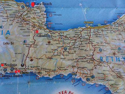 Drive to Vamos and follow the long road that leads through the village. Look out for the sign that indicates the wayto Chora Sfakion and follow that road. On your way to the south you will pass the village of
 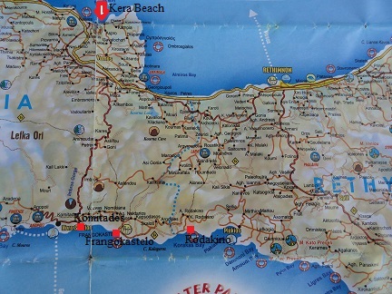 The largest part of this journey goes over the same route as trip 4, but now at the end of the road you go to the left instead of the right. You will first pass
 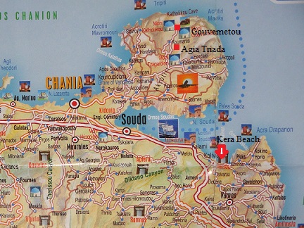 Drive through Kalyves and from here take the national road to Souda.
