
undefined
< US 17 and Branches | Home | US 220 > |
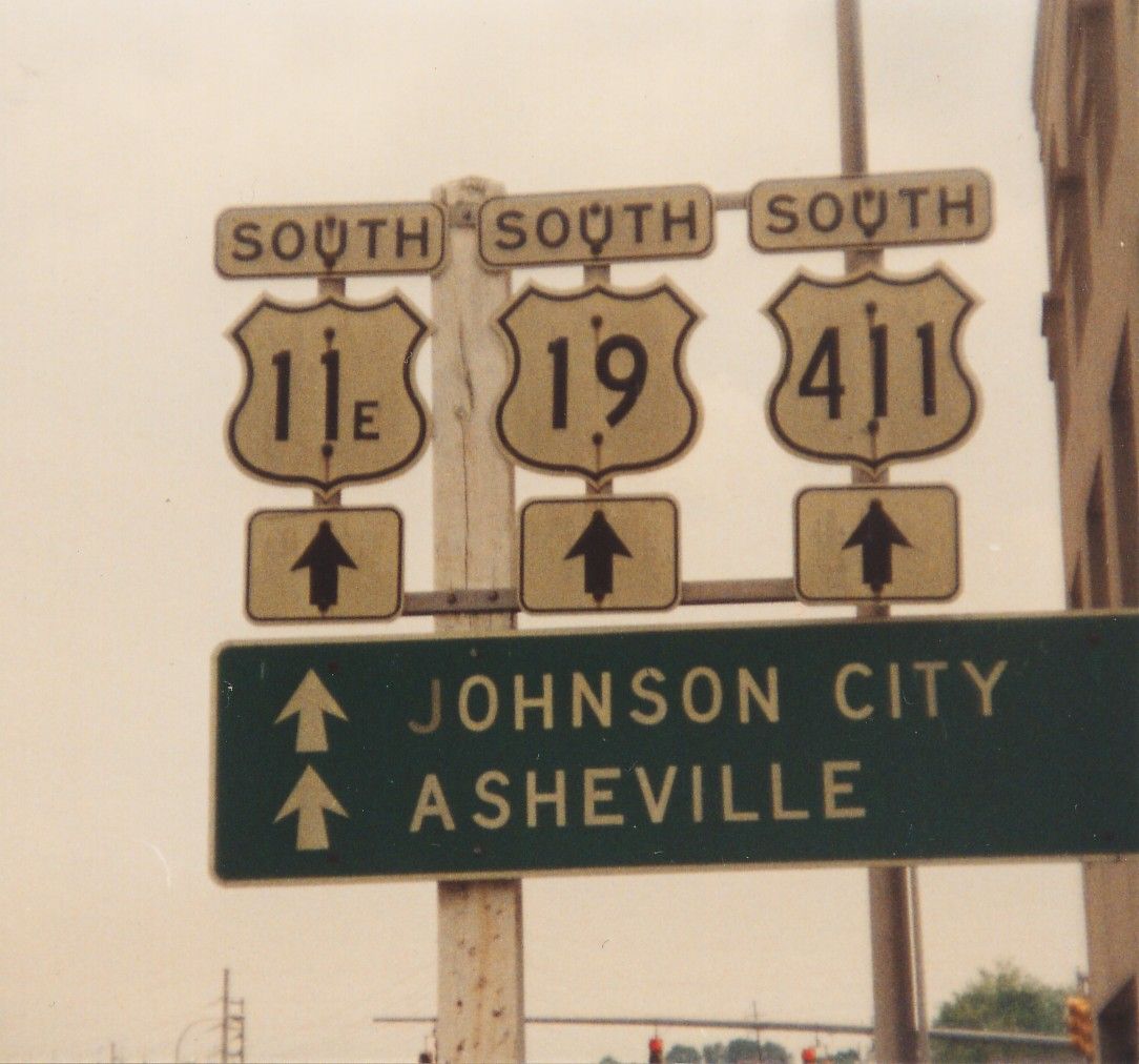
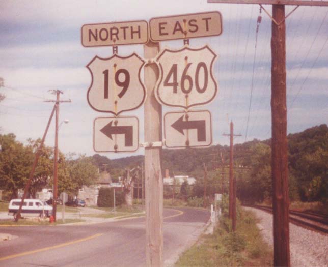
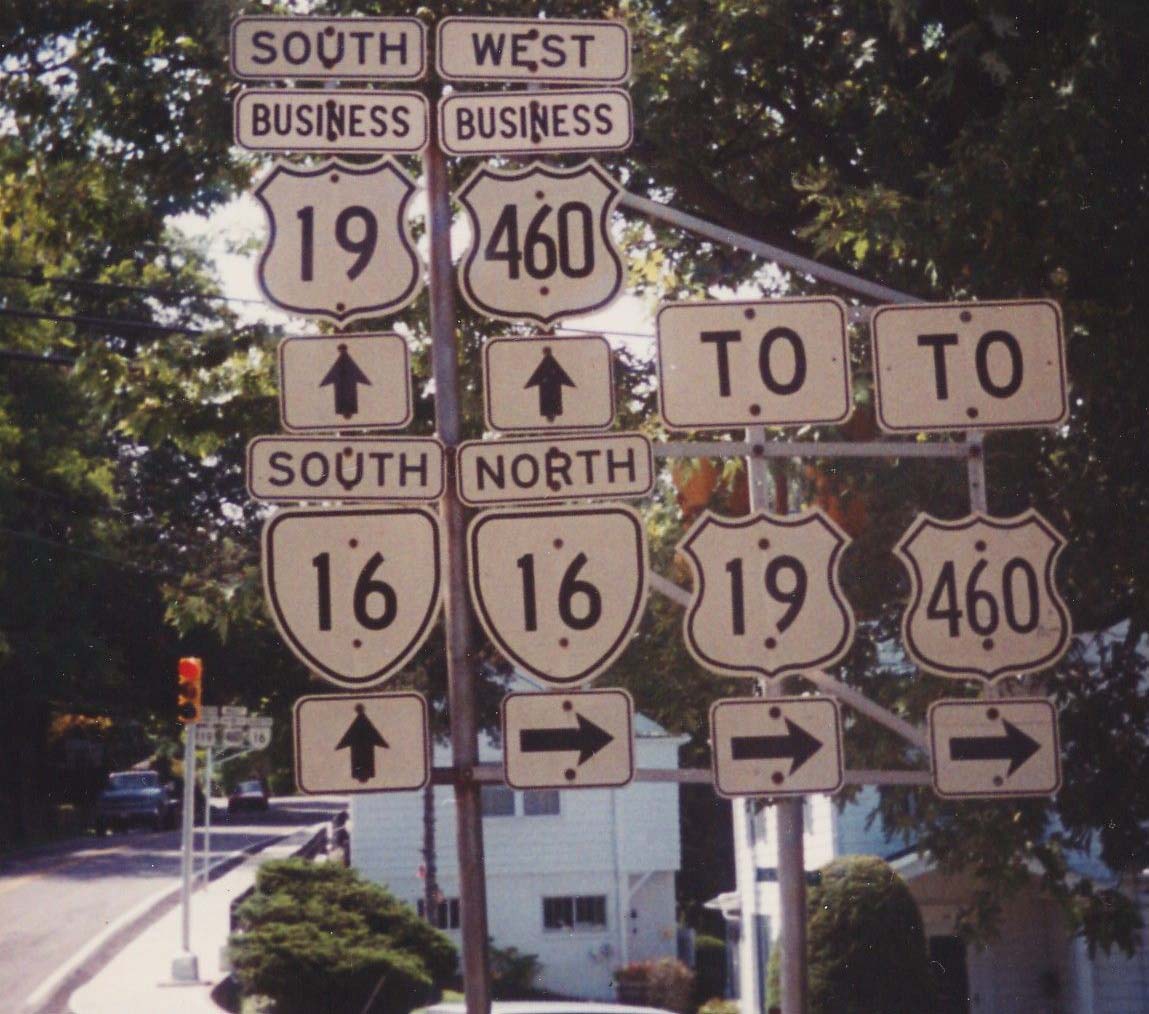
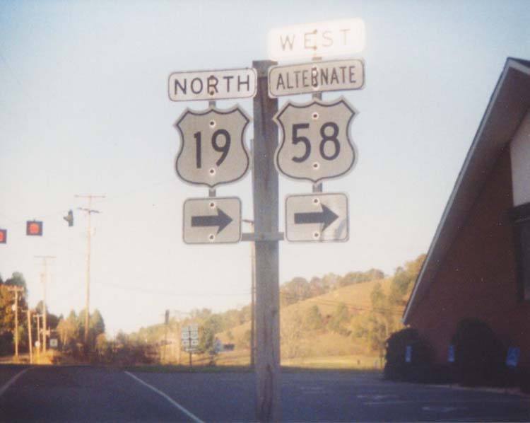
| ROUTE LOG TN STATE LINE, VA 381 BEGIN: 0 - 0 US 421 SB: 0.25 - 0.25 VA 113: 0.25 - 0.5 US 11 BEGIN, US 11E END, US 11W, US 421 NB, VA 381 NB: 0.5 - 1 VA 113: 1 - 2 I-81 (exit 5): 2 - 4 WA-BRI LINE: 3 - 7 VA 140: 6 - 13 US 11 NB: 1 - 14 US 58 ALT EB: 1 - 15 RU-WA LINE: 11 - 26 US 58 ALT WB: 2 - 28 US 19 Bus: 7 - 35 US 19 Bus: 5 - 40 VA 80 EB: 5 - 45 VA 80 WB: 3 - 48 VA 365: 7 - 55 TZ-RU LINE: 0.5 - 55.5 VA 365: 0.5 - 56 US 460 WB: 5 - 61 US 19 Bus, US 460 Bus: 11 - 72 VA 16 ALT: 1 - 73 VA 16: 1 - 74 US 19 Bus, US 460 Bus: 2 - 76 US 460 EB: 11 - 87 VA 102: 2 - 89 WV STATE LINE: 1 - 90 |
Creation: US 19 was a split original US Route that didn't get to Virginia until 1928. It had the same basic alignment as now, and was multiplexed with US 11 from Bristol to Abingdon, VA 106 to Hansonville, VA 112 to Lebanon, and VA 11 to Bluefield.
Adjustments: All the state route multiplexes went away in 1929. The only other adjustments have been slight in Bristol (moved to Euclid Ave in 1962) and the triangle cut-off in Abingdon between US 11 and US 58 ALT. Maps are vague to the exact dates of the Abingdon change, although it took place by 1961 (Washington County map from 1961 shows it). Posting: Fully posted; cutouts in Bristol (although maybe not this set from 1992), Abingdon, Bluefield. White border sign in Abingdon. Tazewell cutouts still abound as of October 2003. Greendale cutouts lasted to at least 1996. Comment: US 19 is a nice 4-lane scenic alternative (when coupled with US 460) to I-81 from Bristol to Christiansburg. US 19 could be added to US 460 to Bypass Bluefield VA-WV, as they cross again in Princeton. US 19 gets the same treatment in Western NC from US 74. A posted US 19 TRUCK exists in Bristol. | ||
| US 19 ALT Decommissioned | |||
| Previous US 19 ALT's: | US 19 ALT: Mentioned in August 1947 CTB Minutes. It appears this was the number for the piece of today's US 19 between US 11 and US 58 ALT. No idea about the lifespan of this, although it probably lasted to at least 1951 when US 58 ALT was first created. | ||
Previous: US 17 and Branches |
Next: US 220 and Branches
Top | Virginia Hwy Index
Home
