 |
Hanover (Hanover County) |
|
|
|
|
ROUTE LOG
VA 54: 0 - 0
US 301, VA 2: 0.03 - 0.03
|
|
North leg of triangle where VA 54 intersects US 301/VA 2. Not posted. Unsure how long it has been there.
Official length: 0.03 miles. That's 158.4 feet!
|
 |
From: US 29 Gainesville (Prince William County)
To: WV line near Star Tannery, Frederick County (continues as WV 55 to US 19, Muddlety, WV
Current Length: 68 miles (VA+WV 55= 291 miles)
|
|
|
|
|
ROUTE LOG
US 29: 0 - 0
US 15: 2 - 2
FQ-PW LINE: 5 - 7
VA 245: 3 - 10
US 17 Bus SB: 5 - 15
I-66 EB (exit 27), US 17 SB: 1 - 16
I-66 WB (3xit 23): 4 - 20
US 17 NB: 1 - 21
WR-FQ LINE: 8 - 29
VA 79: 1 - 30
US 522: 5 - 35
US 340 SB: 0.5 - 35.5
US 522 SB: 1 - 36.5
US 340 NB, US 522 NB: 1.5 - 38
SH-WA LINE: 11 - 49
US 11 SB: 1 - 50
US 11 NB: 0.5 - 50.5
I-81 (exit 296), Begin US 48: 0.5 - 51
FD-SH LINE: 12 - 63
WV STATE LINE: 5 - 68
|
|
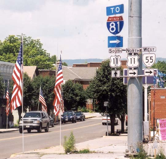
Creation: Appeared in 1929 as the original VA 55. Ran from the Frederick-Shenandoah County Line (west of US 11 Strasburg) to just east of Marshall. This was all new routing.
Adjustments: By 1931 VA 55 had expanded to 3 pieces: 1. WV line to 1 mile east of Marshall 2. US 15 (curr VA 245) The Plains to Prince William County Line 3. Haymarket to US 211 (curr US 29) Gainesville.
Was fused to continuous VA 55 in 1932, and extended west to West Virginia between 1934-37.
VA 55 was moved onto I-66 between Delaplane and Marshall in 1962.
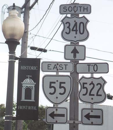
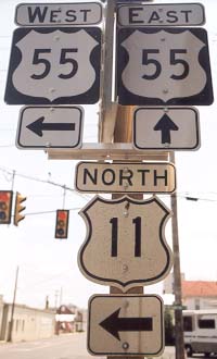
Posting: Fully posted. Cutouts in Strasburg, Front Royal, and The Plains. US 55 shields in 3 different parts of Front Royal. NOTE: As of spring 2002, all the Front Royal US 55 shields were corrected. In August 2002 I spotted error US 55 shields near the West Virginia border at either SR 600 or 604. New US 55 error shields have appeared in Strasburg
Comment: East of Strasburg, this road provides the back road equivalent of I-66.
WV 55 is planned to be re-routed over Corridor
H, a four-lane divided highway which will connect with US 33 at Elkins.
From what I've heard, hardly anyone in WV wants Corridor H, other than
the state government. I've also heard that VA has no intention of
building their section to connect with I-81.
More recent rumors include numbering Corridor H as US 48, which I assume
would include renumbering the part of VA 55 west of I-81. The 2002 Rand McNally shows 2 sections of this WV improvement, near Baker and near Elkins as complete. As of October 2002, one 2-mile section is actually open as WV 55 east of US 220.
|
|
 |
From: US 11 Steeles Tavern (Augusta County)
To: US 60 Dentons Corner (Buckingham County)
Current Length: 63 miles
|
|
|
|
|
ROUTE LOG
US 11: 0 - 0
RB-AU LINE: 1 - 1
NL-RB LINE: 6 - 7
BLUE RIDGE PKWY: 1 - 8
VA 151 NB: 16 - 24
VA 151 SB: 3 - 27
VA 56Y: 0.5 - 27.5
US 29 SB: 5 - 32.5
US 29 NB, Begin US 29 Bus: 4 - 36.5
US 29 Bus NB: 0.5 - 37
BK-NL LINE: 16 - 53
US 60: 10 - 63
|
|
Creation: Appeared in 1930-31 as the original VA 56. It was in 2 sections: 1. VA 808 (curr VA 252 at SR 620 jct) east 1 mile 2. US 11 Midway (curr Steeles Tavern) to Montebello. All of this was new numbering. This is a very scant beginning to route 56
Adjustments: In July 1933, 2 more separate sections appeared: 3. near VA 252 Moffats Creek norht to VA 5 (curr US 250) 3 miles west of Staunton, replacing the north piece of VA 808 4. US 29 Lovingston to US 60 Dentons Corner. This replaced VA 314.
By 1937, a 5th piece appeared, between VA 151 Roseland and Massies Mill, a new routing.
By 1938, sections 1 & 2 were connected. Section 3 was truncated of the north end at VA 254 West View, leaving behind SR 612. Sections (1/2) and section 5 got closer together.
Between 1942-44, VA 56 became continuous between VA 254 and VA 151, but there was still the second piece from US 29 Lovingston to US 60.
Between 1945-47, section 3 was renumbered as an extended VA 292; To recap, at this point there are still 2 discontinuous pieces, with the gap between VA 151 Roseland and US 29 Lovingston
The 1956 and 1957 VDOT maps show everything east of Shipman to US 60 downgraded to SR 777! This is restored to VA 56 on the 1961 VDOT map.
VA 56 was finally one piece in 1971 or 1972, replacing VA 158 #3, which had been in the gap for 15 years or so.
Posting: Fully posted. Maybe a cutout left in Vesuvius
Comment: Nearly all of VA 56 is VERY twisty, with no alignment improvements since the beginning.
|
|
 |
From: VA 8 Patrick County
To: VA 360 near Halifax (Halifax County)
Current Length: 91 miles
|
|
|
|
|
ROUTE LOG
VA 8: 0 - 0
VA 346: 8 - 8
HE-PK LINE: 2 - 10
VA 57 ALT: 6 - 16
US 220 NB, US 220 Bus: 4 - 20
US 220 SB: 0.5 - 20.5
MAR-HE LINE: 5.5 - 26
US 220 Bus NB, VA 457: 0.5 - 26.5
US 58 Bus WB, US 220 Bus SB: 1 - 27.5
HE-MAR LINE: 2.5 - 30
US 58 Bus EB: 1 - 31
VA 457: 2 - 33
PT-HE LINE: 12 - 45
VA 41: 6 - 51
US 29 Bus NB: 11 - 62
US 29 Bus SB: couple blocks - 62
US 29: 1 - 63
HA-PT LINE: 14 - 77
VA 360: 14 - 91
|
|
Creation: Appeared in 1932, and is the only VA 57. Ran from US 58 Martinsville to VA 12 (curr VA 360) near Halifax, with a 20 mile gap around Callands. This replaced original VA 302.
Adjustments: In July 1933, VA 57 was extended west over what was VA 203 to Patrick County Line.
VA 57 was made continuous between 1934-37.
In 1940 or 1941, it was extended to Fairy Stone State Park.
In 1952-53, VA 57 east was truncated to US 29 Chatham, leaving behind SR 832.
VA 57 west was extended over SR 625 to its current end at VA 8 between 1958-61.
VA 57 east of Martinsville was rerouted to hit US 58 further east, leaving behind VA 457 on the old route. This occurred in 1992.
Per Robert Jordan, VA 57 was re-extended over SR 832 to Halifax. This is confirmed on the 2002-04 Official Map.
Posting: Fully posted; cutouts may remain at 57 ALT Jct.
Comment:The section west of Martinsville is surprisingly easy, considering the terrain, unlike VA 40 to the north
|
| Previous VA 57's: |
|
VA 57Y: Earliest CTB reference is March 1949. Was a triangle setup between US 220 and VA 57 in Bassett Forks. VA 57Y was decommissioned in 1978.
|
 |
From: VA 57 Bassett (Henry County)
To: US 220 & VA 57 Collinsville (Henry County)
Current Length: 4 miles
|
|
|
|
|
ROUTE LOG
VA 57: 0 - 0
US 220: 4 - 4
|
|
Creation: First appeared on Official Maps in 1977, in its current arrangement, but mentioned in CTB minutes as far back as November 1957. This was NOT an alignment of VA 57 previously.
Adjustments: None
Posting: Fully posted. Cutouts may still exist at VA 57 Jct.
Comment: Have not driven this one, but it would make more since for VA 57 ALT to extend further east on current VA 57 and put VA 57 with US 220 Bus in Martinsville.
|
|
| VA
58 not currently assigned |
|
|
|
|
| Previous VA 58's: |
|
|
VA 58: Appeared in 1930-31, in 2 pieces: 1. VA 12 (curr VA 274-94 jct) to Grayson 2. US 121 (curr US 52) south for 4 miles. Piece 1 had been VA 116 from VA 12 to Fries and unnumbered to Grayson. Piece 2 was previously unnumbered. VA 58 was renumbered in July 1933 to current VA 94. The scan is from the 1931 official map |

|
 |
From: VA 47 Drakes Branch (Charlotte County)
To: VA 40 Keysville (Charlotte County)
Current Length: 8 miles
|
|
|
|
|
ROUTE LOG
VA 47: 0 - 0
VA 40: 8 - 8
|
|
Creation: Appeared between 1958-61 in its current alignment over an SR route. This is the 4th VA 59.
Adjustments: None
Posting: Fully posted
Comment: Have not driven this one yet. |
| Previous VA 59's: |
|
VA 59 #1: Appeared in 1932 in two pieces: 1. US 501 east 4 miles towards Virgilina (replaced a piece of VA 302) 2. US 58 Clarksville southwest for 2 miles (new routing). Both pieces were quickly replaced by the southernmost parts of VA 49 in July 1933. Today it is all of VA 96, plus VA 49 from Virgilina to Clarksville.
VA 59 #2: This appeared in July 1933, from WV state line near Stacy, west to a little west of US 23 Pound. This had previously been VA 121 #2. This VA 59 was changed to current VA 83 in 1940-41 to match WV 83.
VA 59 #3: This VA 59 showed up in 1940-41, from WV line west of Columbia Furnace to a couple miles east of US 11 Woodstock. This replaced VA 261 to match then-WV 59. Between 1942-44, the piece east of Woodstock was downgraded to SR 758. This WV 59 was changed to VA 42 and 3 SR's between 1948-51.
|
| VA
60 never assigned |
|
|
|
|
|
|
Despite VDOT's efforts to post VA 60 signs in various locations, there has never been a VA 60. |
 |
From: VA 16 Tazewell (Tazewell County)
To: US 460 Narrows (Giles County)
Current Length: 49 miles
|
|
|
|
|
ROUTE LOG
VA 16: 0 - 0
US 19, US 460: 0.5 - 0.5
US 19 Bus, US 460 Bus: 1.5 - 2
BL-TZ LINE: 14 - 16
US 52 SB: 10 - 26
I-77 (exit 64): 0.5 - 26.5
US 52 NB: 0.5 - 27
GI-BL LINE: 8 - 35
VA 100: 13 - 48
US 460: 1 - 49
|
|
Creation: Appeared in July 1933, and is the only VA 61. Originally ran only from VA 81 (curr VA 16) Tazewell to the Tazewell-Bland County Line. This replaced VA 127.
Adjustments: Between 1942-44 a second discontinuous section appeared between VA 8 (curr VA 100) Narrows and the Giles-Bland County Line
This second piece was extended west (over old SR 641) to US 52 Rocky Gap and east to its current end at US 460 Narrows. The 2 pieces were finally joined between 1948-51, again over SR 641.
Posting: Fully posted. A post on Misc.transport.road reported a US 61 sign error exists in the Tazewell area. I found this error sign in October 2003 - it is the first reassurance sign leaving VA 16. Cutouts exist at North Tazewell and also in Tazewell.
Comment: I drove this in October 2003. It was quite rustic. Most of the Giles County portion has been rebuilt (leaving an extensive SR 724 behind). VA 61 is particularly gnarly just west of I-77.
|
|
 |
From: US 58-360 east of Danville (Pittsylvania County)
To: NC state line at Milton, NC, Halifax County (continues as NC 62 to Thomasville, NC)
Current Length: 4 miles (VA+NC 62= 76 miles)
|
|
|
|
|
ROUTE LOG
US 58, US 360: 0 - 0
HA-PI LINE: 3.5 - 3.5
NC STATE LINE: 0.5 - 4
|
|
Creation: Appeared in 1947 over a previously unnumbered road to match NC 62. This is the 3rd VA 62.
Adjustments: None
Posting: Fully posted
Comment: No excitement within Virginia, but on NC 62 north of Burlington there are several early 1920's bridges still in use.
|
| Previous VA 62's: |
|
VA 62 #1: Appeared in July 1933, replacing the 2nd VA 101. Ran from US 58 Ewing straight down to the Tennessee border. This was downgraded to today's SR 744 in 1942 or 1943.
VA 62 #2: Appeared between 1942-44, from US 23 Appalachia to Stonega. This had not been a state highway previously. This was renumbered as current VA 78 in 1947.
|
 |
From: US 58 ALT St. Paul (Russell County)
To: VA 80-83 Haysi (Dickenson County)
Current Length: 44 miles
|
|
|
|
|
ROUTE LOG
US 58 ALT: 0 - 0
VA 270: 1 - 1
DI-RU LINE: 10 - 11
VA 83 WB: 18 - 29
VA 83 EB: 5 - 34
VA 80, VA 83: 10 - 44
|
|
Creation: Appeared between 1958-61 as the 2nd VA 63. Ran from US 58 ALT in St. Paul (curr. VA 270) to VA 83 Fremont. This was a renumbering of VA 64.
Adjustments: VA 63 was extended to Haysi along what had been VA 83 when it was rerouted to the south in 1966.
Posting: Fully Posted
Comment: Have not driven any of this one yet.
|
| Previous VA 63's: |
|
VA 63 #1: Appeared in July 1933, as a renumbering of VA 102 #2. Ran from US 58 west of Jonesville straight down to Tennessee's border. It was downgraded to SR 758 between 1945-47.
|
| VA
64 not currently assigned |
|
|
|
|
| Previous VA 64's: |
|
VA 64:Appeared in July 1933, replacing all of what remained of VA 11 and the southern half of VA 103 #2. It ran from US 19 Lebanon, west to Norton, Appalachia, Jonesville and down to Tennessee near Blackwater. Near Pennington Gap VA 64 went to Woodway instead of Dryden (this is SR 642)
In 1940-41, VA 64 kept only 11 miles of its original route as everything in SW Virginia was rearranged. VA 64 then went from US 19 Hansonville to St. Paul then north to VA 83 Fremont. This alignment had been original VA 70. The previous alignment of VA 64 became - Lebanon to Dickensonville part of curr. VA 71; St Paul west to Norton, Jonesville, and Tennessee became VA 70 #2, except the Woodway route to Pennington Gap became VA 65 #2.
The section from St. Paul east to Dickensonville became US 58 ALT between 1948-51. The rest of VA 64 was renumbered as VA 63 between 1958-61.
|
 |
From: US 23-58-421 Clinchport (Scott County)
To: US 58 ALT Banners Corner (Russell County)
Current Length: 36 miles
|
|
|
|
|
ROUTE LOG
US 23, US 58, US 421: 0 - 0
VA 72 SB: 14 - 14
VA 72 NB: 8 - 22
RU-SC LINE: 4 - 26
US 58 ALT: 8 - 34
|
|
Creation: Appeared between 1958-61 as the 3rd VA 65, and ran as it does today. It replaced VA 66.
Adjustments: None
Posting: Fully Posted
Comment: Never driven this one...
|
| Previous VA 65's: |
|
VA 65 #1: Appeared in July 1933, from US 58 Dot west to Kentucky. This replaced VA 104 #2. Between 1935-37 it was extended east to US 58-421 at Dot over what had been the earliest US 58 alignment from Pennington Gap. This VA 65 was renumbered to VA 66 to match KY 66 in 1940-41.
br>
VA 65 #2: Appeared in 1940-41, from VA 66 (curr US 421) Woodway to VA 70 (US 58 ALT) near Dryden. This had been part of VA 64 previously. This route was downgraded to SR 642 between 1942-44.
|
| VA
66 not currently assigned |
|
|
|
|
| Previous VA 66's: |
|
VA 66 #1: Created in July 1933. Ran from VA 64 (current US 58 ALT-421 Jct) Pennington Gap to Dryden. This was a new alignment. This lasted to 1940-41, when it was replaced as part of VA 70. Today it is part of US 58 ALT.
VA 66 #2: Appeared in 1940-41 to match KY 66 and was in 2 pieces: 1. KY line west of Pennington Gap to US 23-58-421 Clinchport. 2. 8 miles west of Ft. Blackmore east to VA 64 (curr US 58 ALT) near Castlewood. West of Pennington Gap had been original VA 65, and the rest was original VA 70.
By 1944, VA 66 was one piece, and had been rerouted to multiplex with US 58 from Dot to Clinchport. Up to then it had left US 58 at Pattonsville and went directly to Clinchport along current SR's 638 and 600. In 1948 or so, VA 66 was truncated to Clinchport, as current US 421 was extended to KY. Between 1958-61, the remaining VA 66 was renumbered to current VA 65.
|
 |
From: VA 80 Honaker (Russell County)
To: SR 616 Jewell Ridge (Tazewell County)
Current Length: 22 miles
|
|
|
|
|
ROUTE LOG
VA 80: 0 - 0
TZ-RU LINE: 11 - 11
US 460 WB: 1 - 12
US 460 EB, Begin US 460 Bus: 1 - 13
US 460 Bus EB: 1 - 14
US 460: 1 - 15
SR 616: 7 - 22
|
|
Creation: Appeared in 1940-41 as a renumbering of original VA 83, and ran as it does today. This is the 2nd VA 67.
Adjustments: None
Posting: Fully posted
Comment: I finally saw some of this one in person in October 2003, with its US 460 multiplex.
|
| Previous VA 67's: |
|
VA 67 #1: Appeared in July 1933, as a renumbering of VA 106, running from US 23 Appalachia west to KY State line. This was renumbered as VA 160 to match KY 160 in 1940-41. This had been US 23's original exit to Kentucky back in the early 30's.
|
 |
From: US 23 Appalachia (Wise County)
To: SR 601 Exeter (Wise County)
Current Length: 5 miles
|
|
|
|
|
ROUTE LOG
US 23 Bus: 0 - 0
LE-WI LINE: 5 - 5
|
|
Creation: Appeared in its present form in July 1933. This is the only VA 68 and was a renumbering of VA 119 #2.
Adjustments: None
Posting: Assumed to be fully posted. There is a TO KENTUCKY 38 in a Virginia Hwy Shield on VA 68 westbound.
Comment: Have not crossed this one either. |
|
 |
From: US 52 Poplar Camp (Wythe County)
To: Austinville (Wythe County)
Current Length: 5 miles
|
|
|
|
|
ROUTE LOG
US 52: 0 - 0
I-77 (exit 24): 1 - 1
SR 619: 4 - 5
|
|
Creation: Appeared in its current form between 1958-61. This was a renumbering of VA 81 #2. This is the 2nd VA 69.
Adjustments: None
Posting: Fully posted
Comment: Since I-77 blows off US 52 at the Shot Tower Historic Site, VA 69 is the exit to take...
. |
| Previous VA 69's: |
|
VA 69 #1: Appeared in July 1933. Ran from US 23 east of Appalachia north to Roaring Fork. This was a renumbering of VA 133 #2. This was never extended to Pardee. This VA 69 was downgraded to current SR 603 between 1952-53.
|
 |
From: US 58 Jonesville (Lee County)
To: Tennessee State Line near Blackwater, Lee County (continues as TN 70 to NC 208 at Allens Gap)
Current Length: 12 miles (VA+TN 70 = 79 miles)
|
|
|
|
|
ROUTE LOG
US 58: 0 - 0
TN STATE LINE: 12 - 12
|
|
Creation: Appeared in 1963-64 as an upgrade to SR 798. Ran as it does today. This is the 3rd VA 70.
Adjustments: None
Posting: Fully posted
Comment: Haven't driven this one, but the DeLorme map shows VA 70 to be quite a turn filled alignment. VA 70's current route was also VA 70 in the 40's-50's. For some reason VDOT downgraded it for several years, a la VA 56.
|
| Previous VA 70's: |
|
VA 70 #1: Appeared in July 1933 as a 2 piece route: 1. US 58-421 Pattonsville to US 23-58-421 Clinchport. This had been mainline US 421 until then. 2. VA 59 (curr VA 83) Fremont south to Banners Corner, then west to 8 miles past Fort Blackmore. This segment replaced VA 123.
In 1941, piece one was renumbered as VA 66. Today this is SR 600-642 From Fremont to Banners Corner became part of VA 64 (curr VA 63) and the Fort Blackmore stretch became part of VA 66 (curr VA 65) as well.
VA 70 #2: Appeared in 1940-41. Ran from VA 64 (curr VA 63-270 jct) St Paul west through Norton, Big Stone Gap, and Jonesville before going south to meet TN 70. All of this route had been mostly VA 64, plus it replaced the original VA 66 in the Pennington Gap area. Between 1948-51, all of VA 70 east of Jonesville was eliminated by the creation of US 58 ALT, leaving VA 70 to run only from Jonesville south to Tennessee. This VA 70 was downgraded to SR 798 between 1954-56. Today this route has been reborn as VA 70 again.
|
 |
From: US 23-58-421 Bus Gate City (Scott County)
To: US 19 Bus Lebanon (Russell County)
Current Length: 37 miles
|
|
|
|
|
ROUTE LOG
US 23 Bus, US 58 Bus, US 421 Bus: 0 - 0
VA 72: 2 - 2
RU-SC LINE: 15 - 17
US 58 ALT WB: 10 - 27
US 58 ALT EB: 1 - 28
US 19 Bus: 9 - 37
|
|
Creation: Appeared in July 1933 and is the only VA 71. Ran from US 23-58 Gate City to US 19 Hansonville. This replaced VA 107.
Adjustments: In 1940-41, VA 71 and VA 64 switched places east of Dickensonville, putting VA 71 in its current form. The old route to Hansonville today is US 58 ALT.
Posting: Fully posted, but hardly any postings at SR intersections.
Comment: I drove all of VA 71 in October 2003. It is a pretty decent ride, not too curvy.
|
|
 |
From: VA 71 Gate City (Scott County)
To: VA 83 Georges Fork (Dickenson County)
Current Length: 48 miles
|
|
|
|
|
ROUTE LOG
VA 71: 0 - 0
VA 65 WB: 10 - 10
VA 65 EB: 8 - 18
WI-SC LINE: 8 - 26
US 58 ALT: 4 - 30
VA 158: 1 - 31
DK-WI LINE: 8 - 39
VA 83: 9 - 48
|
|
Creation: Appeared in July 1933, and is the only VA 72. Ran from VA 59 (curr VA 83) Georges Fork south to VA 71 in Nickelsville. This replaced VA 122 #2.
Adjustments: Between 1948-51, VA 72 south was truncated to VA 66 (curr VA 65) at Dungannon. The old piece to VA 71 was downgraded to SR 774. About 1986, VA 72 was extended along VA 65 and down to VA 71 as it does today, over mostly SR 619.
Posting: Fully Posted
Comments: Yet another SW Virginia route I have only crossed. |
|
 |
From: US 1 (Henrico County)
To: I-95 (exit 82) Longdale (Henrico County)
Current Length: <1 mile
|
|
|
|
|
ROUTE LOG
US 1: 0 - 0
I-95 (exit 82): 0.5 - 0.5
|
|
Creation: Appeared in its present form in 1966 over a previously unnumbered road. This is the 2nd VA 73.
Adjustments: None
Posting: Fully posted; On 7/13/03 I spotted a white interstate 73 shield on temporary BGS on I-95 SB.
Comment: Many maps incorrectly show VA 73 all over Parham Rd. When Parham Rd. crosses I-64, there are begin and end state maintenance signs, but no evidence this is a secret part of VA 73 or any other route.
|
| Previous VA 73's: |
|
VA 73 #1: Appeared in July 1933 and was not previously numbered. Ran from US 23 Norton south to the Scott County Line. This was downgraded to current CR 619 between 1948-51.
| 
VA 73 in 1941. |
 |
From: US 23 bus City of Norton
To: US 58 ALT City of Norton
Current Length: 3 miles
|
|
|
|
|
ROUTE LOG
US 23 Bus: 0 - 0
US 58 ALT: 3 - 3
|
|
Creation: Appeared in 1977 between US 58 ALT and US 23, and is the 2nd VA 74. This ran over what had been US 58 ALT.
Adjustments: When the US 23-58 ALT bypass was partially completed in 1990, VA 74 was extended further east over another old piece of US 58 ALT.
Posting: Fully posted. Cutouts in Norton.
Comment: Haven't driven this one...
|
| Previous VA 74's: |
|
VA 74 #1: Appeared in July 1933 as a replacement for VA 134. Ran from VA 71 (curr US 58 ALT) Bolton southwest for 14 miles. This was downgraded to current SR 613 between 1942-44.
|
 |
From: one block north of US 11-58 ALT Abingdon
To: Tennessee State Line (continues as TN 44 to Bluff City, TN)
Current Length: 12 miles
|
|
|
|
|
ROUTE LOG
US 11, US 58 ALT WB: 0 - 0
I-81 (exit 17), US 58, US 58 ALT END: 1 - 1
TN STATE LINE: 11 - 12
|
|
Creation: Appeared in 1940-41, as a renumbering of VA 77 #1. Ran as it does now. This is the 2nd VA 75.
Adjustments: None
Posting: Fully posted. Cutouts still up in Abingdon (although Abingdon is now phasing cutouts out). Fully posted on the stub above US 11.
Comment: VA 75 is a rare VA highway that does not retain its number over a state
line. TN 44 was there before and after the state line renumbering. Perhaps VDOT thought Tennessee was going to change TN 44 to TN 75. Otherwise, there was no need to swap VA 75 and 77. With VA 44 available for action today, VDOT could fix this problem...
|
| Previous VA 75's: |
|
VA 75 #1: Appeared in July 1933. Ran from US 58 (curr US 58-421) west of Bristol to the village of Benhams. This was not previously numbered. This was renumbered as VA 77 #2 in 1940-41. Today it is part of SR 700.
|
Last Update: 25 November 2003
Previous: VA 38 - 50 |
Next: VA 76 - 100
Top | Virginia Hwy Index
Home
|

