to Victorville, Ca.
These directions have been
"lifted" directly from
a site that I can not seem to re-locate.
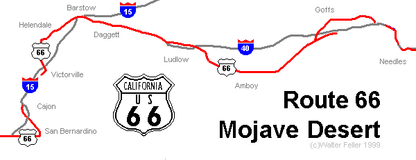
Interactive Map
Courtesy of
Digital
Desert
Interactive Map
Courtesy of
Digital
Desert
Arizona / California State
State Line to U.S. 95
Miles Directions / Sights
0.0 California State Line
- - sign on bridge crossing the Colorado River.
1.0 - Moabi exit.
This exit has two worthwhile side trips.
A right takes you toward Park Moabi. Make a right at the stop sign. You are now on the original alignment of Route 66. About a mile up the twisty road, 66 ends at a large sign made out of rocks. The white bridge, which currently carries the pipeline across the Colorado River, was originally Route 66.5.5If you take a left, follow the pavement to its end. Make another left. About a mile down
this well-maintained dirt road, on the north, is the Topock Maze. This 15-acre geoglyph is believed to be about 600 years old. There are two explanations of its use: 1) that this was where warriors stopped for a purification rite before returning home from battle (the theory recorded on the marker); 2) that the souls of the Mojaves passed through here after death the bad souls losing their way in the maze, the good souls going on to the afterlife.
Of an even more mysterious than the Topock Maze is the structure found at this site. Slow down and prepare to stop for the Agricultural Inspection Station.10.7 Exit the freeway
at East Broadway and turn right. You are now on National Trails Highway.11.5 Carty's Camp
Once a pleasant overnight stay, Carty's Camp was constructed by William and Earnest Mansker in 1925, one year prior to National Trails Road becoming Route 66. The Manskers had seen a similar camp near the Grand Canyon.11.8 Fork.
At this point you can either continue on Broadway through downtown Needles or follow the original Route 66 alignment to Front Street. We follow the path to Front Street.12.3 Front Street in NeedlesOne block from the fork on your left sits the Palms, a well-known overnight stop for early travelers. Until recently, the Palms continued operating as a bed & breakfast by the name National Trails Inn. Note the borax wagon across the street.
You are now on . To your right is El Garces, one of the famous rail stops built by Fred Harvey. As of this writing, the city of Needles will be purchasing the property and is seeking an architectural firm to oversee restoration of this historic site. On your left are a number of shops and the Needles Regional Museum.13.0 After BroadwayTurn left at the end of Front Street and then right on Broadway.
crosses the railroad tracks, take a left onto West Broadway.13.3 The El Rancho Hotel (closed)
- - another famous stop, caught fire on Wednesday, Feb. 17, 1999. As of this writing, there are no known plans for restoring the hotel.15.8 After you cross the freeway, you come to a fork in the road. Turn leftThe borax wagon across the street from National Trails Inn was donated to the City of Needles by the original owner of the El Rancho.
16.0 Needles Wayside Park
One of the original 66 rest stops, Needles Wayside Park is being considered for redevelopment by the Bureau of Land Management. The Needles Regional Museum has built a nature trail here, and many of the old concrete picnic tables still exist.17.0 Rejoin the freeway
23.3 Exit Goffs Road. Take 95 North.
U.S. 95 to Fenner
23.3 Exit Goffs Road. Take 95 North.
30.0 Arrowhead Junction. Turn Left
48.5 Goffs. [Hope to see}
There is simply too much to be said about Goffs to include it all in this tour.56.3 FennerAs you enter town, on the right, is the Goffs Cafe and Market, recently re-opened for business. Across the tracks at the corner of Goffs and Lanfair roads is the Goffs Schoolhouse. Built in 1914 by San Bernardino County, the schoolhouse has been restored and is currently the headquarters for the Mojave Desert Heritage and Cultural Association. The propery contains a massive collection of both historical texts and artifacts.
You need to make an appointment to tour the Goffs Schoolhouse, something you wont want to miss.
This is the new location of Fenner, a good stop for gas and refreshments. Fenner was originally a water stop and siding on the railroad across the freeway.59.7 Goffs RoadAs you continue along the tour you might notice that the names of the town start to form a pattern. So far it's been Goffs and Fenner. Next you'll go to Essex, then Danby and Cadiz. It's easier to see if you're travel west to east. Starting at Amboy the railroad had watering holes every 5 miles or so, these were named in alphabetica order; Amboy, Bristol, Cadiz, Danby, Essex, Fenner, Goffs, Homer, Ibex, Java, and Klienfelter. Since the original National Trails Road which later became Route 66 ran along the rails many of the water stops evolved into the towns you are traveling through.
- - rejoins National Trails Highway.
Fenner to Amboy
61.4 Essex
Essex was founded by Jim Craig. After his car broke down near here, Craig decided Essex would be a good place to open a gas station. He returned with his family and began pumping gas out of 50 gallon barrels. Later, Craig built the post office and gas station that still stand at the site.71 Danby
Danby. From the old gas station and store here, you can see the true Danby down by the railroad tracks.79.5 Cadiz Summit
. . . was built by George and Minnie Tienken, who moved their business (building and all) to this location from Goffs after the 1931 realignment of Route 66. Vandals and the harsh desert elements have left their mark on the ruins.83.0 Chambless
. . . was founded by James A. Chambless as a gas station/hotel. More recently, it operated as a Mexican restaurant until its owner up and vanished. The cabins are rented to farm workers of the nearby Cadiz vineyards.84.4 Road Runner Cafe {stop for refreshments}
94.2 Amboy - - Roy's Cafe and Hotel {A MUST SEE}
. . . was originally a support community and rail siding for local mines. Roy's Cafe and Hotel owned and operated by Buster Burris from 1938 to 1995 is now owned by Walt Wilson and Tim White. Wilson and White market the town as a film location.
Amboy to Ludlow
96.0 Amboy Crater - - (A MUST SEE}
. . . is the most prominent of 24 cinder cones that began erupting about 6,000 years ago. Geologists date the last eruption to 500 years ago, but Needles old-timers recall an eruption during the 40s.101.6 Bagdad.It seems that the students of Barstow High School had too much time on their hands and spent months piling junk in the crater. When theyd amassed a sizable mound, they set it on fire. The Federal Emergency Management Agency was notified, and residents of nearby Amboy prepared to evacuate. A Los Angeles Times reporter, flying overhead, rained on the students parade and bon fire.
There doesn't seem to be much here now, but this was once a booming little community complete with a school, church and its own Harvey House. All that remains is broken pottery, a small cemetery and the siding (still used by Marines from the base at Twentynine Palms).108.6 Siberia
. . still has a building standing, kind of. The remnants of the old store and cafe are crumbling but picturesque.122.2 Ludlow
. . . is one of the few towns of its type in the Mojave Desert still prospering. A mining town turned highway town, it was unaffected by the opening of I-40. The Ludlow Cafe (not to be confused with the Ludlow Coffee Shop) and the Ludlow Mercantile still stand in relatively good shape.Ludlow to Barstow
134.8 Pisgah Crater
. . is one of the 24 cinder cones we spoke of back at Amboy. The cone is being mined by the Twin Mountain Rock Co. If you have a mind for adventure and danger, check out the lava tubes around the cinder cone. You will need an experienced guide to find and explore them.152 The Bagdad Cafe - - - { AMUST SEE}
. . . is the site of the cult classic film of the same name. The cafe is still open and attracts both film and Route 66 enthusiasts.155.3 Newberry Springs
Thanks to its easily tapped water supply, Newberry Springs was one of the most important communities in the development of the railroad as well as Route 66. Water pumped from the aquifer was carried by a train of 20 tank cars to all of the preceding communities.161.5 Agricultural stop seen in the movie The Grapes of Wrath
167 Daggett
. . . is a community with a long history and a list of important names too long to list here. Originally the milling town for the silver mines in the Calico Mountains, Daggett has hosted many travelers through the Mojave Desert.169.6 National Trails Highway joins I-40.
171.6 Nebo
Exit I-40 at Nebo and turn left. There are some interesting old stone buildings after you pass under the freeway. Most notable is the Grey Stone Cafe. Turn right on Montara. Main Street in Barstow is Route 66, but there is nothing of interest until you get downtown.175.2 Barstow
First Street in Barstow. This is the original Route 66 thoroughfare in Barstow. The El Rancho Motel, the Village Cafe, the Barstow Garage (now a church) are all still in excellent condition. Down First Street is Casa del Desierto, fully restored and in pristine shape.
Barstow via Helendale to Victorville
= 38.0 miles
| on Rimrock Rd and go East for
Turn left on N St and go North for Turn left on Santa Maria St,Sunrise Ave and go West for Turn right on Perth Ave and go North for Turn left on Surrey Rd and go West for Turn right on Woodham Ave and go Northwest for Continue on National Trails Hwy and go Southwest for To Helendale
on National Trails Hwy and go South for Turn right on Air Expy,Air Base Rd and go West for Turn left on Village Dr and go South for Turn right on Amargosa Rd and go South for to Victorville, CA
[ Roy Rogers Museum ]
|
0.2 miles
0.5 miles 0.7 miles 700 feet 300 feet 40 feet 18 miles
To by-pass Helendale Continue on National
13 miles 1.3 miles 1.8 miles 1.5 miles |