|
GPS Conversion and Usage
This document uses programs necessary to convert from
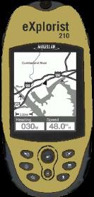
one program to another and concentrates on the usage of the Magellan eXplorist
GPS’s. The author uses an eXplorist 210. I have also used the Magellan Triton
300 that I bought for my son and eXplorist files can be uploaded to to the
Triton.
The programs covered are:
Google Earth with “kml” file types
GPSBabel used to convert “kml” files to eXplorist
“upt” files
Magellan’s Mapsend Lite used to create route “rte” files from
“upt” files
ITNConv used to convert “upt” files and “rte” files to
Google Earth
MS Excel used with “kml” files for MS Streets and
Trips
MS Streets and Trips using MS Excel documents
Obviously, all these programs can do
more than what the author uses them for.
1. First, Create a new folder in Google Earth
and add the waypoints of interest. Save the
folder by “right clicking” the folder and “Save As…” and save as a “kml”
file to a
convenient location.
2. Use GPSBabel to convert Google Earth
“KML” files to Magellan Explorist “UPT”
files. If needed, delete all unnecessary lines (waypoints) from the “UPT”
file. Use the
following information for this conversion:
Open GPSBabel
Under the “Input” area, choose “Google Earth (Keyhole) Markup
Language
Leave “Options” alone (optional)
Choose the “KML” file
Under the “Output” area, choose “Magellan SD Files (as for
eXplorist)
Leave “Options” alone (optional)
Click on the “Start the file save dialog” button
Choose a location and give the file a name
In the “What?” area, choose “Waypoints”
Click on “Filter”
Transformation area, choose “Transform”, and “Routes ->Waypoints”
Waypoints area, choose “Duplicates”
Routes & Tracks area, choose “Simplify” and choose number of points
Tracks area, choose “GPS Fixes” and the choose “2D”
Click “OK”
Click “Let’s Go”
Verify the following is the last line, if not, add it: $PMGNCMD,END*3D
3. Use Mapsend Lite from Magellan to
create route, “RTE”, files from “UPT” files for
Magellan Explorist. Mapsend Lite will first save the route as a “UPT”
then an “RTE”.
Also, use Mapsend Lite to convert Track *.log files
to a gpx file, then open in Google Earth.
4. Use ITNConv to convert “UPT” and “RTE” to
“Google Earth”. Here is an example:
Open “ITNCONV”
Click the “Open” button and load Route file “rte”
At the “Export file format”, choose “Google Earth”
Click on “Export”
Now double
click on the newly created “kml”, Google Earth will open and
show a “line
drawing” of the route, nifty Huh?
5. Open a Google Earth “KML” files with MS
Excel. Copy and Paste the desired
waypoints to a new MS Excel document. Create only three columns. One
labeled
“Location”, one labeled “Latitude”, and one labeled “Longitude”.
Make all points for
Latitude and Longitude using the “degrees and decimal”
notation (I.E. 83.1234
and -43.1234, see figure 1). The “minus” sign equals “W” and “S”.
Don’t
use the N, S, E, or W notation. This new MS Excel document can now be used
by the
“Import Data Wizard” in “MS Streets and Trips”.
Figure 1
|
Location |
Latitude |
Longitude |
|
NCED |
35.19078018 |
-97.3991847 |
|
9xNCED |
35.18947362 |
-97.4001819 |
|
24thx9 |
35.18865198 |
-97.40606801 |
|
RCx24 |
35.24708845 |
-97.40608778 |
|
77xRockCreek |
35.24696583 |
-97.46073679 |
|
35x77 |
35.28275579 |
-97.48513259 |
|
35x240 |
35.39198335 |
-97.49519551 |
|
35x235 |
35.46350567 |
-97.49222772 |
|
35x40 |
35.46594638 |
-97.47287044 |
|
44x35 |
35.60028446 |
-97.42720194 |
Undocumented service functions:
Magellan Explorist 210™ FAQ
http://www.gpsfaqs.org/faqs/magellan/explorist/explorist210/undocumented.html
Magellan Explorist 210™
has several hidden functions meant to aid their support and service groups.
Warning
These commands are not documented by
Magellan for a reason - you can "break" your unit using them, requiring a
service repair to recover. These repairs may not be covered by warranty, so
proceed at your own risk.
If the unit is powered off, the following commands may be
helpful:
-
IN + PWR - Full selftest of unit
including screen test, keypad test, NMEA test.
-
OUT + PWR - Serial port test
-
ESC + PWR - Burn-in process
-
LIGHT + ENTER + PWR - Upload of new
firmware
-
NAV + PWR - Service Function window
-
NAV + MENU + PWR - Force power off
-
GOTO + OUT + POWER - clear memory and
set all settings as default.
While unit is powered off, press and hold the NAV key then
press the PWR key. If the unit is already on, press MENU key then press
right-left-right-left arrows. In the center of the screen, the service function
window with text "00" will appear. Using the arrows, change "00" to the number
of any service function listed below, then press ENTER.
Table 1. Undocumented service codes for
Magellan Explorist 210™
|
Code |
Model |
Function |
|
00 |
100+ |
Display firmware version and unique ID of unit |
|
01 |
100+ |
Show statement of corellator channels |
|
02 |
100+ |
Show memory dump and registers after unit's last
failure |
|
03 |
100+ |
Turn WAAS on or off |
|
05 |
100+ |
Clear ephemerides |
|
10 |
100+ |
Turn unit off |
|
15 |
100+ |
Full selftest, like IN + PWR |
|
16 |
100+ |
Serial port test, like OUT + PWR |
|
17 |
100+ |
Burn in, like ESC + PWR |
|
20 |
100+ |
Show calibration |
|
22 |
300 600 |
Clear calibrations of electronic compass barometer
and thermometer. |
|
26 |
100+ |
Waiting for remote assistance |
|
27 |
100+ |
Waiting for remote assistance |
|
30 |
100+ |
Clear memory menu |
|
31 |
100+ |
Clear XO parameters. May be usefull if unit can't
find any satellites |
|
32 |
100+ |
Clear all memory prompt |
|
33 |
200+ |
Verify basemap |
|
38 |
100+ |
Interface language select |
|
40 |
100+ |
Set serial port baud rate |
|
41 |
100+ |
NMEA settings |
|
70 |
100+ |
Waiting for remote assistance |
|
71 |
100+ |
Create some POIs for testing |
|
72 |
100+ |
Display screen frame rate |
|
75 |
100+ |
Simulator settings |
|
78 |
100+ |
Service report |
|
82 |
100+ |
Compensation offset settings.
Warning
DO NOT change if you dont know what compensation is |
|
90 |
100+ |
XO and AD settings.
Warning
DO NOT change if you dont know what is XO and AD |
|
92 |
100+ |
Waiting for remote assistance |
|
93 |
200+ |
Rename of basemap |
|
94 |
200+ |
Report serial flash memory usage |
|
95 |
200+ |
Erase serial flash memory
Warning
After doing this, your basemap will be erased. |
|
96 |
200+ |
Report about structure of serial flashmemory |
|
97 |
200+ |
Clear secondary SMC basemap. |
|
98 |
100+ |
Basemap upload mode |
|
99 |
100+ |
Firmware upload mode like LIGHT + ENTER + PWR |
Back To Top
|