
< US 1 and Branches | Home | US 13 > | 
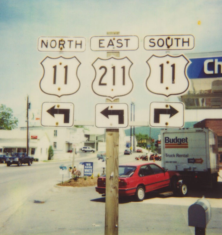
Photo: US 11 crossing its own alternate route in Salem (courtesy Chris E) |
|||||||||||||||||||||||||||||||||||||||||||||||||||||||||||||||||||||||||||||||||||||||||||||||||||||||||||
|
|
|
|
| ROUTE LOG |
US 11E, US 11W, US 19 SB, US 421, VA 381: 0 - 0 VA 113: 1 - 1 I-81 (exit 5), US 58: 2 - 3 WA-BRI LINE: 3 - 6 VA 140: 6 - 12 US 19 NB: 0.5 - 12.5 US 58 ALT WB: 1 - 13.5 US 58 ALT EB, VA 75: 0.5 - 14 I-81 (exit 19), US 58 WB: 2 - 16 US 58 EB: 0.5 - 16.5 VA 80: 5 - 21.5 VA 91: 4 - 25.5 I-81 (exit 32): 3 - 28.5 SM-WA LINE: 2 - 30.5 VA 107: 1 - 31.5 I-81 (exit 39): 4 - 35.5 I-81 (exit 44): 4 - 39.5 VA 16 SB: 2 - 41.5 VA 16 NB: 1.5 - 43 I-81 (exit 50): 5 - 48 WY-SM LINE: 4.5 - 52.5 VA 90: 4.5 - 57 I-81 (exit 67): 7 - 64 US 21 SB: 3.5 - 67.5 US 21 NB: 0.5 - 68 VA 365: 1 - 69 I-81 SB (exit 73), I-77 NB, US 52 NB: 1 - 70 US 52 SB, VA 121: 7 - 77 I-77 SB (exit 32): 2 - 79 PU-WY LINE: 4 - 83 I-81 NB (exit 89), VA 100: 4 - 87 VA 99: 5 - 92 VA 100: 7 - 99 VA 114: 8 - 107 RAD-PU LINE: 0.5 - 107.5 VA 232: 0.5 - 108 VA 177: 1 - 109 MO-RAD LINE: 2.5 - 111.5 VA 8: 7 - 118.5 US 460 Bus WB: 0.5 - 119 VA 111: 1 - 120 US 460: 0.5 - 120.5 I-81 (exit 118), US 460 WB, US 460 Bus END: 0.5 - 121 RO-MO LINE: 13 - 134 SAL-RO LINE: 6 - 140 VA 112: 1 - 141 US 11 ALT, US 460 ALT: 1 - 142 US 460 EB: 0.75 - 142.75 VA 311: 0.25 - 143 US 11 ALT, US 460 ALT: 0.25 - 143.25 VA 419: 2 - 145.25 ROA-SAL LINE: 0.75 - 146 VA 117: 0.75 - 146.75 US 220 Bus SB, US 221 SB, VA 116 EB: 4 - 150.75 I-581 (exit 7), US 220, US 220 Bus END: 0.25 - 151 US 11 ALT, US 220 ALT, US 221 NB, US 460, VA 116 WB: 0.5 - 151.5 VA 101: 2.75 - 154.25 VA 118: 0.25 - 155 RO-ROA LINE: 0.5 - 155.5 VA 117: 2 - 157.5 VA 115: 0.5 - 158 BO-RO LINE: 1 - 159 US 220 ALT: 4 - 163 I-81 (exit 162): 12 - 175 VA 43 NB: 4.75 - 179.75 VA 43 SB: 0.25 - 180 I-81 SB (exit 167): 1 - 181 RO-BO LINE: 7 - 188 I-81 NB (exit 175): 2 - 190 VA 130: 2 - 192 I-81 (exit 180): 4 - 196 US 11 Bus, VA 251: 8 - 204 US 60: 1 - 205 LEX-RO LINE: 0.5 - 205.5 US 11 Bus: 0.5 - 206 RO-LEX LINE: 0.25 - 206.25 I-64 (exit 55): 1 - 207.25 VA 39: 0.25 - 207.5 I-64, I-81 (exit 195): 4 - 211.5 AU-RO LINE: 10 - 221.5 VA 56: 0.5 - 222 US 340: 8 - 230 I-64, I-81 (exit 213): 0.5 - 230.5 VA 262: 7 - 237.5 STA-AU LINE: 0.5 - 238 VA 261: 0.5 - 238.5 US 250 EB: 0.75 - 239.25 US 11 Bus, US 250 WB, VA 254 WB: 0.25 - 239.5 VA 254 EB: 0.75 - 240.25 VA 261: 0.25 - 240.5 US 11 Bus: 2 - 242.5 VA 275: 0.5 - 243 AU-STA LINE: 1 - 244 VA 363: 8 - 252 VA 256: 1 - 253 RB-AU LINE: 2 - 255 VA 257: 4 - 259 HAR-RB LINE: 3 - 262 I-81 (exit 243): 1 - 263 VA 331: 2 - 265 US 33: 0.5 - 266.5 RB-HAR LINE: 1.5 - 268 I-81 (exit 251): 2 - 270 I-81 (exit 257), VA 259: 7 - 277 SH-RB LINE: 6 - 283 US 211 WB: 1 - 284 US 211 EB: 3 blocks - 284 VA 263: 7 - 291 VA 292: 1 - 292 VA 185: 7 - 299 VA 42: 4 - 303 VA 55 EB: 13 - 316 VA 55 WB: 3 blocks - 316 I-81 (exit 298): 1 - 317 FR-SH LINE: 1 - 318 VA 277: 7 - 325 VA 37: 3 - 328 WIN-FR LINE: 1.5 - 329.5 US 17, US 50 EB, US 522 SB: 3 - 332.5 US 50 WB, VA 7: 0.5 - 333 US 522 NB: 0.5 - 333.5 FR-WIN LINE: 0.5 - 334 VA 37: 1.5 - 335.5 I-81 (exit 317): 0.5 - 336 WV STATE LINE: 7 - 343
|
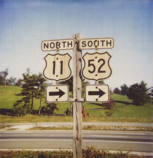
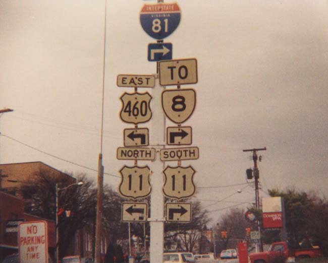
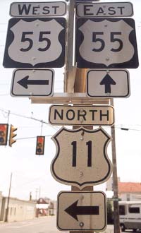
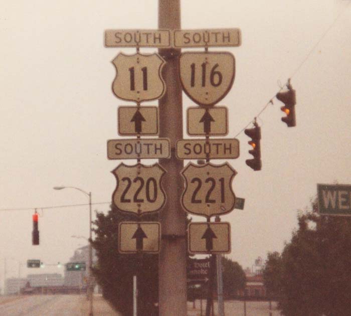
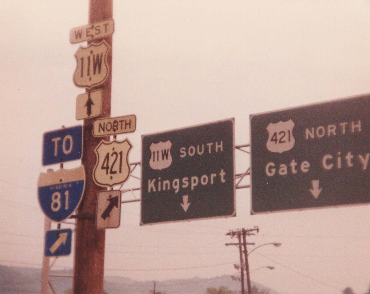
| Creation: US 11 appeared in Virginia the same year it appeared nationally - 1927. It ran generally the same as it does now. From Bristol to Roanoke US 11 was paired with VA 10. From Roanoke north to WV, it was paired with VA 33. Adjustments: The VA 10 and VA 33 multiplexes were dropped in 1929. In 1932 or 1933, US 11 changed its alignment in the Pulaski area. It had run from Wytheville to Draper/McAdam, then WEST to Pulaski, then to Dublin. This was a giant 'S' configuration. US 11 was changed to its current approach to Pulaski from the south (replacing part of VA 212). The old alignment became extensions of VA 212 and VA 218 (curr VA 99 and VA 100 pre I-81). US 11 was moved onto I-81 from Ft. Chiswell to SR 618 in 1963 or 1964, and from there to VA 100 in 1965. Both of these moves left behind F-044. US 11 was moved onto I-81 in between Buchanan and Natural Bridge in 1965, leaving behind F-054 and F-055. US 11 had I-81 built directly on top of it between Wytheville and Ft. Chiswell in 1986. Bristol: Original approach from the north was on Myrtle St. and Piedmont St. which lasted until 1962, when US 11 was moved to Euclid Ave. The old route is part of VA 113 today. Roanoke: Early on, US 11 went east from Roanoke to 9th St. before heading north (US 221-460 to VA 115 today). By 1929, US 11 used its current Salem-Roanoke routing. Staunton: Up to 1929, US 11 used today's US 11 Business as the way through town. The 1931 inset shows US 11 shifting left to use Central Ave. The 1932 inset shows US 11 returning to today's US 11 Business routing. The 1933 inset shows US 11 shifting east of the downtown area, using Coalter Ave. The old route through downtown became part of VA 5 (curr US 250) and VA 11Y. Between 1934-37, US 11 was put back on today's US 11 Business. The Coalter Ave routing became US 11 ALT (today it carries a couple blocks of VA 254 but is otherwise unnumbered). Winchester: Through at least 1941, US 11 used Loudon St. Today this is US 11 NB as US 11 is split into one-way streets. Harrisonburg: Through at least 1932, US 11 used Main St. Today this is US 11 NB as US 11 is split into one-way streets. Posting: Fully posted; cutouts remain in Bristol, Marion, Ft. Chiswell, Christiansburg (though this set has been replaced with a new set), New Market (this particular set is gone now), Strasburg, and Winchester (tons). Cutouts in Roanoke made it to at least 1991. Also US 11 cutouts are sporadically used in rural areas of the Shenandoah Valley. White border US 11 signs exist in Abingdon. US 11 is erroneously posted as US 11 Business just west of Downtown Salem. 
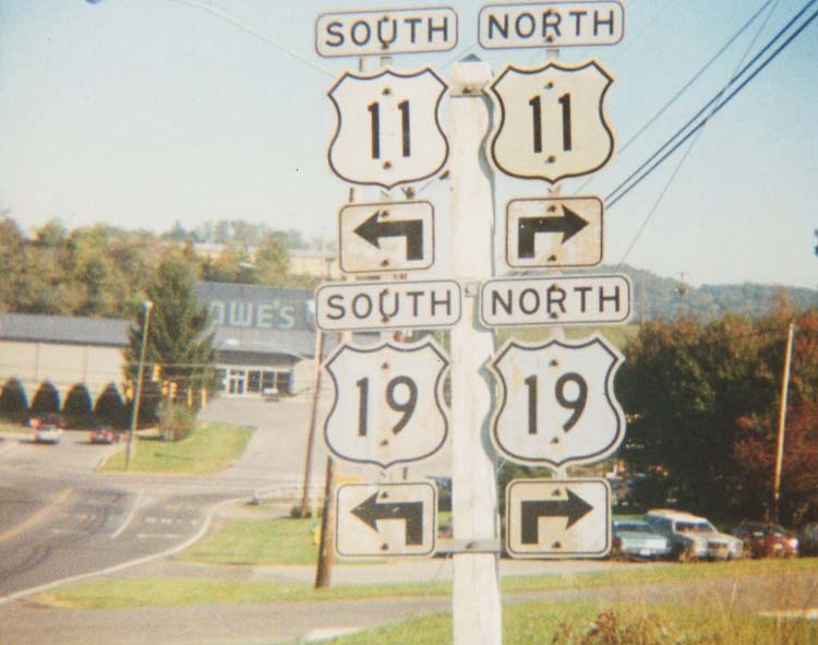
Thanks to Chris E. for this 7/3/05 photo US 11 mainline goes through downtown Salem and US 11 ALT bypasses central Salem. A strategically missing US 11 sign makes the right turn at College Ave problematic for the uninitiated. Comment: In Virginia, this road is never more than a couple miles from I-81 (or, more accurately, I-81 is never more than a couple miles from US 11). Yet most of the time you cannot see the interstate while driving US 11. This would probably be an interesting highway for old road buffs - sort of an eastern US 66. US 11 is also notable for going over Natural Bridge - you'd never realize though since the owners have convienently lined the road with high fences to force you to pay the price of admission. There's also Route 11 potato chips, which can be washed down with Root 66 Beer. US 11 follows the old Lee Highway. Virginia improved US 11 to multilanes in several spots, all before I-81 was built along side it, notably between near Christiansburg and Salem and also Lexington to Greenville. An older 4-lane section was built between Roanoke and Buchanan. US 11 has posted truck routes in Staunton (on the VA 261 route) and in Bristol. |
||||||||
|
|
|
| ROUTE LOG |
US 11, US 460, US 460 ALT BEGIN: 0 - 0 US 11: 1 - 1 VA 419 SB: 1.5 - 2.5 US 460 WB, US 460 ALT END, VA 419 NB: 0.5 - 3 ROA-SAL LINE: 0.5 - 3.5 VA 117: 0.5 - 4 VA 116 NB: 1.5 - 5.5 I-581 (exit 6): 1.25 - 6.75 US 11, US 221, US 460 EB, VA 116 SB: 0.25 - 7
|
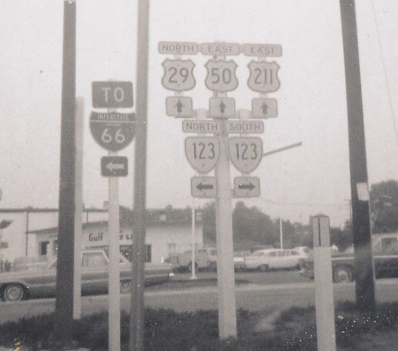
| Creation: Appeared in 1958 in its current form. It was formed as mostly a multiplex with US 460, but did have its own short new alignment west of downtown Salem. This is the 7th US 11 ALT. Adjustments: None Posting: Fully posted; mini-white border signs throughout Roanoke; Embossed cutouts existed to at least 1991. Comment: Provides a more direct route than US 11 through Roanoke. Still coexistent with US 460 most of length. I still don't understand why this wasn't routed over VA 117 to form an actual Roanoke Bypass. | Previous US 11 ALT's: |
US 11 ALT #1: Appeared between 1935-37, as a renumbering of US 11. Ran from US 11-250 (curr US 11 Bus-US 250-VA 254) Staunton to US 11 north of Staunton. It ran along Coalter St. as a straighter alternative to US 11. It definitely lasted to 1953. The 1955 map shows the current US 11 Bypass, so I believe this original US 11 ALT was decommissioned when the bypass (presumed to be US 11 ALT) was christened. Today it carries a piece of VA 254 in Downtown Staunton.
US 11 ALT #2: Appeared in 1938. Was a 4-mile loop off US 11 north of Lexington. It did not go through or bypass any town, although a field inspection showed it was probably the mainline US 11 before then. It served no purpose whatsoever that I can see to be an ALT route. This US 11 ALT was downgraded to SR 645 between 1945-47. US 11 ALT #3: Shown in CTB Minutes only: Appeared April 1944 as Valley Ave and Loudon St. between Braddock to North Sts in Winchester. This is the street in between the current one-way NB-SB streets in Winchester. This US 11 ALT was decomissioned in August 1950. Surprisingly, today's MSN map feature shows this as 11 ALT right now. US 11 ALT #4: Shown but not labeled on 1952-53 Official Maps, and mentioned in Dec 1953 CTB Minutes, as the old piece of US 11 east of Dublin. Was downgraded to an SR and is called "Old Route 11" today. US 11 ALT #5: Appeared in 1954 or 1955 as a newly constructed bypass of Staunton. Ran from US 11-250 just south of Downtown to US 11 near Verona. It is unclear when US 11 ALT became US 11 Bypass, but I guess 1976, as that is when this transformation occurred in Lexington. Today it also carries some of VA 254. US 11 ALT #6: Appeared in 1956 as a newly constructed Lexington Bypass. Ran from US 11 at the Maury River Bridge to US 11-VA 251 jct. US 11 ALT became US 11 Bypass in 1976. |
||||||
|
|
|
|
| ROUTE LOG |
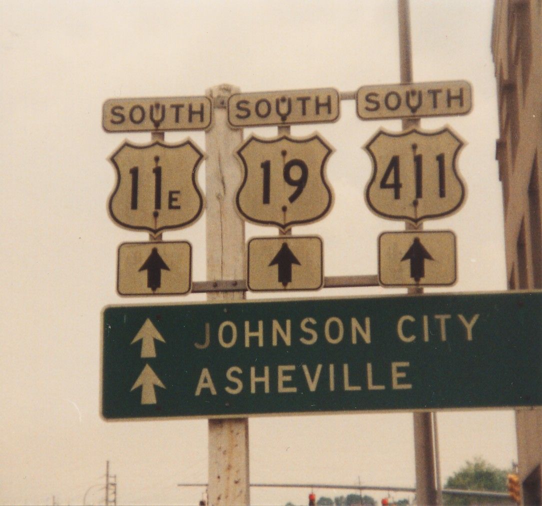
TN STATE LINE, BEG VA 381: 0 - 0 US 421 SB: 0.25 - 0.25 VA 113: 0.25 - 0.5 US 11, US 11W, US 19, US 421 NB, VA 381 NB: 0.5 - 1
|
Creation: Appeared in 1930-31. The 1929 official map (and the official insets 1929-1933) shows this as just US 19. Before that it might have been US 511 (1929 inset map labels it as TN 34 only). Originally began at the corner of Piedmont and State Streets, so that really only US 11E NB was in Virginia.
| adjustments: This lasted to 1962, when US 11E was extended north to US 11's relocation at Euclid Ave. Posting: Fully posted - see recent postings (big thanks to Nicholas Mooneyhan); some cutouts remained until 2001ish. Here is a 1992 cutout assembly in Bristol. Comment: US 11E could be eliminated in Virginia and Tennessee altogether, as almost half of its total distance is multiplexed with other US Routes. A. Froehlig notes that recent traffic logs from VDOT show this as US 11-19 TRUCK only. |
|||
|
|
|
|
| ROUTE LOG |
TN STATE LINE, US 421 NB: 0 - 0 US 11, US 11E, US 19 NB, US 421 SB, VA 381: 1.3 - 1.3
|
Creation: Appeared in 1930-31. The 1929 official map (and the official insets 1929-1933) shows this as just US 11. At any rate, this had been just US 11 prior to that. Originally ran along State St. to Piedmont, so really only US 11W SB was in Virginia.
| Adjustments: In 1962, US 11W was rerouted to avoid downtown Bristol via Euclid Ave. Posting: Fully posted; cutouts still remain; here is a 1992 cutout assembly in Bristol. Comment: This should go back to being US 11, as this remains a good alternative to I-81/I-40 to Knoxville. A. Froehlig notes that US 11W is shown on VDOT traffic logs as just US 11. |
|||
|
|
|
|
| ROUTE LOG |
I-81 (exit 264), VA 211: 0 - 0 US 11 SB: 0.25 - 0.25 US 11 NB: 0.25 - 0.5 PA-SH LINE: 4.5 - 5 US 340 SB: 4.5 - 9.5 US 211 Bus: 4 - 13.5 US 340 NB, US 340 Bus: 1.5 - 15 US 211 Bus: 1 - 16 SKYLINE DRIVE: 6 - 22 RA-PA LINE: 0 - 22 US 522 SB: 7 - 29 US 211 Bus, US 522 Bus: 5 - 34 US 211 Bus, US 522 Bus: 1 - 35 US 522 NB: 2 - 37 CP-RA LINE: 9 - 46 VA 229: 3 - 49 FQ-CP LINE: 1 - 50 US 17 Bus SB, US 29 Bus SB, US 211 Bus: 7 - 57 US 17 Bus NB: 1 - 58 US 15 Bus, US 29 Bus NB, US 211 Bus: 1 - 59
|
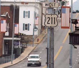
Creation: Appeared in 1927 as an original US Highway. Ran from US 11-VA 33 New Market to US 50-VA 36 Fairfax. US 211 followed the route of VA 21.
| Adjustments: In 1929, US 211 was extended to Washington DC, over what had been US 50's approach to the nation's capital. Additionally, VA 21 was removed from the entirety of US 211. US 211 mainline was rerouted around Warrenton in 1938. The old route through town became US 211 ALT (curr US 211 Bus). In 1960-61, US 211 and VA 309 swapped alignments where they met at Lee Hwy and Old Dominion Dr., such that VA 309 used Lee Hwy for 3/4 mile. US 211 was extended west from US 11 to I-81 in 1967, replacing a small piece of VA 260. In 1984, US 211 was truncated to its current end in Warrenton, leaving behind US 29, which it picked up as a hitchhiker back in 1933. Posting: Fully posted; 4 cutout shields remain in Luray (verified June 2003). New Market cutouts lasted to at least 1995 (but gone now).Error VA 211 sign has been up 10 years at Sperryville - on 7/25/03 I received an e-mail from VDOT that this error sign would be replaced and thanks for pointing it out in this site. On March 20, 2004 I observed this sign was finally corrected (between 12/03-3/04). Also, US 211-VA 211 exit with I-81 SB has error shields pointing you the wrong way for each route. Check out the US 211 Fairfax cutout from 1969! Comment: At 58 miles long, the fourth shortest US highway in existence today. From Dave: It's the only US highway which I have driven in its entirety. It takes about 90 minutes, and only takes that long because of going over Thornton Gap and Massanutten Mtn. I could do a whole web page on this road. It provides access to Skyline Drive and Luray. In Washington (VA), you can stay or eat at the five-star Inn at Little Washington. Except to shell out $400 per night or $80 per meal. (no, I haven't stayed or eaten there). US 211 begins at a traffic light 1/4 mile west of the US 15/17/29 interchange. That sort of thing always bugs me. The identity-challenged town of Washington is always referred to as Washington Va on road signs. Rather unfortunate when you consider this is the oldest of all of the Washingtons in the US, having been platted by George himself in the 1740's. Occasionally you'll hear old-time Fairfaxians refer to 29/211. In Fairfax Co., "old-timers" are people who have been here more than 10 years, and would seem to account for about 10% of the population. The June 1929 Official Map misidentifies this as US 311 in the Washington/Alexandria inset. Lou Corsaro and Eric Smith feature US 211 at their expressway site - Link |
|||
| US 211 ALT Decommissioned | |||
| Previous US 211 ALT's: | US 211 ALT: Appeared in 1938 as a renumbering of mainline US 211 through Warrenton, as the bypass was completed around town. Its routing has not changed and became today's US 211 Bus in 1973. |  |
|
| US 311 Decommissioned | |||
| Previous US 311's: | US 311: Appeared as an original US Highway in 1927. It ran from US 11, VA 10, VA 33 NB (curr US 11, US 11 ALT, US 221, US 460) Roanoke south to NC at Ridgeway on its way to Asheboro, NC. It was attached to VA 33 below Roanoke. US 311 lasted long enough to lose its multiplex (1929) and to see the July 1933 renumbering. Today's VA 311 was a state route extention of US 311. In 1935, US 311 was replaced by US 220, which was extended south from Cumberland, Md on its way to Rockingham, NC. Today US 311's route is still US 220 or US 220 Bus, except between Rocky Mount and Boone's Mill, where it used today's SR 919. | ||
| US 411 Decommissioned | |||
| Previous US 411's: |
US 411 #1: Appeared as an original US Highway in 1927. Ran from US 25E/VA 107/VA 10 WB (curr US 58's turn to head south to Tennessee) Cumberland Gap east to US 11/VA 10 EB Bristol. US 411 did not run as a direct route between US 25E and US 11. At Jonesville, US 411 headed NE to Pennington Gap, SE to Dot, SE to Clinchport (thus avoiding Duffield), to Gate City and finally Bristol. In 1932 or 1933, this particular alignment of US 411 was renumbered as US 421. Today, to follow original US 411 you would take US 58 from Cumberland Gap to Jonesville, US 58 ALT to Pennington Gap, US 421 to Pattonsville, SR's 638 and 600 to Clinchport, and US 58 to Bristol.
US 411 #2: In 1935, modern US 411 was created. It's northern end was muliplexed with US 11E/19 to Bristol. This may have been officially mulitplexed to US 11 proper, meaning US 411 NB was in Virginia. Since the US 11E-11W split was moved in 1962, US 411 may have had a mile inside Virginia. At any rate, US 411 was removed from the US 11E/19 multiplex in 1977. US 411 was still posted in cutout form in Bristol (thanks to Gribblenation and Michael Summa for this great find!) as late as 1992. |
||
| US 511 Decommissioned | |||
| Previous US 511's: | US 511: Created in 1927 as an original US Route. Ran from US 11 Strawberry Plains, TN to US 11 Bristol. Thus, at least US 511 NB was in Virginia. US 511 became US 11E in 1929, so there is some doubt whether US 511 was ever actually signed. | ||
Previous: US 1 and Branches |
Next: US 13
Top | Virginia Hwy Index
Home

, Harrisonburg, <a HREF=)