
undefined
< US 220 | Home | US 522 > |
| |||||
| ROUTE LOG I-81 (exit 70), US 52: 0 - 0 US 11 NB: 1.5 - 1.5 US 11 SB: 0.5 - 2 GR-WY LINE: 17 - 19 US 58, US 221 NB: 13 - 32 NC STATE LINE: 4 - 36 |
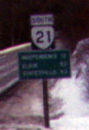
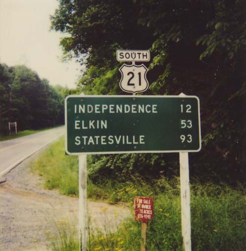
Creation: US 21 appeared as an original US Route in 1927. It was routed over the entirety of original VA 26. It ran from the NC line to the WV line at Bluefield, on its way to Cleveland, OH.
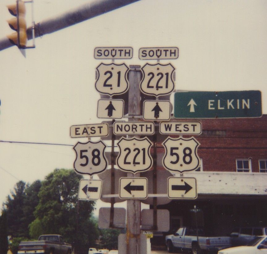
Adjustments: The 1927 route between Wytheville and Bland was rather direct, but US 21 was rerouted to swing west through Favonia and Big Walker Lookout in 1928. The old alignment was not numbered after that, although the route in Bland is today's VA 98. The rest is SR 603, SR 656, and an unnumbered trail. The VA 26 multiplex was removed in 1929, which eliminated a three state route 26 with NC and SC. In 1935, US 52 was added as a multiplex from Bluefield to Wytheville. US 21 was truncated to its current endpoint in 1980, leaving behind US 52 and current VA 598. Posting: Fully posted; Independence cutouts lasted to at least 1993.error VA 21 sign (thanks to Gribblenation) exists south of Wytheville (replacing this sign sometime after 1993). Also 1993 south of Wytheville there were these cutouts.; bonus error: a NC 21 sign exists in Elkin, NC. Bonus error #2: In June 2004 I spotted a US 21 sign along OH 21 in Independence, OH. Comment: The 1981 VDOT shows US 21 multiplex with US 52 to Rocky Gap, but I think it's a mistake since only US 52 is shown in 1980. US 21 is a scenic rural route in Virginia. US 21 is the only US Highway with 3 daughters longer than the parent (221,321,421). | ||||
| US 121 Decommissioned | |||
| Previous US 121's: |
US 121 #1: Appeared as an original US Route in 1927. It was routed over the entirety of VA 15 from Ft. Chiswell to the NC line near Mt. Airy, NC on its way to Lexington, NC. US 121 may have multiplexed with US 11 to meet US 21 in Wytheville, but I have seen no proof one way or another. The VA 15 multiplex was removed in 1929. US 121 was replaced by a greatly expanded US 52 in 1935, but did manage to spawn a virginia state hwy extension in VA 121 during its brief existence in the modern system.
US 121 #2: Proposed number for the Coalfields Expressway. |
||
| ROUTE LOG US 29, US 460 Bus EB, US 501 Bus SB: 0 - 0 US 501 Bus NB: 0.5 - 0.5 US 460 Bus WB: 0.75 - 1.25 US 29 Bus: 0.25 - 1.5 US 501: 3 - 4.5 BD-LYN LINE: 0.5 - 5 BED-BD LINE: 16 - 21 US 221 Bus, VA 122 NB, VA 122 Bus: 1 - 22 US 460 Bus WB: 1.75 - 23.75 US 460 EB, US 460 Bus END: 0.25 - 24 VA 122 SB, VA 122 Bus: 2 - 26 US 221 Bus, US 460 Bus: 1 - 27 BD-BED LINE: 0 - 27 BO-BD LINE: 17 - 44 BLUE RIDGE PKWY: 2 - 46 RO-BO LINE: 2.5 - 48.5 US 220 ALT NB: 0.5 - 49 ROA-RO LINE: 2.25 - 51.25 VA 115: 2.25 - 53.5 US 11 NB, US 11 ALT, US 220 ALT SB, US 460 WB, VA 116 WB: 0.5 - 54 I-581 (exit 8), US 220, US 220 Bus BEGIN: 0.5 - 54.5 US 11 SB: 0.25 - 54.75 US 220 Bus SB, VA 24, VA 116 EB: 0.25 - 55 RO-ROA LINE: 3.5 - 58.5 VA 419: 1.5 - 60 FL-RO LINE: 13 - 73 VA 8: 22 - 95 CR-FL LINE: 17 - 112 VA 100: 10 - 122 US 58 EB: 0.5 - 122.5 US 52: 0.5 - 123 I-77 (exit 14): 2 - 125 GLX-CR LINE: 8 - 133 VA 89: 3 - 136 GY-GLX LINE: 2 - 138 VA 94: 2 - 140 VA 274: 11 - 151 US 21 NB, US 58 WB: 3 - 154 NC STATE LINE: 4 - 158 |
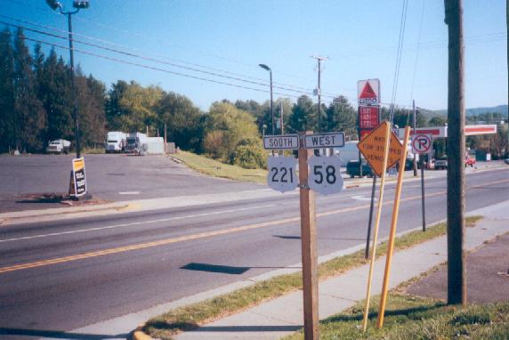
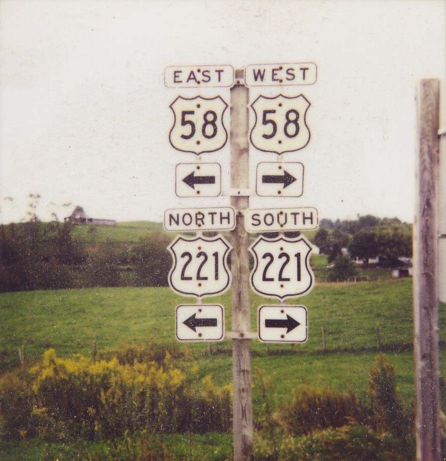
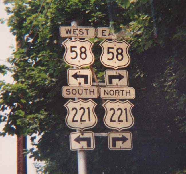
Creation: US 221 was created in 1930, but did not come to Virginia until 1932, when it was extended north from Boone, NC. US 221 entered with US 21 from NC to Independence, then replaced some of VA 12 to Hillsville (US 58 didn't appear until 1934), then all of VA 205 to end at US 311 (curr US 220 Bus) Roanoke.
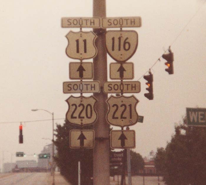
Adjustments: In 1971 or 1972 US 221 was extended east along US 460 to Bedford, then to its current end in Lynchburg, replacing US 460, which moved to its current 4-lane routing. In 1981, US 221 was rerouted west of Galax to a more direct connection to Independence, replacing VA 212 #4. The old route became a piece of VA 94 and all of VA 274. Posting: Fully posted; mini-white border signs in Roanoke; cutouts in Hillsville; cutouts at Independence and VA 274 ; Cutouts in Galax lasted to 1993, and in Roanoke until 1991. Bonus error: A NC 221 sign existed on Grandfather Mtn. in the late 80's. Comment: US 221 nationally has expanded to 5 states, but is never really a featured route anywhere. It is a poor-man's Blue Ridge Pkwy, which it crosses several times (twice in Virginia - Adney's Gap southwest of Roanoke, a brush encounter, and northeast of Roanoke with US 460, a full interchange). | ||
| US 321 Decommissioned | |||
| Previous US 321's: | US 321: In 1931, US 321 was extended north from Boone, NC to Bristol. It ended at US 11E/19. US 321 ran along State St., so US 321 NB was in Virginia. This was short lived, as by 1933 US 321 was renumbered as US 421 for some reason. | ||
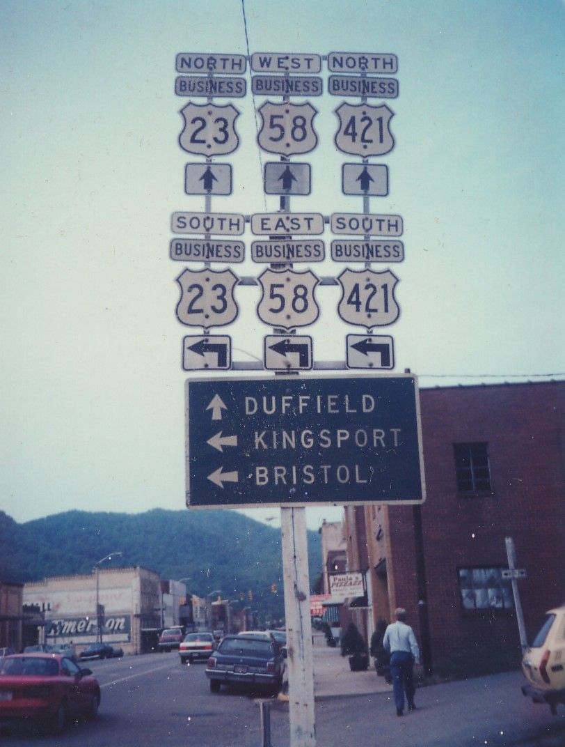
| ROUTE LOG TN STATE LINE: 0 - 0 US 11E SB, US 19 SB, VA 381 SB: 1 - 1 VA 113: 0.25 - 1.25 US 11, US 11E END, US 11W BEGIN, US 19 NB, VA 381 NB: 0.25 - 1.5 US 11W SB: 1.25 - 2.75 I-81 (exit 1), US 58 EB: 1.25 - 4 WA-BRI LINE: 1 - 5 SC-WA LINE: 9 - 14 VA 224: 15 - 29 US 23 SB: 0.5 - 29.5 US 23 Bus, US 58 Bus, US 421 Bus: 0.5 - 30 US 23 Bus, US 58 Bus, US 421 Bus: 4 - 34 VA 65: 10 - 44 US 23 NB: 3 - 47 LE-SC LINE: 7 - 54 US 58 WB: 4 - 58 US 58 ALT EB: 5 - 63 US 58 ALT WB: 0.5 - 63.5 VA 352: 3 - 66.5 KY STATE LINE: 5 - 71.5 |
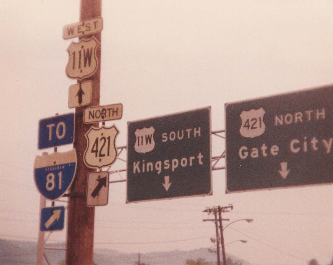
Creation: US 421 appeared in Virginia in 1932 or 1933 (so says General Drafting, Rand McNally, and Gousha, but not the April 1932 or July 1933 VDOT maps which show this as US 411 in Va. and US 321 in Tenn.). It originally entered Virginia at Bristol, then proceeded west to Gate City, Pennington Gap, Jonesville, and ended at US 25E Cumberland Gap. This was a replacement of US 321 in Virginia and all of the original US 411.
Adjustments: US 421 was truncated to end in Bristol in 1934. The rest to Cumberland Gap became mostly US 58, except Jonesville to Pennington Gap to Woodway became VA 66 (curr US 421 and US 58 ALT). In 1935, US 421 was re-extended to US 25E Cumberland Gap as a multiplex with US 58. In 1945 or 1946, US 421 was again truncated to Bristol, leaving behind US 58 once again. Between 1948-50, US 421 came back into play, assuming its current routing from Bristol to Dot to Pennington Gap to Kentucky. Again it was paired with US 58 to Dot, then replaced VA 66 from Dot to Kentucky. Posting: Fully posted; cutouts in Bristol (though maybe not this 1992 assembly. US 421 business is not currently posted, but cutouts did exist in Gate City as late as 1992. Comment: US 421 should be the Hokey Pokey Hwy, as Virginia put US 421 in, put US 421 out, put US 421 in, and they shook it all about. I have not driven very much of US 421 in Virginia, only from Dot to Gate City, so I don't have much to report. | ||
Previous: US 220 |
Next: US 522
Top | Virginia Hwy Index
Home
