
< US 52 | Home | US 60 and Branches > | |||||||||||||||||||||||||||||||||||||||||||||||||||||
|
|
|
| ROUTE LOG |
BEGIN US 58: 0 - 0 US 60: 1 block - 0 I-264 (exit 20), US 58 Bus: 3 - 3 VA 279: 0.5 - 3.5 VA 225: 3.5 - 7 VA 190: 1 - 8 VA 403: 1.5 - 9.5 NOR-VAB LINE: 0 - 9.5 VA 165: 1 - 10.5 US 13: 1 - 11.5 VA 405: 2 - 13.5 VA 166: 1 - 14.5 VA 168: 0.5 - 15 US 460: 0.75 - 15.75 VA 337 WB, VA 337 ALT: 0.5 - 16.25 VA 337 EB, VA 337 ALT BEGIN: 1 - 17.25 POR-NOR LINE: 0.5 - 17.75 VA 164: 0.5 - 18.25 VA 141, VA 337 ALT WB: 1.5 - 19.75 US 17: 1 - 20.75 US 460 ALT EB, VA 337: 1.75 - 22 VA 239: 0.25 - 22.25 CHE-POR LINE: 2 - 24.25 US 13 NB, US 460 EB, VA 191: 1.5 - 25.75 I-664 (exit 13): 0.25 - 26 SUF-CHE LINE: 3 - 29 US 13 Bus, US 58 Bus, US 460 Bus: 3 - 32 VA 10, VA 32 NB, VA 32 Bus: 4 - 36 US 460 EB, US 460 Bus: 1 - 37 US 13 SB, US 58 Bus, VA 32 SB: 4 - 41 VA 390: 9 - 50 US 58 Bus: 0.5 - 50.5 VA 189 NB: 0.5 - 51 VA 272: 6 - 57 US 258 NB, VA 189 SB: 2 - 59 SO-SUF LINE: 1 - 60 US 258 SB, US 258 Bus: 3 - 63 US 58 Bus: 6 - 69 US 58 Bus: 1 - 70 US 58 Bus, VA 35: 2 - 72 VA 308: 9 - 81 GV-SO LINE: 14 - 95 US 58 Bus: 1 - 96 EMP-GV LINE: 0 - 96 US 301: 2 - 98 US 58 Bus: 0.5 - 98.5 I-95 (exit 11): 0.5 - 99 GV-EMP LINE: 1 - 100 BR-GV LINE: 6 - 106 US 58 Bus: 10 - 116 US 58 Bus, VA 46: 2 - 118 MK-BR LINE: 10 - 128 I-85 (exit 12): 4 - 132 US 58 Bus: 0.5 - 132.5 US 1 NB, US 58 Bus: 2 - 134.5 US 1 SB: 4 - 138.5 VA 4: 4 - 142.5 VA 386: 4 - 146.5 US 58 Bus: 1 - 147.5 VA 92: 1 - 148.5 US 58 Bus: 2 - 150.5 VA 364: 7 - 157.5 US 15 NB, VA 49 NB: 0.5 - 158 US 15 SB: 2 - 160 VA 49 SB: 3 - 163 HX-MK LINE: 6 - 169 US 360 EB: 12 - 181 US 501: 1 - 182 VA 119: 16 - 198 PI-HX LINE: 5 - 203 VA 62: 2 - 205 DAN-PI LINE: 2 - 207 US 29 NB, US 58 Bus, US 360 WB, VA 785 BEGIN: 2 - 209 VA 86: 3.75 - 212.75 US 29 SB, US 29 Bus, VA 785 END: 3.5 - 216.25 PI-DAN LINE: 0.75 - 217 US 58 Bus: 5 - 222 HE-PI LINE: 10 - 232 US 58 Bus: 8 - 240 US 220 SB, US 220 Bus: 5.75 - 245.75 US 58 Bus, US 220 NB: 3.75 - 249.5 PK-HE LINE: 11 - 260.5 US 58 Bus: 12 - 272.5 US 58 Bus, VA 8 SB: 3 - 275.5 VA 8 NB: 1 - 276.5 BLUE RIDGE PKWY: 12 - 288.5 FL-PK LINE: 2 - 290.5 CA-FL LINE: 2 - 292.5 US 221 NB: 17 - 309.5 US 52: 0.5 - 310 I-77 (exit 14): 1 - 311 GLX-CA LINE: 8 - 319 VA 89: 3 - 322 GY-GLX LINE: 1 - 323 VA 94: 2 - 325 VA 274: 8 - 333 US 21, US 221 SB: 3 - 336 VA 93: 11 - 347 VA 16 SB: 1 - 348 VA 16 NB: 4 - 352 VA 362: 8 - 360 WA-GY LINE: 11 - 371 VA 91 SB: 12 - 383 VA 91 NB: 0.5 - 383.5 US 11 NB: 10 - 393.5 I-81 NB (exit 19), US 11 SB: 0.5 - 394 US 58 ALT, VA 75: 2 - 396 VA 140: 3 - 399 BRI-WA LINE: 6 - 405 US 11, US 19: 3 - 408 I-381 (exit 1): 2 - 410 I-81 SB (exit 1), US 421 SB: 2 - 412 WA-BRI LINE: 1 - 413 SC-WA LINE: 8 - 421 VA 224: 15 - 436 US 23 SB: 0.5 - 436.5 US 23 Bus, US 58 Bus, US 421 Bus: 0.5 - 437 US 23 Bus, US 58 Bus, US 421 Bus: 4 - 441 VA 65: 10 - 451 US 23 NB: 5 - 456 LE-SC LINE: 7 - 463 US 421 NB: 4 - 467 VA 70: 9 - 476 US 58 ALT: 1 - 477 US 58 Bus: 15 - 492 US 58 Bus: 4 - 496 TN STATE LINE: 14 - 510
|
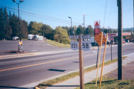
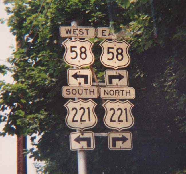
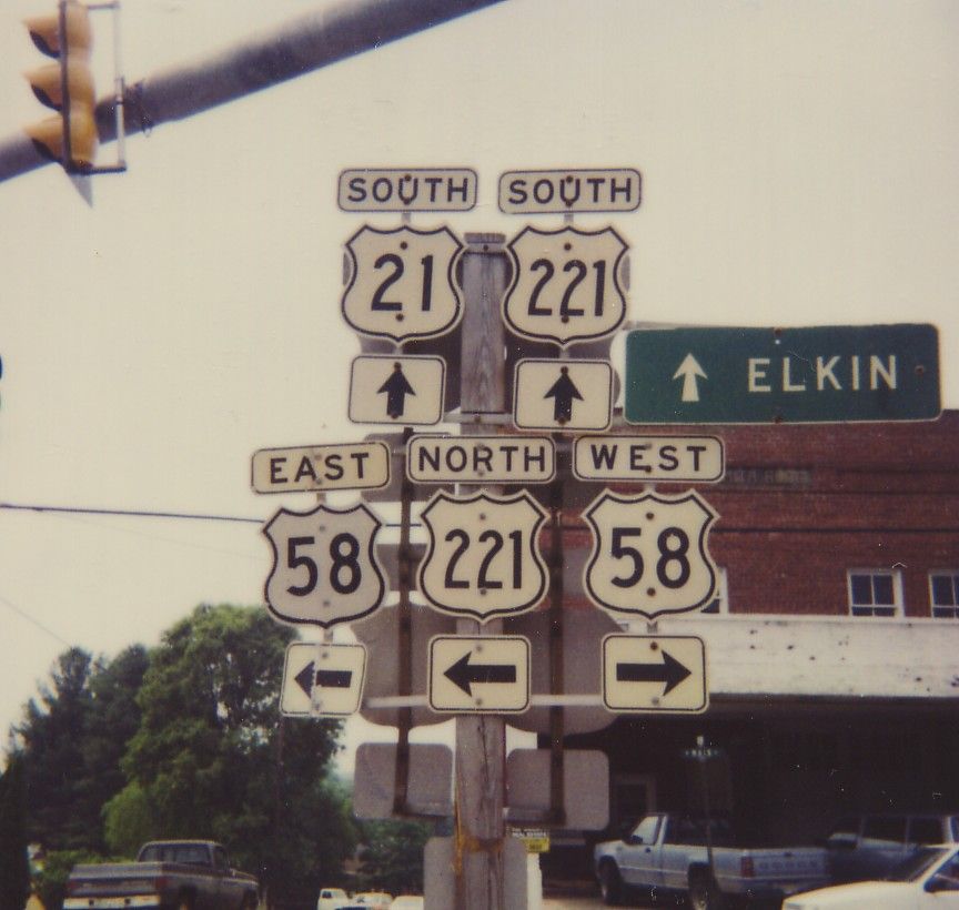
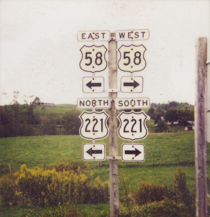
Creation: US 58 was created in 1932. It originally ran generally along its current route from Hillsville to Virginia Beach. It replaced VA 12 from Hillsville to Danville, VA 44 from Danville to South Boston, all of US 401 from South Boston to US 1, VA 12 from South Hill to Franklin, US 117 from Franklin to Suffolk, VA 12 from Suffolk to Portsmouth, and US 117 from Portsmouth to Virginia Beach. US 58 is shown on the April 1932 Official map as discontinuous between Danville and South Hill.
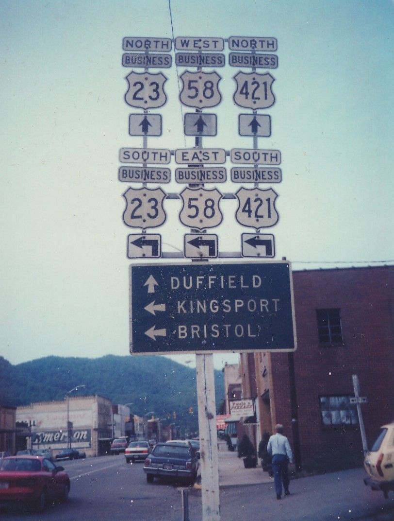
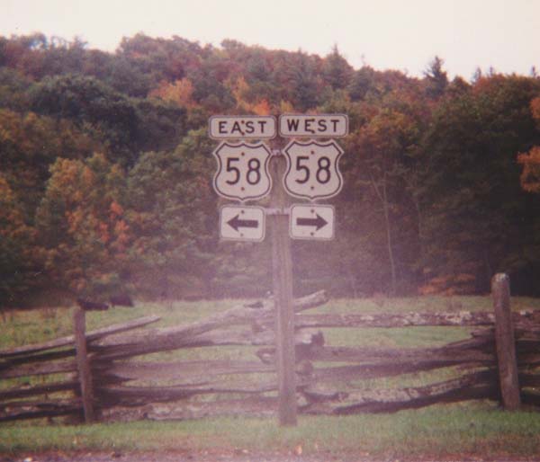
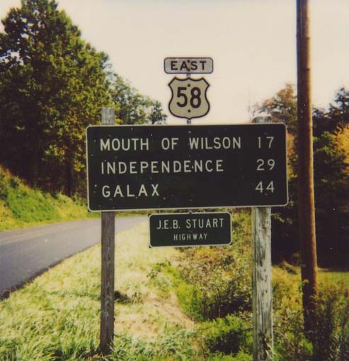
| Adjustments: By July 1933, US 58 was extended west from Hillsville to US 25E Cumberland Gap (but all within Virginia). From Hillsville to Independence was a multiplex with US 221. From Independence to Abingdon was a replacement of VA 12, which was not the direct route used today by US 58. Abingdon to Bristol was a multiplex with US 11-19, and Bristol to US 25E was a replacement of US 421. By 1935, US 58 was continuous between Danville and South Hill. In 1940 or 1941, US 58 was realigned between Damascus and Volney to its current routing along the state border. US 58 had proceeded north from Damascus to Lodi (became part of VA 91), then to Troutdale (became west section of VA 81 -- curr SR 650), then south to Volney (became part of VA 16). The new alignment was a replacement of VA 305. In 1945 (CTB Minutes), US 58 was rerouted in the Danville area. It used to cut south at US 29 Main St. (curr VA 293) across the Dan River, then west along Union St. (curr VA 413) before going back across the Dan River. This appears to have replaced US 58 ALT. Between 1954-55, US 58 received a straighter alignment west of Danville. This would go unmentioned, but the old routing became current VA 51 through Westover Hills. In 1956, US 58 was rerouted between London Bridge and Virginia Beach waterfront. It was given the Laskin Rd. approach, replacing VA 164. The Va. Beach Blvd/17th St. approach became another VA 164. Today it is US 58 Bus. In 1963 or 1964, US 58 was rerouted in Portsmouth and Norfolk to its current alignment through the cities, utilizing the Midtown Tunnel. Previously, US 58 used the Downtown Tunnel and the previous ferry to get to Norfolk. This old routing remained part of US 460 ALT. and US 17 Bus (curr VA 141). The Brambleton Ave section was once part of US 460, but not immediately so. In 1962, US 58 was given the same realignment in Bristol that was given to US 11. Some of the old route is part of VA 113. Up to this point, US 58 EB was in Tennessee in Bristol. In 1966, US 58 was added to I-81 from Bristol to Abingdon. The old route remained US 11 and US 421. In 1996, US 58 west was extended from Cumberland Gap, VA down to the new US 25E alignment in Tennessee, replacing part of the old US 25E alignment. Posting: Fully posted; cutouts in Hillsville. The last Virginia Beach cutout was removed in 1992 (Atlantic Ave SB). Cutouts made it in Galax, Independence and VA 274 until at least 1993, to at least 1992 in Gate City, and to at least 1996 in Grayson Highlands and Green Cove. Check out this 1973 Suffolk cutout assembly. Comment: For a few years after the shortening of US 290 in Texas, US 58 had the distinction of being the longest intrastate US highway in the country - a distinction it lost by being rerouted into Tennesee at its western end in conjunction with the new Cumberland Gap tunnel in 1996. US 58 is over 500 miles long, making it the longest road within Virginia. It flirts with the state border for most of its length, but never makes it over until the very end. US 58 was the last US Route in Virginia (in its current alignment) to be fully paved, as the Damascus-Volney section remained dirt or gravel until 1953. US 58 is on its way to being a 4-lane monster across the bottom of the state. Of its 500 miles only about 140 are still 2-lane. Official maps show US 58 and US 460 multiplexed for a few blocks between Virginia Beach Blvd. and Brambleton Ave along Granby Street. In the field it is not signed this way. US 58 continues west to Duke St. then south to Brambleton with no US 460 multiplex. US 58 was posted to imply its end at Atlantic Ave when I lived there in 1991. Eric Smith and Lou Corsaro take an in-depth look at US 58 at their arterials/expressways site. |
||||||||
|
|
|
| ROUTE LOG |
US 58: 0 - 0 US 421 NB: 12 - 12 US 421 SB: 0.5 - 12.5 WI-LE LINE: 12 - 24.5 US 23 Bus NB: 5 - 29.5 US 23 SB, US 23 Bus END: 1 - 30.5 NRT-WI LINE: 8 - 38.5 US 23 NB, VA 283: 5 - 43.5 VA 74: 1.5 - 45 WI-NRT LINE: 0 - 45 VA 158: 8 - 53 VA 72: 1 - 54 VA 158: 2 - 56 RU-WI LINE: 11 - 67 VA 63: 1 - 68 VA 65: 3 - 71 VA 71 WB: 4 - 75 VA 71 EB: 1 - 76 US 19 NB: 8 - 84 WA-RU LINE: 1 - 85 US 19 SB: 12 - 97 US 11 SB: 0.5 - 97.5 US 11 NB, BEGIN VA 75: 0.5 - 98 I-81 (exit 17), US 58, VA 75 SB: 1 - 99
|
Creation: US 58 ALT appeared in 1951 as a renumbering of VA 70 from Jonesville to St. Paul, VA 64 from St. Paul to Hansonville, and multiplexed with US 19 from there to US 11-58 Abingdon. This is the 5th US 58 ALT.
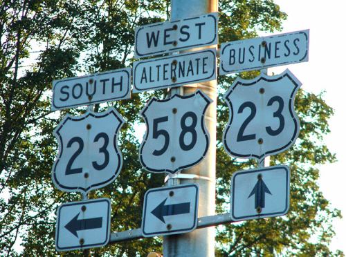
| Adjustments: In 1966, US 58 ALT was extended along VA 75 from Abingdon out to I-81 to meet with the relocated US 58. In 1992, US 58 ALT was moved onto the US 23 freeway around Norton and Big Stone Gap. This left behind US 23 Bus and VA 74. In 1999 or so, US 58 ALT bypassed Coeburn, leaving behing VA 158. Posting: Fully posted; cutouts in Abingdon, Norton, and Big Stone Gap. Comments: US 58 ALT is nearly all 4-lane now as the preferred corridor to US 58 in this part of Virginia. US 58 ALT Business and VA 283 are the same road. While VA 283 is not posted anywhere, there is at least 1 US 58 ALT Business sign at the bottom of the ramp from US 23 NB where US 58 ALT breaks off to the east. | Previous US 58 ALT's: |
US 58 ALT #1: Appeared between 1942-44 as a renumbering of VA 287. Ran along what is now VA 337 ALT today. US 58 ALT was renumbered to VA 337 ALT in 1975.
US 58 ALT #2: Mentioned in CTB Minutes from the mid-40's up through October 1954. I believe this was referring to current US 58 in Danville which bypasses VA 51. Apparently this was signed as mainline US 58 and created VA 51 when the road was actually built and completed. US 58 ALT #3: Appeared between 1942-44 as a replacement for part of US 58 in Downtown Norfolk. Ran from US 58-VA 13Y (curr US 58-VA 166) along Princess Anne Rd. to Bank St, then south to meet US 58 (curr US 460 ALT) near the Downtown Ferry to Portsmouth. US 58 ALT stopped appearing on VDOT maps in 1958. This was downgraded to unnumbered status, but today part of this is VA 404. US 58 ALT #4: Mentioned in 1945 CTB Minutes, as current US 58 west of current VA 293 (US 58 used to drop across the Dan River and use today's VA 413). |
||||||
| US 158 Decommissioned | ||||||||||
| Previous US 158's: | US 158: Appeared in Virginia in 1932, the same year it appeared nationally. Began at US 58-VA 158 (US 58 Bus-US 258) Franklin and went southwest into NC. This was a renumbering of part of US 117. While US 158 was barely 10 miles in Virginia, its VA 158 extension ran all the way to Smithfield. US 158 was renumbered as US 258 in 1940-41. | |||||||||
|
|
|
|
| ROUTE LOG |
VA 143: 0 - 0 VA 169: 0.75 - 0.75 VA 351: 1 - 1.75 VA 169: 1.5 - 3.25 VA 278: 0.25 - 3.5 VA 134 SB: 1.75 - 5.25 VA 152: 0.25 - 5.5 I-64 (exit 263), VA 134 NB: 0.75 - 6.25 VA 415: 0.75 - 7 US 17 NB, VA 143: 2.5 - 9.5 NNS-HAM LINE: 0 - 9.5 US 60, BEGIN VA 32: 0.25 - 9.75 IW-NNS LINE: 2.25 - 12 US 17 SB: 4.75 - 16.75 VA 10 EB, VA 32 SB: 3.25 - 20 US 258 Bus, VA 10 Bus: 2 - 22 US 258 Bus, VA 10 WB: 2 - 24 US 460: 14 - 38 US 58 Bus, US 258 Bus: 13 - 51 SUF-IW LINE: 2.5 - 53.5 US 58 EB, VA 189: 0.5 - 54 SO-SUF LINE: 1 - 55 US 58 WB, US 258 Bus: 4 - 59 VA 189: 2 - 61 NC STATE LINE: 5 - 66
|
Creation: Born nationally in 1932, US 258 was extended into Virginia in 1941, replacing US 158.
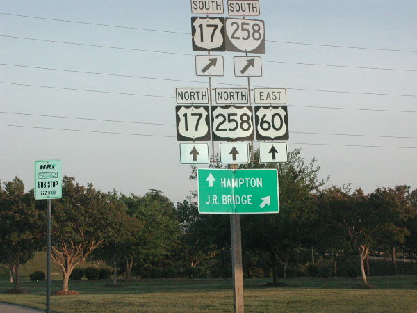
| Adjustments: US 258 was extended north to its current end at Ft. Monroe between 1945-47, promoting the VA 258 extension from Franklin to Ft. Monroe. A. Froehlig reports that US 258 was rerouted to bypass Franklin in summer 2003, utilizing the existing US 58 bypass east, then replacing VA 260 north back to US 258. Posting: Fully posted; error VA 258 sign in Newport News (thanks Gribblenation!) Comment: From Dave: The northern end of US 258 is pretty close to being a true dead end US highway. Rand McNally shows US 258 ending on McNair Rd. within Ft. Monroe (as does 2002-04 VDOT map), and I went to the end of this road and saw that the first/last 258 signs were at the exit of the fort. Unfortunately, I may have gotten it wrong since most other maps show it ending on Ingalls Rd. Have to go back again sometime... |
|||
Previous: US 52 |
Next: US 60 and Branches
Top | Virginia Hwy Index
Home
