
< US 58 and Branches | Home | US 170 > | ||||||||||||||||||||||||||||||||||||||||||||||||||||||||||||||||||||||||||||||||||||||||
|
|
|
|
| ROUTE LOG |
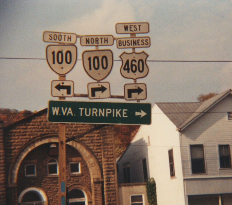
BEGIN US 60: 0 - 0 US 58 Bus: 0 - 2 US 58: 1 - 3 VA 343: 2 - 5 VA 343: 7.5 - 12.5 VA 279: 1.5 - 14 US 13: 3.25 - 17.25 VA 225: 1 - 18.25 VA 166: 1.75 - 20 NOR-VAB LINE: 0.25 - 20.25 VA 170: 1 - 21.25 VA 194: 4.25 - 25.5 US 460: 0.5 - 26 VA 168: 0.75 - 26.75 I-64 EB (exit 273): 0.25 - 27 HAM-NOR LINE: 3.75 - 30.75 VA 169: 2 - 32.75 I-64 WB (exit 267), VA 143 SB: 1 - 33.75 VA 134: 1 - 34.75 VA 143 NB: 0.5 - 35.25 NNS-HAM LINE: 3 - 38.25 I-664 (exit 6): 2 - 40.25 VA 351: 1 - 41.25 US 17, US 258, VA 32: 2.25 - 43.5 VA 152: 1.25 - 44.75 VA 306: 1.5 - 46.25 VA 312: 1.25 - 47.5 VA 173: 5 - 52.5 VA 105: 4 - 56.5 VA 238: 1.5 - 58 JC-NNS LINE: 1.75 - 59.75 YO-JC LINE: 3 - 62.75 VA 199: 2.5 - 65.25 WIL-YO LINE: 1.25 - 66.5 VA 5 WB: 0.5 - 67 VA 5 EB: 0.5 - 67.5 VA 132: 0.5 - 68 JC-WIL LINE: 0 - 68 WIL-JC LINE: 1 - 69 JC-WIL LINE: 1.5 - 70.5 VA 199: 3.5 - 74 VA 30: 6 - 80 NK-JC LINE: 6 - 86 VA 155: 8 - 94 VA 106: 6 - 100 VA 33 EB, VA 249: 4 - 104 HR-NK LINE: 1 - 105 VA 156 SB: 2 - 107 I-295 (exit 28): 2 - 109 VA 33 WB, VA 33Y: 1.5 - 110.5 VA 156 NB: 1.5 - 112 RIC-HR LINE: 4 - 116 VA 5: 2 - 118 US 250: 0.5 - 118.5 US 360 EB: 0.5 - 119 US 360 WB: 0.5 - 119.5 VA 147: 0.5 - 120 US 1, US 301: 1 - 121 VA 161: 2.25 - 123.25 VA 150: 2.25 - 125.5 CH-RIC LINE: 0 - 125.5 VA 339: 0.5 - 126 VA 76: 2 - 128 VA 147: 3 - 131 VA 288: 4 - 135 PO-CH LINE: 4 - 139 VA 13: 10 - 149 VA 300: 1 - 150 US 522: 2 - 152 CU-PO LINE: 11 - 163 VA 45 NB: 5 - 168 VA 13: 2 - 170 VA 45 SB: 3 - 173 BK-CU LINE: 4 - 177 US 15: 8 - 185 VA 56: 6 - 191 VA 24: 2 - 193 AP-BK LINE: 10 - 203 VA 26: 3 - 206 NL-AP LINE: 1 - 207 AM-NL LINE: 5 - 212 US 29: 9 - 221 US 29 Bus: 1 - 222 BLUE RIDGE PKWY: 22 - 244 RO-AM LINE: 0 - 244 BVA-RO LINE: 4 - 248 US 501: 2 - 250 RO-BVA LINE: 1 - 251 I-81 (exit 188): 4 - 256 US 11: 2 - 258 LEX-RO LINE: 0 - 258 US 11 Bus: 1 - 259 RO-LEX LINE: 1 - 260 I-64 EB (exit 50): 5 - 265 AG-RO LINE: 10 - 275 VA 269: 2 - 277 VA 42, VA 269: 6 - 283 US 60 Bus, US 220 SB: 2 - 285 US 60 Bus, US 220 Bus, VA 384: 3 - 288 I-64 WB (exit 16): 8 - 296 VA 18: 0.5 - 296.5 COV-AG LINE: 0.5 - 297 US 220 NB: 0.5 - 297.5 VA 154: 0.5 - 298 AG-COV LINE: 1 - 299 I-64 EB (exit 10), VA 159: 3 - 302 WV STATE LINE: 10 - 312
|
Creation: US 60 appeared in Virginia as an original US Route in 1927. It was attached to the original VA 14 from WV to Crows, Covington, Clifton Forge, and Lexington. From Lexington US 60 was paired with US 11-VA 33 to Natural Bridge. US 60 was paired with VA 141 from Natural Bridge to Natural Bridge Station, where it picked VA 14 back up to Glasgow and Lynchburg. From Lynchburg US 60 was attached to VA 10 to Appomattox, Farmville, and Burkeville. From Burkeville, US 60 was attached to VA 20 to Amelia and Richmond. From Richmond US 60 was attached to VA 39 to Williamsburg and Newport News, where US 60 originally ended at a ferry to Norfolk.
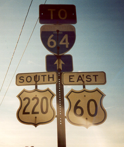
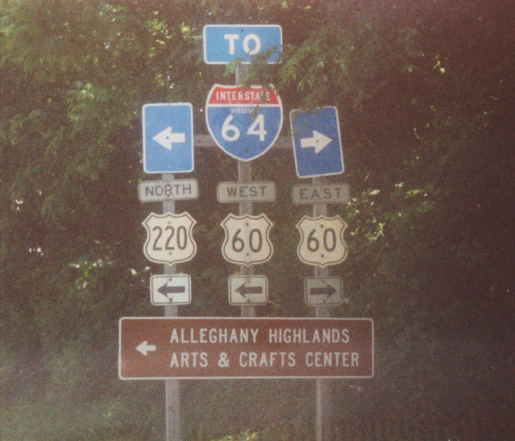
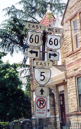
| Adjustments: In 1929, US 60 was assigned in Norfolk. It ran to downtown Norfolk, then multiplexed with US 117 (curr US 58) Virginia Beach Blvd. to end at VA 501 (curr US 60) at the Oceanfront. Also, all state multiplexes with routes 14, 141, 10, and 39 were removed. By 1931, US 60 was rerouted in Newport News over VA 39 to run through Hampton to Old Point Comfort (Ft. Monroe), where a ferry carried US 60 to Ocean View. US 60 continued along the shore as it does now, and ended at Camp Pendleton, below Rudee Inlet. This was a replacement for VA 500 and VA 501 #1. The old route through Norfolk remained US 17 and US 117. In July 1933, US 60 was significantly rerouted west of Richmond. It was changed to go due west to Powhatan, Tobaccoville, Cumberland, Amherst, Buena Vista (replacing VA 13), then to Lexington (replacing VA 14). The old US 60 alignment became US 360 from Richmond to Burkeville, US 460 from Burkeville to Lynchburg, US 501 from Lynchburg to Glasgow, and VA 249 from Glasgow to Natural Bridge (curr VA 130). Around 1935, US 60 was given a straighter alignment between Cumberland and Powhatan (new construction). The old route through Powhatan and Tobaccoville became today's violating VA 13. By 1937, US 60 was routed around Williamsburg as it is now. The old route through town went unnumbered, but became US 60Z in the mid-40's and VA 162 later on. Today this is a tiny part of VA 5 but mostly not numbered. Between 1939-41, US 60 was rebuilt to avoid Cape Henry and Fort Story in Virginia Beach. The old way along the shore became VA 305 a couple years later. Today it is not numbered, but is still posted VA 305 by Virginia Beach. Between 1948-50, US 60 was given a straighter route from Callaghan to West Virginia, replacing US 60 ALT. The old route to West Virginia via Crows became VA 159 and an extended VA 311. In 1957, US 60 was moved onto the new Hampton Roads Tunnel, along with I-64 and VA 168. The section that ran further east to Ft. Monroe became an extended VA 143. In 1963 or 1964, US 60 east in Virginia Beach was truncated to Rudee Inlet. The part to Camp Pendleton went (and remains) unnumbered. In 1966, US 60 was added to I-64 between Covington and Clifton Forge In 1967, US 60 was added to I-64 from the WV Line to today's Exit 7. The old routing is F-046. In 1971 or 1972, US 60 was moved onto I-64 from today's Exit 7 to VA 159, leaving behind SR 661. Also, US 60 was extended on I-64 to the east side of Clifton Forge, leaving behind US 60 Bus. US 60 was moved onto I-64 from there to VA 42 in 1980, leaving behind SR 632. In 1982, US 60 was added to I-64 from VA 42 to SR 623 west of Lexington. The old route became all of VA 269 and SR 880. Around 1992, US 60 was moved onto I-64 over Willoughby Bay, leaving behind an unnumbered route. VDOT maps do not show this explicitly, but US 60 signs went up on I-64 around that time, if memory serves. Adam Froehlig reports that US 60 in Ocean View undewent a slight change in July 2004: WB US 60 traffic wishing to get onto 4th View St and on to I-64 (and US 60 West) must turn left onto Mason Creek Rd (via a new traffic signal), then make a right turn from Mason Creek onto Tidewater Dr, and then on to 4th View. There is no longer a direct connection/turn from WB Ocean View onto 4th View. Furthermore, the city made it to where traffic coming up Tidewater Dr can no longer directly continue onto WB Ocean View...they can only turn left onto 4th View. Traffic on Tidewater wanting to take Ocean View onto the Willoughby Spit must use Mason Creek Rd to make the connection. Posting: Fully posted, except in Virginia Beach Oceanfront Area. Cutouts in Covington, Clifton Forge (though possibly not this 1995 assembly), E. Richmond. Error VA 60 signs have come and gone on I-64 at the VA 30 exit, the frontage road off I-64/US 60 just east of Hampton Roads Tunnel, and a strange VA 60 cutout west of US 13. Error SR 60 signs in circles existed near VA 279 (A. Froehlig reports these have been removed). On August 29, 2003 I spotted a new VA 60 error shield on a green sign just before VA 168 on US 60 WB in Ocean View (also reported in July 2004 by A. Froehlig as gone). One of the strange things about US 60 is how poorly it is posted in Virginia Beach. According to Doug Smith, in the 70's there was a US 60 END sign at the south side of the Rudee Inlet Bridge. When I lived there '91-'93, the easternmost sign with US 60 was at US 58 Laskin Rd. There were a couple reassurance signs west of this (including a now-removed cutout where Atlantic Ave and Pacific Ave come together), but true full posting didn't occur until US 60 became Shore Dr. US 60 also has a Virginia Beach SR posted - SR 651 - at Pleasure House Road. Odd because SR's there went away about the same time part of Pleasure House Road was still VA 166. US 60 is also home to the erroneous SR 305 signs near Cape Henry. A. Froehlig reports a US 60 END sign has appeared summer 2004 just past the south end of the Rudee Inlet Bridge. Comment: The logical precursor to I-64 in VA (even though 64 follows US 250 more closely between Richmond and Staunton). US 60 today is not a major route even where it is nowhere near I-64. That privilege went to its earliest routing, current US 360-460. US 60 from Amherst to Powhatan passes through some empty space in Central Virginia. From Doug Smith I learned that from the 1930's to the 1970's, a marker for the end of the Daniel Boone Trail (national predecessor to US 60) sat near the US 58-60 jct. |
||||||||
|
|
|
| ROUTE LOG |
US 60, BEGIN US 460: 0 - 0 US 460 WB, VA 168 SB: 1 - 1 US 60, END VA 168: 1 - 2
|
Creation: Appeared late August 2004. This is the 4th US 60 ALT in Virginia. First reported to me by Adam Froehlig.
| Adjustments: None Posting: Fully posted at the east endpoint from US 60 and where it switches from Granby to Tidewater Dr. Per Adam Froehlig there are no current reassurance markers anywhere. Comments: I guess this is part of the reconfiguring of how Ocean View wants people to move from US 60 to I-64. | Previous US 60 ALT's: |
US 60 ALT #1: Appears in July 1938 and January 1940 CTB Minutes as Virginia Avenue, between 34th and. 25th Streets, and 25th Street between Virginia and Jefferson Avenues. There is no Virginia Ave in Newport News today, so this may have been Warwick Ave.
US 60 ALT #2: Appeared between 1942-44 as an upgrade to SR 662. Ran from US 60 Callaghan west to West Virginia. Between 1948-50, US 60 ALT became mainline US 60. Today it is I-64/US 60 and associated fronage roads. US 60 ALT #3: Existed at most 1960-61 (appears only on 1961 official map). Shown as the bottom most part of Warwick Ave. The map does not show how mainline US 60 ran during this time. Before and after, this piece was mainline US 60. |
||||||
| US 60Z Decommissioned | ||||||||||||
| Previous US 60Z's: | US 60Z: ran along Francis St., France St., and Richmond Rd. in Williamsburg. Implied as early as 1947. Maps in the early 40's imply this route as unnumbered, but was once mainline US 60 through town. In 1974, US 60Z became VA 132 west of central Wiliamsburg, and VA 5-31 east of central Williamsburg. Today, only VA 5 from central Williamsburg to US 60 is still numbered, as VA 162 (the last designation for the route through town) was eliminated in the early 90's. | |||||||||||
|
|
|
|
| ROUTE LOG |
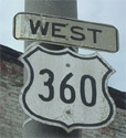
US 58 Bus WB, VA 293, VA 360: 0 - 0 US 29, US 58 WB, US 58 Bus END, VA 785: 1.75 - 1.75 PI-DAN LINE: 2 - 3.75 VA 62: 4 - 7.75 HX-PI LINE: 2 - 9.75 VA 119: 5 - 14.75 US 501: 16 - 30.75 US 58 EB: 1 - 31.75 VA 304: 0.75 - 32.5 VA 34: 0.5 - 33 VA 344, VA 360: 7 - 40 VA 92: 5 - 45 CH-HX LINE: 2 - 47 VA 92: 2 - 49 US 15 SB: 5 - 54 VA 47: 4 - 58 US 15 Bus, US 360 Bus: 7 - 65 US 15 Bus, US 360 Bus: 1 - 66 VA 40: 2 - 68 US 15 Bus, US 360 Bus: 2 - 70 LU-CH LINE: 0 - 70 PE-LU LINE: 6 - 76 NT-PE LINE: 8 - 84 US 360 Bus, US 460 WB, US 460 Bus: 3 - 87 US 360 Bus, US 460 EB, US 460 Bus: 1 - 88 VA 323: 1 - 89 VA 49 NB: 2 - 91 AM-NT LINE: 5 - 96 VA 307: 0 - 96 US 360 Bus: 9 - 105 US 360 Bus: 3 - 108 VA 153: 4 - 112 CH-AM LINE: 1 - 113 VA 288: 15 - 128 VA 150: 7 - 135 RIC-CH LINE: 0 - 135 VA 161: 2.25 - 137.25 VA 10: 0.25 - 137.5 US 1, US 301: 1 - 138.5 US 60 WB: 1.5 - 140 US 60 EB: 0.5 - 140.5 US 250: 0.25 - 140.75 HR-RIC LINE: 1.5 - 142.25 I-64 (exit 192): 0.5 - 142.75 HN-HR LINE: 3.75 - 146.5 US 360 Bus: 0.5 - 147 VA 156: 0.5 - 147.5 US 360 Bus: 0.25 - 147.75 I-295 (exit 37): 0.25 - 148 KW-HN LINE: 14 - 162 VA 30: 6 - 168 KQ-KW LINE: 4 - 172 VA 14: 2 - 174 ES-KQ LINE: 5 - 179 US 17 SB: 8 - 187 US 17 NB: 2 - 189 RI-ES LINE: 1 - 190 VA 3 Bus WB: 5 - 195 VA 3, VA 3 Bus END: 1 - 196 NB-RI LINE: 8 - 204 VA 202: 3 - 207 VA 201: 9 - 216 VA 200: 7 - 223 END US 360, SR 644: 7 - 230
|
Creation: US 360 was created in 1933. It ran from Danville to Reedville, via Halifax and Wyliesburg. US 360 replaced: from Danville to Halifax, VA 12; from Halifax to Burkeville, US 501; from Burkeville to Richmond, US 60; from Richmond to Callao, VA 13; from Callao to Reedville, VA 607.
| Adjustments: Between 1948-50, US 360 was rerouted in Richmond (east of US 60) to its current 17th St-Fairfield-Mechanicsville Tpk route. Originally US 360 used 21st St-Mosby St-Mechanicsville Tpk. US 360 was straightened out to bypass both Clover and Wyliesburg between 1968-70. The old route became part of VA 92 and remained a piece of US 15. In 1984, US 360 was rerouted between Danville and VA 344 to its current alignment along US 58 to South Boston, then north to VA 344. The segment from US 58 to VA 344 had been VA 304. The old alignment from Danville to VA 344 via Halifax became VA 360. Posting: Fully Posted; cutouts remain in S. Richmond; Reedville cutouts looked like they were being phased out in 1996. In April 2004 A. Smith reports that there is a "C360" in a white rectangle along US 360 Bus in Mechanicsville. Comments: The US 360 Bridge over the James River dates back to at least the 20's. US 360 is one of the two intrastate US highways remaining in VA. Mostly a four-lane divided highway. Ends in Reedville at a side-road intersection with CR 644. CR 644 continues for exactly 0.43 mile before ending in a cul-de-sac. This is the closest Virginia comes to having a dead-end US highway. The west end of US 360 is also a bit odd. See VA 360. Other than the greater Richmond area, US 360 remains a good thoroughfare to travel south central Virginia. |
|||||
| US 360 ALT Decommissioned | ||||||||||||
| Previous US 360 ALT's: |
US 360 ALT #1: Appears in the June 1962, July 1963, January 1964, and July 1964 CTB minutes as the route designation for the Keysville Bypass to be built shortly thereafter. It is unclear whether the road was ever posted as such or not.
US 360 ALT #2: Appears in the August 1962 CTB minutes as the Amelia Bypass, which opened as US 360 Bypass in 1966. US 360 ALT #3: Appears in the May 1965 CTB Minutes as the Burkeville Bypass, which opened 1968-70 as US 360-460 Bypass. |
|||||||||||
|
|
|
| ROUTE LOG |
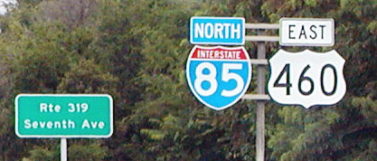
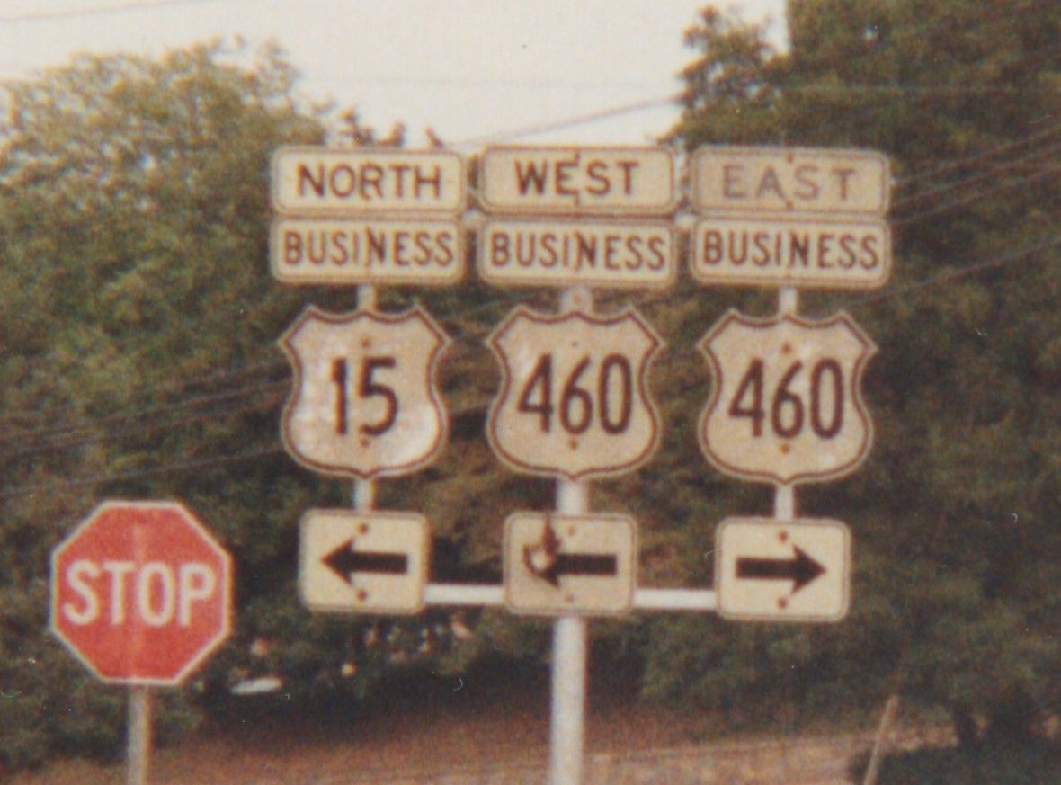
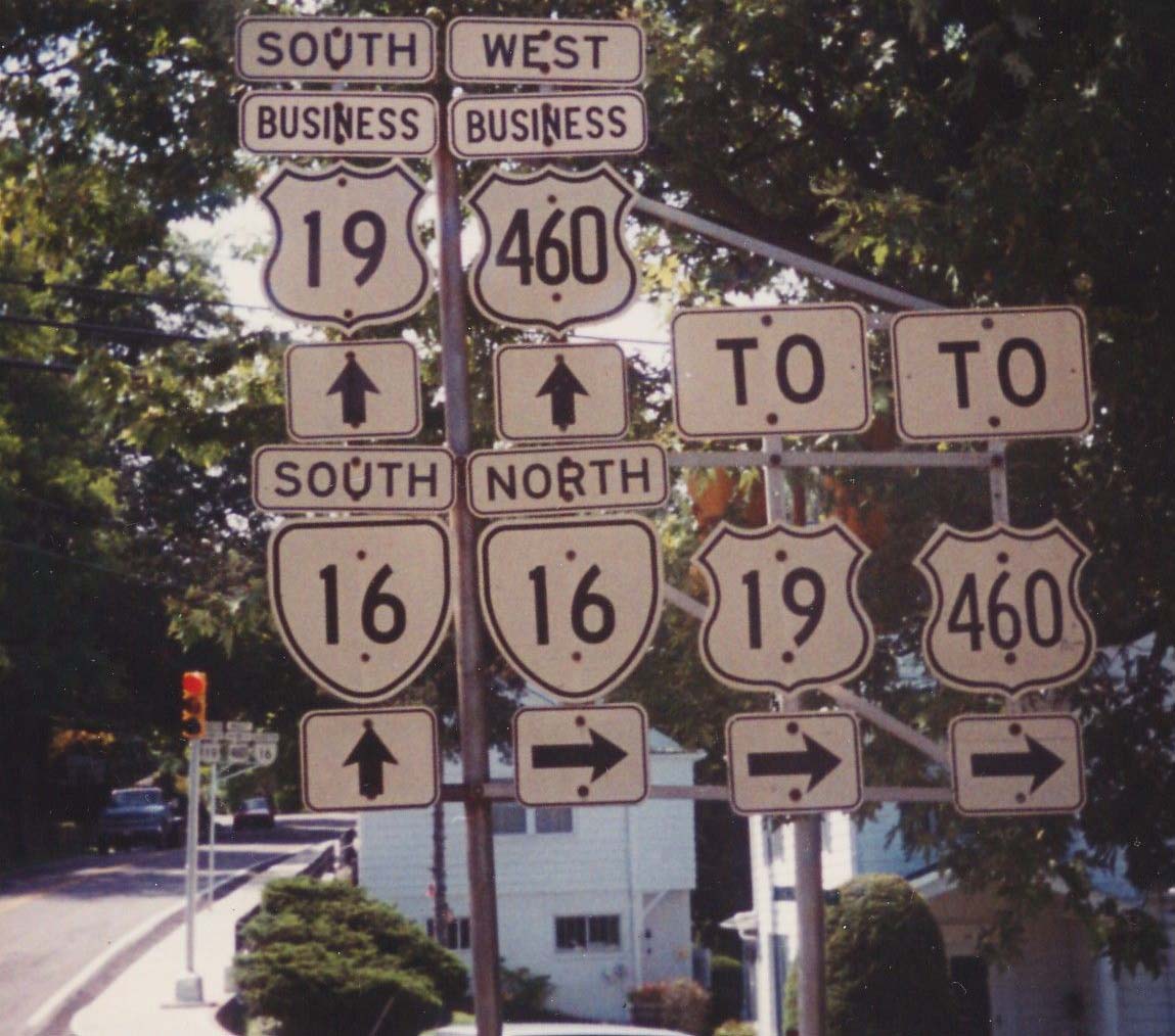
US 60: 0 - 0 VA 168: 0.5 - 0.5 I-64 (exit 276): 2 - 2.5 I-564: 0.25 - 2.75 VA 165: 0.25 - 3 VA 247: 3.25 - 6.25 US 58: 0.75 - 7 US 460 ALT, VA 337 EB: 0.25 - 7.25 VA 168 NB, VA 337 WB: 0.75 - 8 VA 166 NB: 0.5 - 8.5 I-264 (exit 11): 0.25 - 8.75 VA 168 SB: 1 - 9.75 CHE-NOR LINE: 0.5 - 10.25 VA 246: 0.5 - 10.75 VA 337: 0.25 - 11 I-464 (exit 3): 1.5 - 12.5 US 13 NB, VA 166 SB: 0.5 - 13 VA 196: 2.25 - 15.25 US 17: 1 - 16.25 I-64 (exit 297): 1 - 17.25 US 58 EB, US 460 ALT, VA 191: 4.5 - 21.75 I-664 (exit 13): 0.25 - 22 SUF-CHE LINE: 3 - 25 US 13 Bus, US 58 Bus, US 460 Bus: 3 - 28 VA 10, VA 32 NB, VA 32 Bus: 4 - 32 US 13 SB, US 58 WB, US 460 Bus, VA 32 SB: 1 - 33 IW-SUF LINE: 4 - 37 US 258: 3 - 40 SO-IW LINE: 6 - 46 SU-SO LINE: 5 - 51 SX-SU LINE: 1 - 52 VA 31: 1 - 53 VA 40: 8 - 61 PG-SX LINE: 7 - 68 VA 156: 6 - 74 I-295 (exit 3): 3 - 77 PET-PG LINE: 0.25 - 77.25 VA 106: 0.25 - 77.5 VA 109: 1.5 - 79 US 460 Bus: 0.5 - 79.5 I-95 SB (exit 50): 0.25 - 79.75 US 301: 0.25 - 80 I-85 BEGIN (exit 68), I-95 NB (exit 51): 0.75 - 80.75 DI-PET LINE: 3.5 - 84.25 US 1, US 460 Bus: 1 - 85.25 I-85 SB (exit 61), US 460 Bus: 1.75 - 87 VA 226: 1 - 88 NT-DI LINE: 22 - 110 VA 153: 1 - 111 US 460 Bus: 3 - 114 US 460 Bus: 8 - 122 VA 49 SB: 4 - 126 VA 49 NB: 2 - 128 VA 323: 1 - 129 US 360 EB, US 360 Bus, US 460 Bus: 1 - 130 US 360 WB, US 360 Bus, US 460 Bus: 1 - 131 PE-NT LINE: 4 - 135 VA 307: 3 - 138 US 15 SB, US 15 Bus: 4 - 142 US 15 NB, US 460 Bus: 5 - 147 US 460 Bus: 11 - 158 AP-PE LINE: 1 - 159 US 460 Bus: 1 - 160 US 460 Bus: 7 - 167 VA 24 EB, VA 131: 2 - 169 US 460 Bus, VA 26: 1 - 170 VA 24 WB: 8 - 178 CB-AP LINE: 1 - 179 LYN-CB LINE: 6 - 185 US 460 Bus, US 501 SB, US 501 Bus: 2.5 - 187.5 US 501 NB: 3 - 190.5 CB-LYN LINE: 3 - 193.5 US 29: 0.5 - 194 US 460 Bus: 5 - 199 BD-CB LINE: 1 - 200 US 221 NB, US 460 Bus, VA 122 NB: 12 - 212 BED-BD LINE: 0 - 212 VA 122 SB, VA 122 Bus: 2 - 214 US 221 Bus, US 460 Bus: 1 - 215 BD-BED LINE: 0 - 215 BO-BD LINE: 17 - 232 BLUE RIDGE PKWY: 2 - 234 RO-BO LINE: 2.5 - 236.5 US 220 ALT NB: 0.5 - 237 ROA-RO LINE: 2.25 - 239.25 VA 115: 2.25 - 241.5 US 11, BEGIN US 11 ALT, US 221 SB, VA 116 SB: 0.5 - 242 I-581 (exit 6), US 220, US 220 ALT END: 0.25 - 242.25 VA 116 NB: 1.25 - 243.5 VA 117: 1.5 - 245 SAL-ROA LINE: 0.5 - 245.5 US 11 ALT SB, US 460 ALT, VA 419: 0.5 - 246 VA 311: 1.5 - 247.5 US 11 SB: 0.25 - 247.75 US 11 ALT, US 460 ALT: 0.75 - 248.5 VA 112: 1 - 249.5 RO-SAL LINE: 1 - 250.5 MO-RO LINE: 6 - 256.5 I-81 NB (exit 118), US 11 SB, US 460 Bus: 13 - 269.5 I-81 SB (exit 118C): 0.5 - 270 US 11, US 460 Bus: 0.5 - 270.5 US 460 Bus: 2.25 - 272.25 VA 114: 0.5 - 272.75 US 460 Bus: 1 - 273.75 VA 314: 2.25 - 276 VA 412: 1 - 277 US 460 Bus: 3 - 280 GI-MO LINE: 5 - 285 VA 42: 1 - 286 US 460 Bus: 11 - 297 US 460 Bus, VA 100: 3 - 300 VA 61: 3 - 303 US 219: 4 - 307 WV STATE LINE: 3 - 310 WV STATE LINE: 0 - 310 US 19 NB: 4 - 314 US 19 Bus, US 460 Bus: 11 - 325 VA 16: 2 - 327 VA 16 ALT: 1 - 328 US 19 Bus, US 460 Bus: 1 - 329 US 19 SB: 11 - 340 US 460 Bus: 1 - 341 US 460 Bus: 1 - 342 VA 67: 2 - 344 US 460 Bus, VA 67 NB: 2 - 346 VA 67 SB: 1 - 347 BU-TZ LINE: 6 - 353 VA 83 WB: 16 - 369 VA 83 EB: 4 - 373 KY STATE LINE: 13 - 386
|
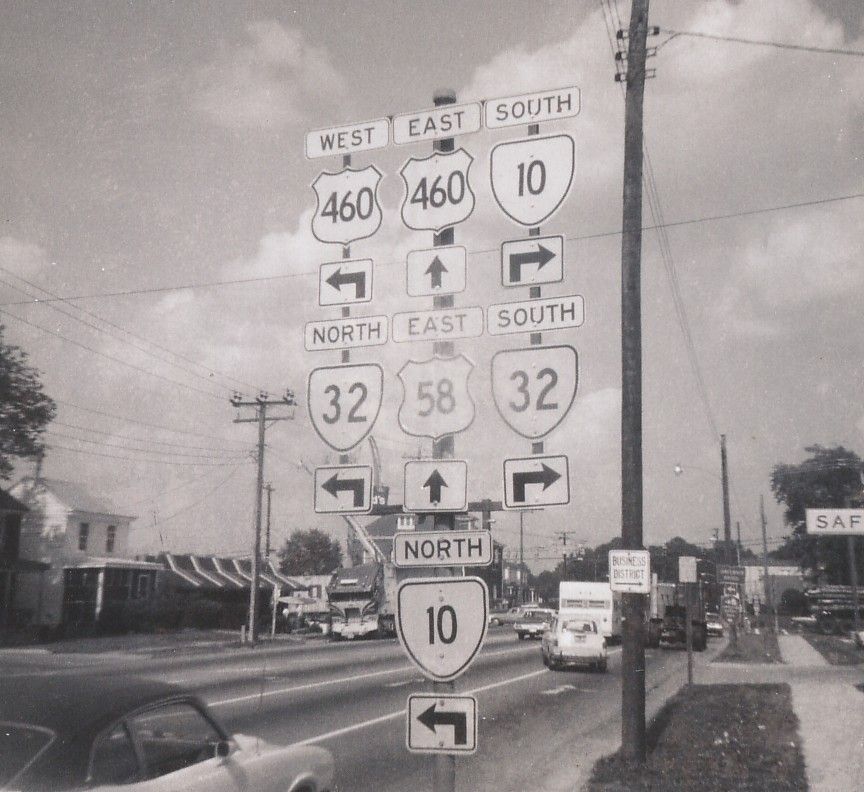
Creation: US 460 appeared in 1933 as an intrastate US Route. It ran from US 11 and US 311 (curr US 220 Bus) Roanoke to US 60 Chesapeake Beach (near current US 60-US 13 jct). US 460 replaced: Roanoke to Lynchburg, VA 10; Lynchburg to Burkeville, US 60; Burkeville to Petersburg, VA 10; Petersburg to Suffolk, VA 52; Suffolk to Norfolk, US 117; Norfolk to US 60, VA 12.
| Adjustments: Between 1934-37, US 460 was given a straighter alignment over Lakeside Ave in the western Lynchburg area, bypassing the Forest Ave routing, which became VA 291 (since decommissioned). Between 1942-44, US 460 was given its current Suffolk to Downtown Norfolk routing, moving onto US 58 between Suffolk and Bowers Hill, US 13 from Bowers Hill to just over the Gilmerton Bridge, then north along Bainbridge Ave to Norfolk. The old alignment from Suffolk-Driver-Portsmouth-Norfolk became VA 337. Also in this timeframe, US 460 went west from Downtown Norfolk along what looks like Brambleton to end at Granby St. (unnumbered then). The old route out Princess Anne Rd to Chesapeake Beach became VA 13Y, US 13, and the other VA 13Y. Today this is VA 166, Shell Rd and Pleasant House Rd (Northampton Blvd. didn;t exist until 1964). Between 1945-47, US 460 was extended west from Roanoke to St. Louis, MO. In Virginia, it replaced: Roanoke to Salem, VA 24; Salem to Christiansburg was a multiplex with US 11; Christiansburg to Pearisburg, VA 8; Pearisburg to Rich Creek, VA 100; Rich Creek to WV was a multiplex with US 219; WV to Claypool Hill was a multiplex with US 19; Claypool Hill to KY, VA 4. Between 1948-50, US 460 was straightened out between Salem and Roanoke to its current Melrose Ave routing. Previously US 460 used Melrose, Gilmer, and Lafayette to Lynchburg Tpk. (So there was a brief multiplex with US 11-220 in Downtown Roanoke, unlike today). The old routing went unnumbered. In 1958, US 460 EB was extended north along Granby Street (replacing VA 170) to its current end at US 60. The previous stub west on Brambleton went unnumbered but later became US 58 and VA 337. In 1968, US 460 was rerouted south of Petersburg to provide a direct route to the new I-85. The old approach to US 1 became VA 226. In 1972, US 460 was rerouted between Bedford and Lynchburg over the nice 4-lane route, replacing VA 297. The old route from Bedford through Downtown Lynchburg became an extended US 221. Additionally, US 460 ran along the US 29 freeway to US 501 (curr US 501 Bus), then south to where US 501 SB-US 460 EB split. This arrangement remained until 1989 when the full US 460 freeway bypass was completed (eliminating VA 224). In 1979, US 460 was rerouted to avoid Bluefield. It used SR 740 and new construction for several years before the full US 460 freeway was completed. The old route remained US 19. Posting: Fully posted; cutouts in Pearisburg (which replaced this 1991 assembly), oversized cutout in Petersburg, and in 2000 there were still US 460 cutouts in Bluefield. Roanoke cutouts made it to at least 1991, Farmville cutouts lasted to at least 1992, and Tazewell cutouts still abound as of October 2003. Check out this 1973 Suffolk cutout assembly! On 9/29/02 I observed two error VA 460 Business signs on VA 40 EB in Blackstone (verified A. Froehlig mid-2003). US 460 is erroneously posted as US 460 Business just west of Downtown Salem. 
Thanks to Chris E. for this 7/3/05 photo US 460 mainline goes through downtown Salem and US 460 ALT bypasses central Salem. Chris E. also reports a new erroneous US 460 Business posting WB leaving VA 419. Comments: Major four-lane east-west route in southern VA. I guess you could say it's usurped US 60. US 460 bypass of Christiansburg and Blacksburg, in the process of being connected directly, opened in two phases with the EB alignment open from the extended VA 114 in July 2002 first. Today the whole thing is open. |
|||||
|
|
|
| ROUTE LOG |
I-664 (exit 13), US 13, US 58 WB, US 460, VA 191: 0 - 0 POR-CHE LINE: 1 - 1 VA 239: 2.5 - 3.5 US 58 EB, VA 337 WB: 0.25 - 3.75 VA 337 ALT: 0.25 - 4 I-264 WB (exit 4), VA 337 EB: 0.25 - 4.25 US 17: 1 - 5.25 VA 141: 1.75 - 7 NOR-POR LINE: 0.5 - 7.5 I-464 (exit 6), VA 337 WB: 0.5 - 8 I-264 EB (exit 9), VA 337 EB, VA 337 ALT: 0.5 - 8.5 US 460, VA 337: 1 - 9.5
|
Creation: US 460 ALT appeared November 1952 (CTB Minutes). It ran from US 13-58-460 Bowers Hill along US 58 to Portsmouth, then east along with VA 337 to Norfolk Naval Shipyard, then over the Downtown Ferry to meet US 460 in Norfolk. This is the 1st of 3 US 460 ALTs
| Adjustments: US 460 ALT was moved onto I-264 from Portsmouth Blvd. to Norfolk in 1971 or 1972. Posting: Fully posted on its US 58 multiplex. Not posted at all on I-264. In 1993 there was 1 US 460 ALT sign posted in Downtown Norfolk, near the on-ramp for I-264. It is not posted at US 460 in Norfolk. Comment: Branches off at St. Paul's Blvd. & Brambleton Ave., cross the Berkley Bridge and Downtown Tunnel, coexist with I-264 to Portsmouth Blvd., then runs with US 58 to Bowers Hill. A more direct route, I'll admit. |
|||||
