
< 800 to 3111 | Home | 8 to 13 > Photo: |
|||||||||||||||||
| U.S. 1 |
| VA 1 not currently assigned | |||
| Previous VA 1's: | VA 1: An original Virginia route that existed from the beginning until 1923, as the forerunner to the 1920's VA 31. The 1922-23 Auto Trails map shows VA 1's alignment thus: then-NC 75 (curr US 15) to Clarksville (really!), then east to Lawrenceville, then north to Alberta, then to Petersburg, Richmond, Elmont, Negro Foot, Chilesburg, Spotsylvania CH, Fredericksburg, Woodbridge, Occoquan, Alexandria, to DC. Today this generally would be US 15, US 58, VA 46, US 1, Staples Mill Rd, Purcell Rd, SR 626, VA 54, SR 671, SR 738, VA 208, US 1, SR 906, VA 123, SR 611, US 1. Note that "OLD Washington HWY" at an I-295 overpass east of US 33 was part of this routing. VA 1 was changed to VA 31 in 1923, except for Richmond to Chilesburg appears to have gone unnumbered (though later VA 312, then VA 51), as VA 31 was given the straighter US 1 routing through Ashland and Doswell. | ||
|
|
|
| ROUTE LOG |
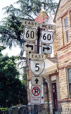
US 1, US 301 SB: 0 - 0 RIC-HR LINE: 0 - 0 I-95 (exit 82): 0.5 - 0.5 HR-HN LINE: 1 - 1.5 I-295 (exit 41): 0.5 - 2 VA 54, VA 54Y: 12 - 14 CL-HN LINE: 2 - 16 VA 30: 3 - 19 US 301 NB, VA 207, Begin US 301 Bus, Begin VA 207 Bus: 14 - 33 US 301 Bus NB, VA 207 Bus SB: 1 - 34 SP-CL LINE: 17 - 51 US 17, Begin US 17 Bus: 1 - 52 FRD-SP LINE: 5 - 57 VA 3: 1 - 58 Us 1 Bus SB: 0.5 - 58.5 US 1 Bus NB, US 17 Bus NB, VA 3 Bus: 0.5 - 59
|
Creation: VA 2 appeared in 1933 as a replacement for VA 50 during the Great Renumbering II. It began at US 1 as it does now, but it is not clear if VA 2 started out with the multiplex with US 17 North of New Post, but it was definitely there by 1941. This is the 2nd VA 2. | Adjustments: none except US 301 was attached to the southern 34 miles in 1940 Posting: Fully posted. Posting in the city of Fredericksburg is very scarce and largely confusing. VA 2 south appears on the US 1 Byp right after a gantry suggesting VA 2 turns left on US 1 Bus. There are also error VA 2 Business signs at US 301/VA 207 Bus. in Bowling Green Comments: An alternate route to I-95 and US 1. Coexistent with US 301 south of Bowling Green, an unusally long multiplex for Virginia. | Previous VA 2's: | VA 2 #1: An original Virginia route that existed from the beginning until 1923, as the forerunner to the 1920's VA 32. The 1922-23 Auto showed VA 2's alignment: then-NC 75 (curr US 15) below Clarksville to Keysville, Farmville, Gordonsville, Orange, Culpeper, Bealeton, Warrenton, Middleburg, Leesburg to Maryland at Point of Rocks. Today this is approximately US 15 from NC to US 250, SR's to Gordonsville, US 15 to Locust Dale, SR's and US 522 to Culpeper, US 15 to Remington, SR's and US 17 to Bealelton and Opal, US 17 and VA 245 to The Plains, SR 628 and US 50 to Middleburg and Gilberts Corner, and US 15 to Maryland. VA 2 was renumbered as VA 32 in 1923. | ||||||
|
|
|
|
| ROUTE LOG |
US 15 Bus NB, US 29 Bus NB, US 522 NB: 0 - 0 US 15 Bus SB: 0.5 - 0.5 US 15, US 29: 1 - 1.5 US 522 SB: 0.5 - 2 OR-CP LINE: 15 - 17 VA 20: 4 - 21 SP-OR LINE: 0 - 21 FRD-SP LINE: 13 - 34 I-95, US 17 (exit 130): 0.5 - 34.5 US 1: 1 - 35.5 VA 3 Bus: 0.5 - 36 US 1 Bus: 0.5 - 36.5 US 17 Bus, VA 2: 0.5 - 37 ST-FRD LINE: 0.5 - 37.5 VA 3 Bus: 0.5 - 38 VA 206: 16 - 54 VA 205: 2 - 56 US 301: 2 - 58 WE-ST LINE: 7 - 65 VA 205: 4 - 69 VA 204: 2 - 71 VA 347: 6 - 77 VA 214: 1 - 78 VA 202: 8 - 86 RC-WE LINE: 5 - 91 VA 203: 1 - 92 VA 3 Bus: 3 - 95 US 360, VA 3 Bus: 1 - 96 LA-RC LINE: 17 - 113 VA 354: 1 - 114 VA 201: 5 - 119 VA 200: 10 - 129 MI-LA LINE: 3 - 132 VA 33 WB: 5 - 137 VA 33 EB: 3 - 140 MT-MI LINE: 2 - 142 VA 198 EB: 1 - 143 VA 198 WB: 2 - 145 VA 14 EB: 2 - 147 GL-MT LINE: 1 - 148 US 17 Bus, VA 14 WB: 7 - 155
|
Creation: VA 3 appeared in 1933 as a full replacement for both VA 37 and VA 827 during the Great Renumbering II. Thus, it began in Westland (east of White Stone along curr. SR 695) and proceeded to Warsaw, Fredericksburg, past Culpeper to Front Royal and Winchester (along curr US 522), and continued to the WV line (curr. SR 739). The 1933 Official map shows a small break in VA 3 above Winchester. This is the 2nd VA 3.
| Adjustments: The small break above Winchester was connected by July 1936. VA 3 west was truncated to Culpeper between 1945-47 with the addition of US 522. The section above Winchester became VA 261. Between 1948-53, VA 3 was truncated on the east end to VA 200 at White Stone. In 1957, VA 3 replaced VA 200 from White Stone to VA 33, and was extended south to Gloucester (also eliminating VA 225). By 1961 VA 3 was using the new Rappahannock River bridge to its current Gloucester end. In 1986 VA 3 and VA 200 swapped alignments between Kilmarnock and White Stone Posting: Fully posted. Cutouts still up in Culpeper (thanks Gribblenation) Comments: One of the longest state routes in Virginia, stretching between Chesapeake Bay and the Shenandoah foothills. Until around 1996, part of this road in King George and Westmoreland Cos. had the odd name Historyland Highway. David Thompson makes this comment:
VDOT is slowly upgrading VA 3 in Northern Neck (billboards used to ask "VA 3 Historyland Highway or Colonial Cowpath") and in Culpeper County Signage oddity: At VA 206 in King George Co. is highest route with a highway shield I've ever seen: CR 9951. It goes into an elementary school. | Previous VA 3's: | VA 3 #1: An original Virginia route that existed from the beginning until 1923, mostly as the forerunner to the 1920's VA 33. The 1922-23 Auto Trails map shows VA 3 to run:
then-NC 897 (curr US 220) to Ridgeway, Martinsville, Rocky Mount, Roanoke, Buchanan, Lexington, Brownsburg, Middlebrook, Staunton, Harrisonburg, New Market, Strasburg, Winchester, then west to Gore and West Virginia. Today this is approximated by VA 87, US 220, SR 919, US 220, US 11, VA 39, VA 252, US 11, and US 50. In 1923 VA 3 became the first VA 33 except between Lexington and Staunton, which got a little of the first VA 172 but was mostly unnumbered. VA 33 was given to US 11's current routing from Lexington to Staunton. The VA 3 section west of Winchester became part of VA 36.
VA 3 CONN: Early designation for what became the VA 3 Bypass of Fredericksburg, which had the section between US 17 BUS-VA 2 and VA 3 across the river open long before the bypass was completed. Is shown as VA 3 CONN on Official State Maps from 1986 and is even still called that erroneously on the 2002-04 map. When it was extended west to US 1 Bus around 1995, it was signed as just VA 3. Before that the short connector across the river was just "TO VA 3" or "TO US 17." |
||||||
|
|
|
| ROUTE LOG |
US 58: 0 - 0 NC STATE LINE: 8 - 8
|
Creation: Appeared between 1954 and 1956, as mostly new road, and a little SR 712. This is the 4th VA 4 | Adjustments: None Posting: Fully posted Comment: This apparently was built to serve the Kerr Dam, which appeared around 1953. Why VDOT used 4 for this when many 3 digit numbers were available is beyond me. Louer Corsaro shares his experience with VA 4: VA 4 in its entirety a dead narrow road with occasional homes. Midway through VA 4, goes through Kerr Dam at Kerr Lake, it was really something to see, which undoubtfully is the only thing to see on VA 4 and few lake homes. Crossing into NC, you would see your typical " Welcome to NC " guide sign in the distance but before you would cross into NC, you would see signs indicating the ground is low and it is prone to flooding. The day we traveled, fortunately the road was passable but there was a little water at the very bottom of the highway inches away from crossing the border! Once crossing into NC, the roadway goes uphill and turns away from the immediate Kerr Lake watershed. | Previous VA 4's: |
VA 4 #1: An original route that lasted until 1923. Ran from Cape Charles to the Maryland line above New Church, although it used a little different tack than current US 13. VA 4 was renumbered to VA 34 in 1923. Today this is approximated by VA 184, US 13, VA 178, VA 181, SR 609, VA 178, SR 719, VA 126, and US 13. VA 4 might be the longest route that has never touched another numbered route (as Maryland had no route numbers during VA 4's lifetime). Additionally, the 1922-23 Auto Trails Map does not show a Cape Charles Ferry to anywhere on mainland Virginia.
VA 4 #2: The next VA 4 was created in 1933 and replaced..1) VA 603 in its entirety (Hartfield to Deltaville) 2) part of original VA 38 (Saluda to Hartfield) 3) part of VA 30 (West Pt to Saluda) 4) VA 415 in its entirety (Bottoms Bridge to West Pt) 5) VA 429 in its entirety (Richmond to Seven Pines) 6) VA 420 in its entirety (Montpelier to Richmond) 7) part of original VA 39 (Boswell's Tavern to Montpelier) 8) part of original VA 17 (Harrisonburg to Boswell's Tavern) and 9) all of VA 814 from Harrisonburg to then-WV 5. It lasted until 1938, when it was replaced in its entirety by the original alignments of US 33 and current VA 33 VA 4 #3: The second VA 4 came during the State Line renumbering of 1940, replacing VA 59 #2 (which ran west from US 19 Claypool Hill) so it could match up with KY 4. This only lasted a few years when it was replaced by US 460 between 1945-47. VA 4 ALT: Created between 1935-37, and it is unclear if this had been mainline VA 4. Formed two legs of a triangle with original VA 4, with VA 157 bisecting the middle. It appears part of this is today's Mountain Rd. Thus, much of this has been removed by the I-295 Jct with US 33. It was replaced by VA 33 ALT in 1938. VA 4X: Shown in the January 1923 CTB minutes as the route from Tasley to Onancock. Later in 1923 this became the original VA 341. Today it is all of VA 126 and the westernmost 3/4 mile of VA 179. |
||||||
|
|
|
| ROUTE LOG |
US 60: 0 - 0 HR-RIC LINE: 1 - 1 VA 895: 5 - 6 I-295 (exit 22): 3 - 9 VA 156 NB: 5 - 14 CC-HR LINE: 2 - 16 VA 106, VA 156 SB: 4 - 20 VA 155: 10 -30 JC-CC LINE: 13 - 43 VA 199 NB: 8 - 51 VA 31, VA 199 SB: 0.5 - 51.5 WIL-JC LINE: 0.5 - 52 VA 132 SB: 1.5 - 53.5 VA 132 NB: 0.5 - 54 Colonial Pkwy: 0.5 - 54.5 US 60 EB: 0.5 - 55 US 60 WB: 0.5 - 55.5 VA 143: 0.5 - 56
|
Creation: Appeared in 1933 and is the 2nd VA 5. It replaced all of original VA 41 from Keswick to Williamsburg, part of original VA 39 from Keswick to Monterrey, and all of VA 835 from Monterrey to then-WV 56
| Adjustments: Everything west of Richmond was upgraded to the original alignment of US 250 in 1937. Between 1948-53 its ending with US 60 was moved from Fulton St. to 25th Av. Also in that timeframe, VA 5 swapped alignments with VA 146 just south of Richmond. In the 90's VA 5 was changed to jog with VA 199 over to VA 31. Posting:Fully posted. Cutouts still up in Richmond. Comments: Most of this road is marked as a Scenic Byway, and deservedly so. | Previous VA 5's: |
VA 5 #1: An original state route that lasted until 1923. Ran from Richmond south along VA 1 (curr US 1-301) to Petersburg. Then VA 5 continued south to the current US 301-VA 35 jct, then southeast to Homerville and Courtland. VA 5 was paired from there with VA 12 east to Franklin, Suffolk, then with VA 10-12 to end in Portsmouth. In 1923, the non-multiplexed portion of VA 5 (Petersburg to Courtland) became VA 35, as it mostly remains today. Petersburg to Richmond became part of VA 31. Courtland to Suffolk remained part of VA 12, and Suffolk to Portsmouth remained part of VA 10. Today the original VA 5 is generally US 301, VA 35, US 58, and VA 337.
VA 5 ALT: Appeared on the 2000-01 VDOT map, as being proposed west of Williamsburg to connect VA 5 near CR 614 to VA 199 near VA 321/CR 615. when I drove the new VA 199 freeway in January 2001, there was an exit for VA 321 and I saw no VA 5 ALT signs. However, I didn't get a chance to exit and look around, so I don't know what happened to it. The 2002-04 official map shows most of this road as SR 5000. Several people have written to say most of this is posted as SR 5000. See the VA 321 entry for more details. |
||||||
|
|
|
| ROUTE LOG |
US 250: 0 - 0 VA 151 NB: 3 - 3 VA 151 SB: 6 - 9 VA 6Y: 5 - 14 US 29 SB: 0.5 - 14.5 VA 6Y: 0.5 - 15 US 29 NB: 4 - 19 AL-NL LINE: 2 - 21 VA 20 NB: 13 - 34 VA 20 SB: 0.5 - 34.5 FV-AL LINE: 0.5 - 35 US 15 SB: 17 - 52 US 15 NB: 2 - 54 GO-FV LINE: 5 - 59 VA 45: 6 - 65 US 522 NB: 9 - 74 VA 396: 0.5 - 74.5 VA 329: 0.5 - 75 US 522 SB: 0.5 - 75.5 VA 310: 2 - 77.5 VA 310: 0.5 - 78 VA 288: 10 - 88 HR-FV LINE: 2 - 90 VA 157: 2 - 92 RIC-HR LINE: 2.5 - 95.5 VA 197: 3 - 98.5 I-195: 0.5 - 99 VA 161: 1 - 100
|
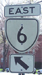
Creation: Appeared in 1933 and is the 2nd VA 6. Had same endpoints as now except ended in actual village of Afton at then-VA 5. VA 6 replaced part of original VA 18 west of US 29, and all of original VA 19 from US 29 to Richmond.
| Adjustments: In 1938, VA 6 was truncated to the VA 6-151 Southern Split, where VA 151 then ran to Afton. VA 6 was re-extended north to end at US 250 east of Afton Mtn. in 1965. VA 6 and 151 swapped their alignments around 1992 to their current positions. Posting: Fully posted. Cutouts still exist in Richmond Amy Barden reports that starting in November 2004 that an error US 6 shield now exists on US 250 WB on Afton Mtn. Comments: Most of this road is also a Scenic Byway. Looking on a map today, it could almost be an extension of VA 5. VA 6 is a nice ride through the James River valley. | Previous VA 6's: | VA 6 #1: An original route that existed until 1923. Ran from West Virginia near Gore east (with VA 3 and VA 7) to Winchester, then solo through Millwood, Middleburg, Fairfax, then to VA 1 (curr US 1)Alexandria. The DC area is not clear. In 1923 VA 6 was renumbered to VA 36. Today this is US 50, SR 723, US 50, and VA 236. | ||||||
|
|
|
| ROUTE LOG |
VA 6: 0 - 0 US 29, VA 6: 0.2 - 0.2
|
Creation: I think this was created in 1979. I'm pretty sure whenever it was created it replaced Mainline US 29 which was 4-laned around Woods Mill. On the other hand, the US 29 Bridge in the area looks older than 1979. This is at least the 2nd VA 6Y
| Adjustments: None Posting: Fully posted from US 29 SB Comments: Forms a triangle with VA 6 and US 29. What is strange is that 6Y is on the wrong leg! An inspection of the set up shows it is impossible to turn North on US 29 from the 6Y leg, so VA 6 had to be routed on the other leg for continuity. | Previous VA 6Y's: | VA 6Y #1: This was an early spur of VA 6 to the town of Schuyler. Created in July 1933 as a newly numbered route, and was renumbered to VA 335 in 1938. Today it is SR 800. | ||||||
|
|
|
|
| ROUTE LOG |
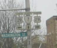
US 11, US 522: 0 - 0 FD-WIN LINE: 1 - 1 I-81 (exit 315): 0 - 1 CK-FD LINE: 3 - 4 VA 7 Bus: 4 - 8 US 340: 2 - 10 VA 7 Bus: 2 - 12 LN-CK LINE: 6 - 18 VA 7 Bus: 5 - 23 VA 7 Bus: 1 - 24 VA 287: 4 - 28 VA 7 Bus, VA 9: 4 - 32 VA 7 Bus: 2 - 34 US 15 SB, US 15 Bus: 2 - 36 VA 267: 1 - 37 US 15 NB, VA 7 Bus: 1 - 38 VA 28: 7 - 45 VA 391: 2 - 47 FX-LN LINE: 1 - 48 VA 228: 1 - 49 VA 193: 2 - 51 VA 267: 6.5 - 57.5 VA 123: 1.5 - 59 I-495 (exit 47): 1 - 60 I-66 (exit 66): 1.5 - 61.5 FAL-FX LINE: 0.5 - 62 US 29, VA 237: 1.5 - 63.5 FX-FAL LINE: 1 - 64.5 US 50, VA 338: 0 - 64.5 VA 244: 2 - 66.5 AR-FX LINE: 1 - 67.5 I-395 (exit 5): 1 - 68.5 ALX-AR LINE: 1 - 69.5 VA 402: 0 - 69.5 US 1: 2 - 71.5
|
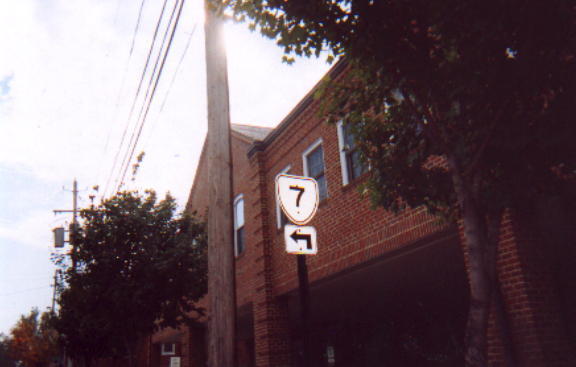
Creation: Appeared in 1933 as current route, plus extended northwest to WV heading for Berkley Springs. This replaced all of original VA 822 north of Winchester, part of Original VA 37 from there to Berryville, and most of original VA 54 from Berryville to Alexandria. This is the 2nd VA 7.
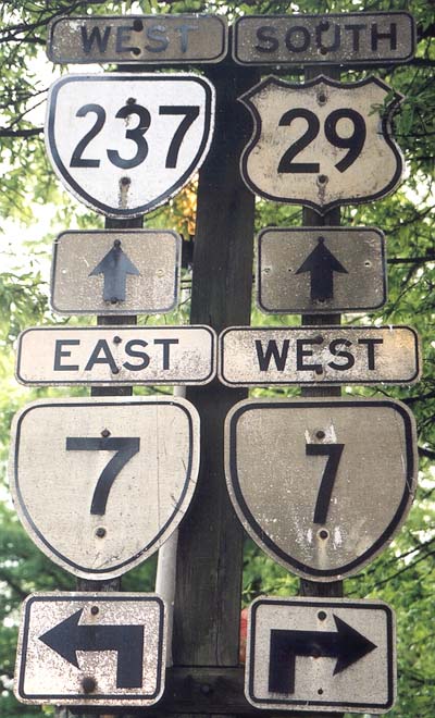
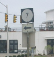
| Adjustments: truncated to Winchester about 1941 as US 522 was introduced into Virginia. It does not appear that VA 7 was ever removed from sections of US 340 or 340 ALT that ran from Winchester to Berryville at various times. Postings: Fully posted. Cutouts still up in Falls Church and Winchester; check out this old set of VA 7 cutouts also in Falls Church (thanks Gribblenation); there is a square VA 7 sign on King St. in Alexandria (on the hill near the Masonic Memorial) which looks exactly like a Maine Hwy. sign. Dan F in January 2004 reports the square sign is gone, but replaced by a "one piece sign with a "TO" Banner and a normal VA shield with West 7 inside." Just down the street from that sign is a white border VA 7 sign. A VA 7 circle exists at Tyson's Corner. In May 2005 I spotted 2 error circle 7 signs, in tiny shields on green signs on VA 7 Bus WB in Leesburg. A US 7 error sign was recently removed from the US 340 Exit in Berryville. Comments: One of Northern Virginia's most important and clogged roads. By VA standards, it could be a US highway - maybe US 450 or an extended proposed US 48. VA 7 is 4-lane from Winchester to Falls Church. | Previous VA 7's: |
VA 7 #1: An original state route until 1923. Began at WV state line near Gore. VA 7 went (with VA 3 and VA 6) to Winchester, then south with VA 3 (curr US 11) to Middletown, then east to Cedarville, Front Royal, Washington, Sperryville, Culpeper, Fredericksburg, Falmouth, King George, Montross, Warsaw, Lottsburg, Heathsville, and ending at Reedville. In 1923, VA 7 was renumbered: VA 36 from WV to Winchester; VA 33 from Winchester to Middletown; VA 37 from Middletown to Warsaw, unnumbered from Warsaw to Lottsburg (though shortly became part of VA 13); VA 371 from Lottsburg to Reedville. Today this would look like: US 50, US 11, SR 627, US 522, VA 3, US 1, either VA 212 or SR 607, VA 3, 4 SR's from Emmerton to Lottsburg, US 360.
VA 7X: Appears in November 1922 CTB Minutes as the route between VA 7 (curr VA 3) Templeman to Callao. In January 1923 VA 7X was described as continuing to Reedville. Later in 1923 this became the original VA 371. Today it is all of VA 202, plus US 360 east of Callao. VA 7Y: Mentioned in CTB Minutes of November 1922 as the route between VA 7 (curr VA 3) and Washington's Birthplace. In 1923 this was renumbered as VA 372. Today it is VA 204. |
||||
Previous: VA 800 - 3111 |
Next: VA 8 - 13
Top | Virginia Hwy Index
Home
