
< 100 to 125 | Home | 151 to 175 > | ||||||||||||||||||||||||||||||||||||||||||||||||||||||||||||||||||||||||||||||||||||||||||||||||||||||||||||||||||||||||||||||||||||||||||||||||||||||||||||||||||||||||||||||||||||||||||||||||||||||||||||||||||||||||||||||||||||||||||||||||||||||||||||||||||||||||||||||||||||||||||||||||||||||||||||||||||||||||||||||||||||||||||||||||||||||||||||||||||||||||||||||||||||||||||||||||||||||||||||||||||||||||||||||||||
|
|
|
| ROUTE LOG |
VA 179: 0 - 0 US 13 Bus, VA 316: 2 - 2
|
Creation: Appeared in 1993 or 1994, replacing the northern section of VA 178. This is the 4th VA 126.
| Adjustments: None Posting: Fully posted Comments: Appears to merge with VA 316 on the VDOT map, but actually both routes intersect US 13 Bus. at Tasley. I drove this in August 2003 and there is nothing interesting to report. | Previous VA 126's: |
VA 126 #1: Appeared in 1929 as a replacement for VA 111 #1. Ran from US 19 Claypool Hill to VA 121 (curr VA 83) Grundy. This was renumbered as VA 83 in July 1933. Today it is part of US 460.
VA 126 #2: Appeared in July 1933 as a 2-piece route: 1. US 501 Volens to VA 40 Cody. This was a replacement for VA 303. 2. US 501 Gladys south to Long Island. This piece was not previously numbered. Piece 1 was downgraded to SR 761 between 1942-44. Piece 2 was truncated to run from US 501 Gladys south to SR 699, leaving behind SR 761 between 1942-44. This remnant of VA 126 became part of SR 603 between 1945-47. VA 126 #3: Appeared between 1948-50. Ran from US 460 (curr US 221) to VA 297 (curr US 460 Bus) on Graves Mill Road. This had been part of VA 128 previously. In 1966 VA 126 was extended east to US 29 ALT (curr US 29 Bus), over what was part of VA 297. VA 126 was removed in 1977 - the part in Campbell County became SR 1425, the Fort Ave part became US 460 Bus, the part in between is simply Graves Mill Rd. |
|||||||
|
|
|
| ROUTE LOG |
US 522: 0 - 0 WV STATE LINE: 3 - 3
|
Creation: This appeared in 1965, replacing SR 698. This is the 3rd VA 127.
| Adjustments: None Posting: Fully posted. Mileage sign gives distance to Cumberland, MD (a short cut I have used), but this requires two state line crossings and the route goes VA 127-WV 127-WV 29-WV 9-MD 51. Good luck with that. Comment: Street Atlas shows a segment running on the state line, but this is not actually the case. | Previous VA 127's: |
VA 127 #1: Appeared in 1929, running from US 19 Tazewell east to the Bland County Line. This was a newly numbered route. In 1932, this was extended west to VA 112 (curr VA 16) north of Tazewell. This eliminated VA 137. VA 127 was renumbered as VA 61 in July 1933.
VA 127 #2: Appeared in July 1933 as a renumbering of the vertical half of original VA 43. Ran from VA 24 Evington to US 460 (curr US 221) Forest. VA 127 was downgraded to current SR 811 between 1948-50. |
|||||||
|
|
|
| ROUTE LOG |
US 29 Bus: 0 - 0 US 29, US 501 NB: 0.5 - 0.5 US 501 SB: 0.5 - 1 US 460 Bus, US 501 Bus: 3 - 4
|
Creation: Appeared in July 1933 as a replacement for VA 319. Ran from US 460 (curr US 221) in the Forest (west of Lynchburg) area to US 460-501 Lynchburg. This is the 2nd VA 128.
| Adjustments: Between 1948-50, VA 128 was truncated on the west end at US 29, its current routing. The truncated segment became VA 126 #3 (current SR 1425 Graves Mill Rd). Between 1954-56, the east end was extended over US 460-501 and then up 12th St. This replaced the US 29 routing. VA 128 was truncated back to its current position between 1959-1961. Posting: Fully posted Comment: Today's VA 128 on Mayflower Ave. is not much different from long ago - narrow and rather twisty. The indented horseshoe curve to get over the RR tracks is an adventure. .. | Previous VA 128's: | VA 128 #1: Appeared in 1929 as a renumbering of VA 117 #2. Ran from Pocahontas to Bluefield College. This was renumbered as VA 85 in July 1933. Today it is VA 102. | |||||||
|
|
|
| ROUTE LOG |
US 501: 0 - 0 VA 34: 0.5 - 0.5 US 501: 3.5 - 4
|
Creation: Appeared in July 1933 in its current position. This had been the mainline US 501. This is the 2nd VA 129.
| Adjustments: None. Check out the 1941 mapscan. Posting: fully posted Comments: Four-lane alternate to US 501.  | Previous VA 129's: | VA 129 #1: Appeared in 1929 as a renumbering of original VA 123. Ran from VA 12 (curr US 58) Mouth of Wilson southeast to the NC line. This was renumbered as VA 93 in July 1933. | |||||||
|
|
|
| ROUTE LOG |
US 11: 0 - 0 US 501 NB, VA 130Y: 6 - 6 AM-RB LINE: 1 - 7 US 501 SB: 5 - 12 BLUE RIDGE PKWY: 3 - 15 US 29: 17 - 32
|
Creation: Appeared in July 1933. Ran from Pedlar Mills east to US 29 Madison Mills, then east along current VA 210. This replaced both VA 317 and VA 311. This is the 2nd VA 130.
| Adjustments: Between 1945-47, VA 130 was extended west to US 501 over a SR route. In 1948-49, VA 130 was rerouted at its southern split from US 29 to today's VA 210-US 29 Bus jct. The previous split location (1/2 mile north) became VA 130Y. Today this stub is part of the US 29 Bypass. In 1953, VA 130 was extended west again to its current end at US 11, replacing VA 249. The piece east of US 29 was renumbered as VA 210 in 1962. In 2005, VA 130 was extended east to the future US 29 Madison Height Bypass. Posting: Fully posted. Cutout assembly at intersection with old VA 130 at Natural Bridge Station Comments:Good scenic route. In January 2005, Mike Tantillo reported on MTR that the jct with the Madison Heights bypass has VA 130 postings up, but that at current US 29 in Madison Heights VA 130 is still only posted as west of 29. On May 8, 2005 Mapmikey observed the US 29 intersection to have VA 130 posted in both directions. | Previous VA 130's: | VA 130 #1: Appeared in 1929 as a newly numbered route. Ran from VA 12 (curr US 58) Damascus south to the Tenn St Line. This was renumbered to VA 78 in July 1933. Today it is part of VA 91. | |||||||
|
|
|
| ROUTE LOG |
VA 130: 0 - 0 US 501: 0.1 - 0.1
|
Northern leg of triangle with US 501. Dave doesn't remember this being
posted when he went through in 1996, and I saw no posting when I drove by in October 2001. This was probably born in 1953, and may have been VA 249Y before that. This is the 2nd VA 130Y.
| | Previous VA 130Y's: | VA 130Y #1: Appears explicitly on the 1948 and 1949 Official Maps. Formed a triangle with US 29 south of Madison Heights (curr US 29 Bus-VA 210 jct). The 1947 Official Map showed 130Y as part of VA 130. VA 130Y is implied on maps 1950-1953, but not explicitly labeled. In 1954-55, VA 130Y became the northernmost 1/2 mile of the US 29 Bypass of Lynchburg. Note that the 130Y was on the "wrong" leg of the triangle. |  VA 130Y in 1949. |
||||||
|
|
|
| ROUTE LOG |
US 460 Bus: 0 - 0 US 460 Bus: 1 - 1 US 460, VA 24: 1 - 2
|
Creation: Appeared in July 1933. Ran from VA 24, across US 460, VA 26, and back to US 460. This replaced part of VA 306 and all of VA 309. This is the 3rd VA 131.
| Adjustments: VA 131 was extended north to the US 460 Bypass, replacing VA 24, about 1997. Posting: Fully posted, but driving east there is an unmarked turn at old VA 26 (curr SR 727). Comment:Interesting note: This is not the same Civil War town from your history class. The original Appomattox is now a ghost town about 4 miles northeast on VA 24. The town moved to the railroad in the late 1800's. This was actually a common occurrence in the South.  VA 131 in 1941. | Previous VA 131's: |
VA 131 #1: Appeared in August 1928 as a replacement for original VA 112 between Lebanon and Hansonville. In 1929, US 19 was routed this way, relegating VA 131 to the scrap heap.
VA 131 #2: Appeared in 1923. Ran from VA 13 (curr US 360) St. Stephens Church southeast to King and Queen CH. It was renumbered as part of VA 29 in 1929. Today it is part of VA 14. |
|||||||
|
|
|
| ROUTE LOG |
VA 199, COLONIAL PKWY: 0 - 0 VA 5 WB: 2 - 2 VA 5 EB: 0.5 - 2.5 VA 132Y: 0.5 - 3 US 60: 0.5 - 3.5 JC-WIL LINE: 0 - 3.5 VA 143: 1 - 4.5
|
Creation: Appeared in 1958. Ran from VA 168 (curr VA 143) south to US 60Z-VA 5-VA 31 (Henry St. at Jamestown Rd.) This had been part of VA 31, and is the 4th VA 132.
| Adjustments: In 1974, VA 132 was extended west along Lafayette St. to US 60, replacing US 60Z. In 1979, VA 132 was given its current routing, leaving behind VA 162 on Lafayette St. (no number today) Posting: Fully posted; VA 132 and other routes are signed with brown-background signboards in central Williamsburg. Comments: VA 132 runs directly through the center of town on Henry St. Features stop signs at pedestrian-only Duke of Gloucester St. | Previous VA 132's: |
VA 132 #1: Appeared in 1923, from VA 13 Tobaccoville to VA 20 (curr US 360) Amelia. This was renumbered as part of VA 406 in 1929. Today it is SR 681.
VA 132 #2: Appeared in July 1933 as a short stub off US 460 at Evergreen. This was not previously numbered. VA 132 was downgraded to SR 681 between 1942-44. How odd two old VA 132's are SR 681's... VA 132 #3: Appeared in 1957 as a newly numbered route. Ran from VA 31 (curr VA 132) south to the extended Colonial Parkway. This was renumbered in 1958 to VA 132Y. 

|
|||||||
|
|
|
| ROUTE LOG |
VA 132: 0 - 0 COLONIAL PKWY: 0.5 - 0.5
|
Creation: VA 132Y appeared in 1958 as a renumbering of VA 132, as a connector from today's VA 132 to Colonial Parkway.
| Adjustments:None Posting: Fully posted at VA 132. Comments: Provides access to the Colonial Williamsburg Visitors Center. |
|||||||||
|
|
|
| ROUTE LOG |
US 15: 0 - 0 SR 604-692: 1 - 1
|
Creation: Appeared in July 1933 as a replacement for VA 305 #1. Ran from US 15 to US 460 Prospect (see scan under VA 134 entry). This is the 3rd VA 133.
| Adjustments: Between 1942-44, VA 133 was rerouted to the way it is today. Doing so eliminated VA 134 #2 and left behind SR's 658 and 626. Posting: Fully posted Comment:serves Hampden-Sydney College. | Previous VA 133's: |
VA 133 #1: Appeared in 1928, running from VA 13 (curr US 60) Cumberland to VA 10-VA 32 (curr US 15 Bus-460 Bus) Farmville. This replaced what had been the westernmost portion of VA 13 before it was extended to the mountains. This was renumbered as VA 310 in 1929. Today it is part of VA 45.
VA 133 #2: Appeared in 1930-31. Ran from VA 11 (curr US 23 Bus) east of Appalachia north to Roaring Fork. This was not previously numbered. In July 1933 this became the original VA 69. Today it is SR 603. |
|||||||
|
|
|
| ROUTE LOG |
US 60, VA 143: 0 - 0 VA 351: 0.5 - 0.5 I-64 (exit 265): 0.5 - 1 US 258 NB: 1 - 1.5 VA 152: 0.5 - 2 I-64 EB (exit 263), US 258 SB: 0.5 - 2.5 I-64 WB (exit 262): 1 - 3.5 VA 172: 2 - 5.5 YO-HAM LINE: 1 - 6.5 VA 171: 4 - 10.5 US 17: 0.5 - 11
|
Creation: Appeared between 1942-44, as a renumbering of VA 170 north of the James River. Had the same endpoints as today, but ran much more direct over Armistead Blvd. This is the 3rd VA 134.
| Adjustments: VA 134 was rerouted along US 258 and I-64 like today in 1963 or 1964. Armistead Blvd. became part of a longer VA 172 (today it is mostly unnumbered). Posting: fully posted comments: North of I-64 used to be a really good shortcut to US 17, but now there must be 10 stoplights in between... | Previous VA 134's: |
VA 134 #1: Appeared in 1930-31 as a newly numbered route. Ran from VA 107 (curr US 58 ALT) Bolton southwest a few miles. This was renumbered as VA 74 in July 1933. Today it is part of SR 613.
VA 134 #2: Appeared in July 1933. Ran from VA 133 (curr VA 133-SR 658 jct) to Hampden-Sydney. This was not numbered previously. VA 134 was renumbered as part of current VA 133 between 1942-44. VA 134A: Appears in CTB Minutes between 1961-63 as the designation for Magruder Blvd. VA 134A became VA 134 by 1964. |  VA 134 in 1941. |
||||||
|
|
|
| ROUTE LOG |
US 17: 0 - 0 VA 164: 0.5 - 0.5 I-664 (exit 8): 1.5 - 2 VA 367: 0.5 - 2.5
|
Creation: Appeared between 1954-56 in its current location. This was not previously numbered. It is the 3rd VA 135.
| Adjustments: None Posting: Fully posted Comments: Originally the end of VA 135 was at Pig Point Ordinance Depot. The college didn't arrive until 1966. | Previous VA 135's: |
VA 135 #1: Appeared in 1930-31 as a newly numbered route. Ran from US 11 Chilhowie southeast for 3 miles. This was renumbered as the original VA 79 in July 1933. Today it is SR 762 and a hair of VA 107.
VA 135 #2: Appeared in July 1933 as a renumbering of VA 318. Ran from US 360 Green Bay to US 460 west of Rice. This was downdraded to SR 696 between 1945-47. VA 135Y: Shown in CTB Minutes as being eliminated in May 1943. Was a triangle at the jct of US 360 and VA 135 (curr SR 696) in Green Bay. |  |
||||||
|
|
|
| ROUTE LOG |
US 1: 0 - 0 SR 652: 1 - 1
|
Creation: Appeared between 1954-56 in its current form. This replaced part of current VA 137, and is the 3rd VA 136.
| Adjustments: None Posting: Fully posted Comment: Haven't driven this one | Previous VA 136's: |
VA 136 #1: Appeared in 1930-31. Ran from VA 127 (curr VA 61) Gratton to Burkes Garden. This was not previously numbered. In July 1933 this was renumbered as VA 87. Today it is SR 623.
VA 136 #2: Appeared in July 1933. Ran from curr SR 635-655 jct southeast of Victoria to US 360 Jennings Ordinary. North of Victoria was VA 404, and south of Victoria was VA 403. VA 136 south of VA 40 was downgraded to SR 635 between 1942-44. The rest of VA 136 was renumbered as part of VA 49 between 1948-50. |
|||||||
|
|
|
| ROUTE LOG |
VA 40, BEGIN VA 138: 0 - 0 VA 138 SB: 4 - 4 BR-LU LINE: 4 - 8 VA 46: 4 - 12
|
Creation: Appeared in July 1933. Originally ran from VA 48 (curr VA 40) Blackstone to US 1 Alberta. This replaced VA 423 and was some new routing. This is the 2nd VA 137.
| Adjustments: In 1941, two things happened: 1. VA 137 was rerouted to run from US 1 Alberta to VA 40 in Kenbridge. The original route to Blackstone became part of VA 46. The new routing to Kenbridge was a replacement of part of VA 34 #2. 2. A second and third discontinuous piece was created, from VA 88 (curr SR 619) Purdy to SR 645 Henry, with a small break just west of US 301 Jarratt. Both of these pieces had been parts of VA 32. Between 1945-47, those 2 additional pieces were downgraded to SR 631 and 608, except it left behind current VA 139. Between 1954-56, VA 137 was reduced to its current routing (which contains none of its original routing), leaving behind SR 658 and current VA 136. Posting: Fully posted Comment: This has had a strange history, spawning 2 useless routes in the 130's, plus the westernmost 4 miles are multiplexed with VA 138. | Previous VA 137's: | VA 137 #1: Appeared in 1930-31, running from VA 112 (curr VA 61) to US 19 in the Tazewell area. This was not previously numbered. It was overtaken by VA 127 in 1932. Today it is the westernmost 2 miles of VA 61. | |||||||
|
|
|
| ROUTE LOG |
US 1: 0 - 0 LU-MK LINE: 3 - 3 VA 137 EB: 10 - 13 VA 40, VA 137 END: 4 - 17
|
Creation: Appeared in July 1933, as a replacement for VA 416 and VA 433. It originally ran from VA 48 (curr VA 40) Kenbridge to South Hill, then east on US 58 to LaCrosse where it proceeded south to Bracey. This is the 2nd VA 138.
| Adjustment: VA 138 south was truncated to its current routing between 1945-47, leaving behind SR 618. Posting: Fully posted. Comment: Northernmost 4 miles are multiplexed with VA 137. | Previous VA 138's: | VA 138 #1: Appeared in 1930-31 as a short stub above VA 126 (curr US 460 Bus) Richlands. This was renumbered as VA 83 in July 1933. Today it is part of VA 67. | |||||||
|
|
|
| ROUTE LOG |
US 301: 0 - 0 SR 610: 1.5 - 1.5
|
Creation: Appeared between 1945-47, as a replacement for the eastern piece of VA 137. This is the 3rd VA 139.
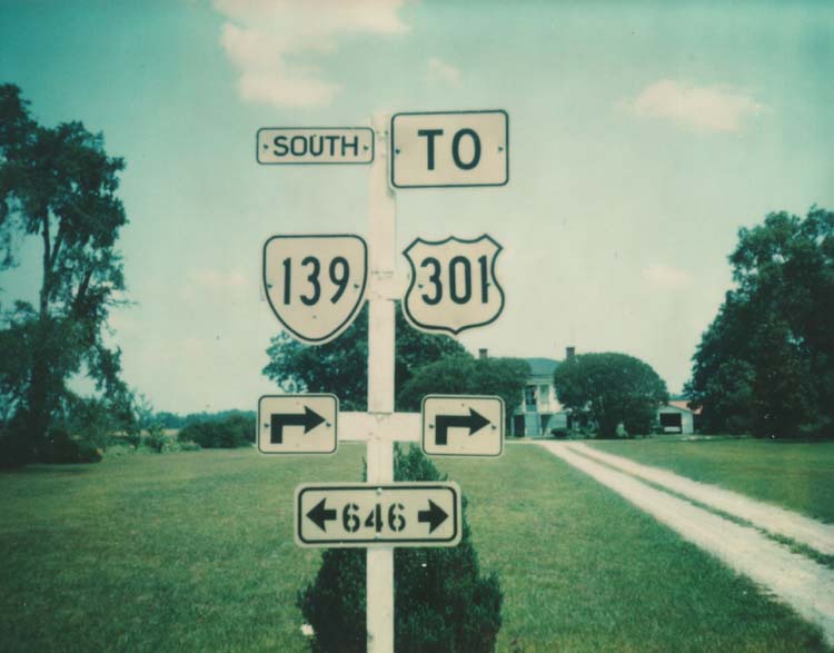
| Adjustments: None Posting: Fully posted; Cutout in Jarratt made it at least as far as 1976. Comment: I have no idea why this has not been extended east to I-95. | Previous VA 139's: |
VA 139 #1: Appeared in 1932. Ran from VA 12 (curr US 58) Mouth of Wilson southwest to then-NC 681. This was renumbered as VA 92 in July 1933. Today it is part of VA 16. This is the highest VA 1xx route of the 1929 system that I could find.
VA 139 #2: Appeared in July 1933, as a newly numbered route. Ran from US 58 Broadnax to the current SR 658-659 jct. This was downgraded to SR 658 between 1942-44. |
|||||||
|
|
|
| ROUTE LOG |
I-81 (exit 14), US 58: 0 - 0 VA 372: 0.5 - 0.5 US 11, US 19: 0.5 - 1
|
Creation: Appears on my 1961 Washington County Map, overrunning part of SR 647. This is the 2nd VA 140. Ran as it does today, even though I-81 is shown as a dotted line on the '61 county map.
| Adjustments: None Posting: Fully posted Comments: Provides easy access from I-81 to the west side of Abingdon. This could easily be US 19 or Green 81, if Virginia were ever so inclined to have a green interstate. | Previous VA 140's: | VA 140 #1: Appeared in July 1933 as a renumbering of VA 402. Ran from US 58 Edgerton to US 1 near Rawlings. This was downgraded to SR 712 between 1948-50. | |||||||
|
|
|
| ROUTE LOG |
US 17: 0 - 0 VA 337: 0.5 - 0.5 I-264 (exit 7), US 460 ALT: 1.5 - 2 US 58, VA 337 ALT: 2 - 4
|
Creation: First appeared on a VDOT state map in 1975. I seem to recall it being around when I lived in Norfolk in 1974. In any case, in 1970 it was still US 17 Bus. This is the 3rd VA 141.
| Adjustments: None Posting: Fully posted; last cutout removed in 1993. Comment: Serves Norfolk Naval Shipyard and downtown Portsmouth | Previous VA 141's: |
VA 141 #1: Appeared in 1923, running from VA 33 (curr US 11) Natural Bridge to VA 14 (curr US 501) Glasgow. This had been part of VA 14 in 1922. VA 141 was overrun by a piece of US 60 in 1927, so VA 141 died in 1929. Today it is part of VA 130.
VA 141 #2: Appeared in July 1933 as a renumbering of VA 426. Ran from US 1 Dinwiddie to US 301 Carson. This was downgraded to SR 703 between 1942-44. VA 141Y: 1937-1941 VDOT state maps imply a triangle setup at US 301 Carson. Shown in CTB Minutes as decommissioned in May 1943 - it became SR 623. |  |
||||||
|
|
|
| ROUTE LOG |
US 1, US 460 Bus: 0 - 0 VA 319: 1 - 1 PET-DI LINE: 1 - 2 END VA 142: 1 - 3
|
Creation: Appeared in July 1933 and is the 2nd VA 142. Replaced VA 439. Ran as it does today.
| Adjustments: None Posting: Fully posted at US 1 and VA 319 but nowhere east of VA 319. Comment: Blown off by I-85, even though an exit exists alongside it (Squirrel Level Rd). | Previous VA 142's: | VA 142 #1: Appeared in 1923, running from VA 13 (curr US 60 Bus) Clifton Forge south to Eagle Rock. Between 1924-27 VA 142 was renumbered as an extended VA 17. Today it is part of US 220 and a small piece of VA 43. | |||||||
|
|
|
| ROUTE LOG |
US 258: 0 - 0 VA 169: 1 - 1 I-64 (exit 267), US 60 EB: 0.5 - 1.5 VA 134: 0.5 - 2 US 60 WB: 0.5 - 2.5 NNS-HAM LINE: 3 - 5.5 VA 351: 1.5 - 7 US 17 SB, US 258: 2.5 - 9.5 VA 152: 1 - 10.5 VA 306: 2 - 12.5 US 17 NB, VA 312: 1 - 13.5 I-64 (exit 255): 3.5 - 17 VA 173: 2 - 19 VA 105: 3 - 22 VA 238: 2.5 - 24.5 I-64 (exit 247): 0.5 - 25 JC-NNS LINE: 0.5 - 25.5 YO-JC LINE: 1.5 - 27 I-64 (exit 243): 1.5 - 28.5 VA 199: 1.5 - 30 VA 162: 2 - 32 WIL-YO LINE: 0.5 - 32.5 COLONIAL PKWY: 0.5 - 33 VA 5: 0.5 - 33.5 YO-WIL LINE: 0.5 - 34 VA 132: 0.5 - 34.5 I-64 (exit 238): 0.5 - 35
|
Creation: Appeared between 1945-47. Ran on 35th St. from US 60 Newport News to VA 167 Hampton. This was previously part of VA 168. It is the 3rd VA 143.
| Adjustments: In 1958, VA 143 was extended north along Jefferson Ave. to US 17-258-VA 168 (curr US 17-258 Split), replacing a piece of VA 168. Also, the other direction of VA 143 was extended to its current end at US 258, replacing the pre-Hampton Roads Bridge alignment of US 60. Between 1959-61, VA 143 was extended north again to I-64/VA 168 (curr Exit 255) replacing more of VA 168. In 1966, VA 143 was extended to its current end at I-64 Exit 238, again replacing more of VA 168. Posting: Fully posted. There is a sign at its northern end that implies VA 143 continues on the frontage road, but that is inaccurate. Comments: Dave relates the following: "I will always associate this road with Hot Dog King in Newport News. When I was a little kid, I hated always seeing Burger King, because I hated hamburgers at the time. So I was thrilled at seeing the Hot Dog King on a family trip in 1977. Of course, my parents weren't as thrilled, so of course we didn't stop. It wasn't until February 1996 that I finally made a point of stopping. I ordered a hot dog, of course." This part of the road is also part of US 17. | Previous VA 143's: |
VA 143 #1: Appeared as new routing in 1923. Ran from VA 14 (curr VA 311-159 jct) Crows south to then-WV 81. This was renumbered as part of VA 22 in 1929. Today it is part of VA 311.
VA 143 #2: Appeared in July 1933. Ran from US 460 Nottoway CH east for 2 miles. This was downgraded between 1942-44 to SR 646. |
|||||||
|
|
|
| ROUTE LOG |
VA 36: 0 - 0 COL-PG LINE: 3 - 3 I-95 (exit 54): 1 - 4 US 1 SB, US 301 SB: 1 - 5 CH-COL LINE: 1.5 - 6.5 US 1 NB, US 301 NB: 0.5 - 7 VA 10 WB: 5 - 12 VA 10 EB: 0.5 - 12.5 VA 145: 2 - 14.5
|
Creation: Appeared in July 1933 as a replacement for VA 425. Ran from VA 145 Centralia to VA 37 (curr VA 10) Chester. This is the 2nd VA 144.
| Adjustments: VA 144 was extended south to US 1-301 Colonial Heights between 1942-44 over a previously unnumbered route. VA 144 was extended over new construction to its end at VA 36 in 1988. Posting: Fully posted. Error US 144 sign on VA 144 WB at US 1-301. Comments: The world's largest Arby's is on VA 144 east of I-95. | Previous VA 144's: | VA 144 #1: Appears on the 1928 VDOT map as today's VA 86. This was probably part of VA 14 before. In 1929 it was renumbered to VA 301. |  |
||||||
|
|
|
| ROUTE LOG |
VA 10: 0 - 0 VA 144: 3.5 - 3.5 VA 288: 0.5 - 4 US 1, US 301: 2 - 6
|
Creation: Appeared in July 1933 as a renumbering of VA 410. Ran as it does today. This is the only VA 145.
| Adjustments: None Posting: Fully posted. On both directions on VA 10, there are erroneous signs indicating VA 145 proceeds west. This is a short driveway into a strip mall. Comments: I've driven it, but it is not memorable in any way. | ||||||||
|
|
|
| ROUTE LOG |
VA 76: 0 - 0 I-195, VA 195: 0.5 - 0.5
|
Creation: Appeared in its present form in 1976. This was new construction. This is the 3rd VA 146.
| Adjustments: None Posting: VA 146 was posted for the first time in July 2003 (Thanks to Zachary Robbins for this information) but in a way that may confuse unfamiliar motorists. Comment: Forms the SE part of the I-195/VA 76/VA 195 freeway triangle. Riddle me this, VDOT -- if you have 3 routes meeting at a 3-sided triangle, why do you need a 4th number? | Previous VA 146's: |
VA 146 #1: Appeared in July 1933 as a renumbering of VA 430. Was a very short loop off of VA 5 SE of Richmond. This was lengthened by 1937 so that it was about 2 miles long. It became part of VA 5 between 1948-50.
VA 146 #2: Appeared between 1948-50, overriding an older alignment of VA 5 (they flip-flopped routes). This version of VA 146 was decommissioned in 1966. Today it is unnumbered. |
||||||
|
|
|
| ROUTE LOG |
US 60: 0 - 0 RIC-CH LINE: 4 - 4 VA 150: 0 - 4 HR-RIC LINE: 1.5 - 5.5 RIC-HR LINE: 1 - 6.5 VA 197: 1.5 - 8 VA 161: 1 - 9 US 1, US 301: 1.5 - 10.5 US 60: 0.5 - 11
|
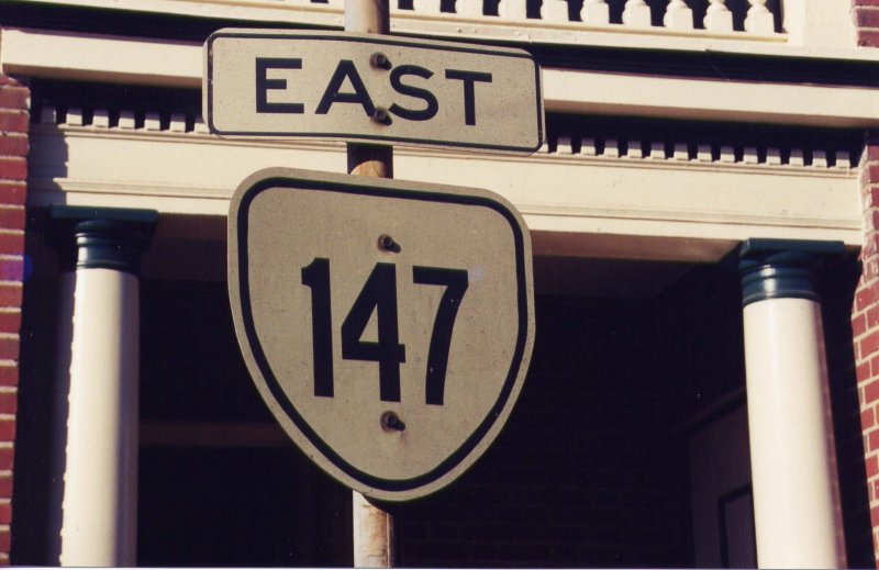
| Creation: Appeared in July 1933 as a renumbering of VA 418 and also replaced VA 19 along River Rd (VA 6 began life on Patterson Ave). This is the only VA 147. Adjustments: None Posting: Fully posted. Cutouts can still be found in Richmond (thanks Gribblenation!) Comments: Splits into one-way streets in downtown Richmond. May be only VA route with brick surface near US 60 downtown. |
||||||||
|
|
|
| ROUTE LOG |
I-77 (exit 8): 0 - 0 US 52: 1 - 1
|
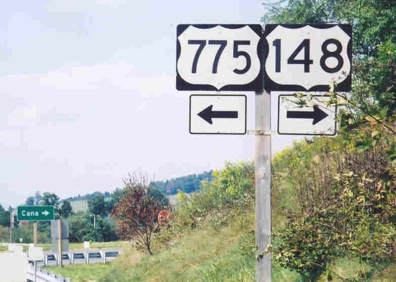
Creation: Appeared in 1981 in its present form. This was SR 775. This is the 2nd VA 148.
| Adjustments: None Posting: Fully posted; error US 148 sign exists, along with an error US 775 shield (thanks to Adam Prince for photolink). Comment: Connector from I-77 to US 52. This is the likely way to get from I-77 to the Blue Ridge Parkway. | Previous VA 148's: |
VA 148 #1: Appeared in July 1933 as a renumbering of VA 412. Ran from US 360 near Chula north to the Appomattox River. This was extended south to VA 38 Scotts Fork between 1942-44. VA 148 north of US 360 was downgraded to SR 604 between 1945-47. VA 148 was eliminated by an extended VA 153 in 1952. |
||||||
|
|
|
| ROUTE LOG |
I-95 (exit 67), VA 895: 0 - 0 US 1, US 301: 1 - 1 VA 10: 3 - 4 US 360: 3 - 7 US 60: 1.5 - 8.5 VA 76: 2 - 10.5 RIC-CH LINE: 0.5 - 11 VA 147: 1.5 - 12.5 HR-RIC LINE: 1.5 - 14 END VA 150: 1 - 15
|
Creation: Appeared between 1968-1970 from I-95 to VA 147. This was mostly new routing, although there was a Chippenham Pkwy SR 892 between VA 147 and Forest Hill Ave. before VA 150 was christened. This is the 2nd VA 150.
| Adjustments: VA 150 was extended north across the James River to its current end around 1990. Posting: Fully posted; On June 16, 2002 I saw an error US 150 shield on a green sign indicating where trucks should enter the Supply Depot. The sign is on US 1-301 NB about 2 miles south of VA 150. Comments: Today VA 150 is a modern freeway, except between VA 147 and Forest Hill Ave, which still has several at-grade intersections. Is there a reason VA 150 can't be signed to VA 6? | Previous VA 150's: | VA 150 #1: Appeared in July 1933 as a renumbering of VA 312 #2. Ran from US 29 Amherst to the village of Colleen. It did NOT touch US 29 again. The 1947 VDOT map clearly shows SR 671 in between. VA 150 was eliminated between 1948-50 when US 29 was given a direct route from Amherst to Lovingston. In Amherst County VA 150 became SR 739. In Nelson County it became US 29. | ||||||
Previous: VA 101 - 125 |
Next: VA 151 - 175
Top | Virginia Hwy Index
Home
