| Serum Run Maps &
Trail Notes |
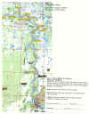
| Maps and Notes for the trail traveled today |
In
2002, 2005, and 2006 I captured a GPS Track Log for the entire Serum Run route. Using
captured data I created waypoints for navigating the trail, and even to act as
approximate mileage markers, all of which I have overlaid on USGS maps. I
have made maps for the Serum Run trail annually starting in 2004.
While the file size of the maps are currently to large for web posting, below
you will find waypoint data and a brief description of each days travel, and a
map for the first day of travel.
FAQ
/ How To's
Accuracy
Most
handheld GPS devices are fairly accurate, however they may be off as far as 500
feet depending on conditions. I have found the maps and data that I have
created on my computer to be pretty accurate for the most part. While it
may not lead me blind to within arms reach of a cabin door, it will generally
get me pretty close if not right on.
Downloading
To
Download a file or map image simply right click on the file name and
select save target as. Left click on the desired file and open it, and
then right click and select Save. A pop up window will open asking you
where to save it and what to name it. (Note the location you are saving it
to for future reference.) The file should then download.
Go Back to Top of Page
Datum
(What to use)
Map
Datum is the geographical survey standard that was used in creating the
map. All maps on this site where created using North American Datum, 1927,
Alaska (NAD 27 ALASKA). Since I use my maps in conjunction with my GPS on
a regular bases, I also set my GPS to NAD 27 ALASKA datum. Many GPS units
default to WGS 84 Datum, which only varies from NAD 27 ALASKA by a few
seconds. I have posted the waypoint data in both NAD 27 ALASKA and WGS 84
datum. If you choose to set your GPS to NAD 27, use the NAD 27 data.
If your GPS is set to WGS 84 then use the WGS 84 data, your accuracy to the maps
may vary somewhat, but should still be close.
Go Back to Top of Page
Printing
Maps
Maps
are posted in .jpg format, and should be viewable with you internet browser
software and most photo or imagining software. You will want to download
the jpg file to your hard drive first. Once downloaded open or view the file
using photo or imaging software for maps, notepad, word processing software for
waypoints. Then select File / Print, and set up your printer option for
Portrait or Landscape as needed for maps. You may also want to set to print to
fit one page.
National
Geographic markets waterproof paper that was truly waterproof! REI had it, and
it wasn't cheap but it worked wonderfully! If using waterproof paper, do a
practice print on plan paper first to make sure the map is going to come out
right before you waste expensive paper.
I
also printed front and back sides to conserve paper.
Go Back to Top of Page
Printing
Waypoints
You
should be able to print out the waypoints from the web site or by downloading
them to your hard drive and then printing them from Microsoft Excel, or by using
Microsoft Word and importing the Excel file and then printing it.
Go Back to Top of Page
Downloading
Waypoints to GPS unit
If
you have GPS or mapping software that you use with your GPS feel free to e-mail
me and see if I can export the data to suit your software. I use
OziExplorer, which is available as a download trail version or full version for
a $75 registration fee. See my GPS page for more
information on software and hardware. In most cases you should be able to
convert the Microsoft Excel file into a format that can be imported to your
mapping/GPS software.
Go Back to Top of Page
Source
for Maps and GPS Data
I
use OziExplorer GPS/Mapping software in conjunction with USGS topographical maps
on CD to create these maps. For the 2002, 2005, and 2006, Serum Runs I was able to capture a
GPS track log for the entire trip. In 2003, waypoint data was created
using captured data from 2002, and/or creating waypoints by computer overlaid on
2002 track log data. Since 2005 I have used the combination of all the
track logs to place waypoints at key locations along the trial. All maps are NAD 27 ALASKA datum.
(See my GPS Navigation section of this site for more details of hardware and
software used.)
Go Back to Top of Page

| 


